Property Record
783 Maher Rd, Watsonville, CA 95076


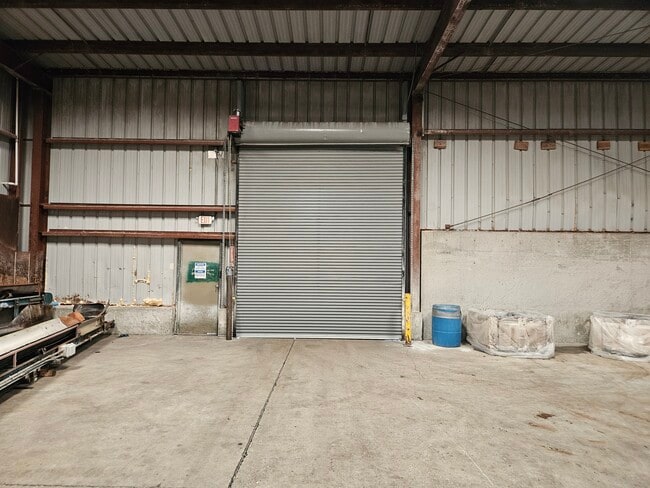
Current Lease Availabilities
Property Detail
783 Maher Rd
Salinas, CA
ASSRS MP A2 LOS CARNEROS RO NICHOLSON EST SUB 5 EXC SWLY 2.59 AC & EXC LOT A 178.85 AC EXC POR IN CO RD 178.766 AC
181-131-003-000
MONTEREY
Horticulturegrowinghousesagricultural
California
B and X Area of moderate flood hazard, usually the area between the limits of the 100-year and 500-year floods.
a
2024
171.64 AC
2025
North Monterey County
110503
Salinas
NEARBY LISTINGS FOR SALE OR LEASE
-
-
View all Watsonville listings for lease on LoopNet.com
DEMOGRAPHICS near 783 Maher Rd
1 mile
3 mile
5 mile
2025 Total Population
1,128
9,122
22,458
2030 Population
1,049
8,480
21,202
Pop Growth 2025-2030
(7.00%)
(7.04%)
(5.59%)
Average Age
43
42
41
2025 Total Households
348
2,842
6,745
HH Growth 2025-2030
(7.76%)
(7.57%)
(6.08%)
Median Household Inc
$91,249
$108,333
$108,221
Avg Household Size
3.10
3.10
3.10
2025 Avg HH Vehicles
3.00
3.00
3.00
Median Home Value
$869,631
$797,542
$800,280
Median Year Built
1975
1977
1978
Nearby Places
Map Layers
Map Styles
 Street
 Aerial
Transit
 Traffic
 Biking
Places
Listings with unknown addresses are not visible on the map
- Restaurants
- Banks
- Shops
- Fitness
- Groceries
PUBLIC TRANSPORTATION
AIRPORT
Monterey Regional
Drive
Walk
Distance
Monterey Regional
36 min
25.4 mi
Freight Ports
Port of Redwood City
Drive
Walk
Distance
Port of Redwood City
94 min
73.7 mi
Nearby Properties
Address
Land Use
TOTAL SIZE
Lot Size
Zoning
Address
Land Use
TOTAL SIZE
Lot Size
Zoning
Address
Land Use
TOTAL SIZE
Lot Size
Zoning
112.40 AC
Address
Land Use
TOTAL SIZE
Lot Size
Zoning
Address
Land Use
TOTAL SIZE
Lot Size
Zoning
35,722 SF
3.36 AC
Address
Land Use
TOTAL SIZE
Lot Size
Zoning
17.50 AC
Address
Land Use
TOTAL SIZE
Lot Size
Zoning
96.89 AC
Address
Land Use
TOTAL SIZE
Lot Size
Zoning
5,375 SF
1.60 AC
Address
Land Use
TOTAL SIZE
Lot Size
Zoning
1,296 SF
0.90 AC
Address
Land Use
TOTAL SIZE
Lot Size
Zoning
13.15 AC
Address
Land Use
TOTAL SIZE
Lot Size
Zoning
340.78 AC
Address
Land Use
TOTAL SIZE
Lot Size
Zoning
10,000 SF
1.69 AC
Address
Land Use
TOTAL SIZE
Lot Size
Zoning
14,402 SF
1.58 AC
Address
Land Use
TOTAL SIZE
Lot Size
Zoning
15,618 SF
1 AC
Address
Land Use
TOTAL SIZE
Lot Size
Zoning
4,582 SF
56.23 AC
Address
Land Use
TOTAL SIZE
Lot Size
Zoning
2,018 SF
154.92 AC
Address
Land Use
TOTAL SIZE
Lot Size
Zoning
Address
Land Use
TOTAL SIZE
Lot Size
Zoning
3,112 SF
3 AC
Address
Land Use
TOTAL SIZE
Lot Size
Zoning
4,797 SF
9.86 AC
Address
Land Use
TOTAL SIZE
Lot Size
Zoning
5,366 SF
2 AC
Address
Land Use
TOTAL SIZE
Lot Size
Zoning
Address
Land Use
TOTAL SIZE
Lot Size
Zoning
Address
Land Use
TOTAL SIZE
Lot Size
Zoning
11,049 SF
1.01 AC
Address
Land Use
TOTAL SIZE
Lot Size
Zoning
Address
Land Use
TOTAL SIZE
Lot Size
Zoning
867 SF
30.80 AC
The World's #1 Commercial Real Estate Marketplace
Connect with us
© 2026 CoStar Group
The information above has been obtained from sources believed reliable. While we do not doubt its accuracy we have not verified it and make no guarantee, warranty or representation about it. It is your responsibility to independently confirm its accuracy and completeness. Any projections, opinions, assumptions, or estimates used are for example only and do not represent the current or future performance of the property. The value of this transaction to you depends on tax and other factors which should be evaluated by your tax, financial, and legal advisors. You and your advisors should conduct a careful, independent investigation of the property to determine to your satisfaction the suitability of the property for your needs.