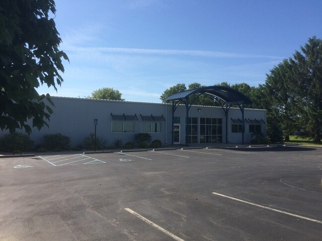
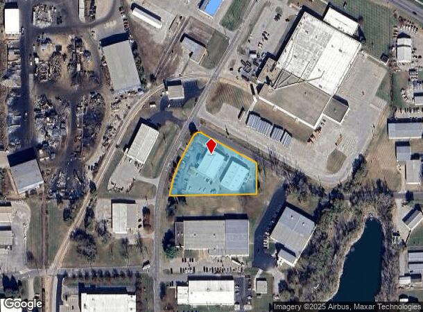
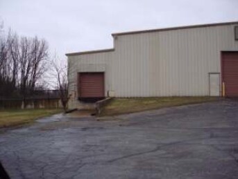
Property Record
783 S Marr Rd, Columbus, IN 47201

NEARBY LISTINGS FOR SALE OR LEASE
Property Detail
783 S Marr Rd
03-96-29-340-000.500-005
Bartholomew Industrial Park
Industrialgeneral
TRACT J-1A OF REPP-FRAMS REPLAT BARTH IN TRACTS J-1-B-2 LOT 2Z MP 096.0000002.0000
X
Bartholomew
18005C0142E
Indiana
0
2z
2024
1.72 AC
010800
Other Market Areas
8,625 SF
Columbus, IN
DEMOGRAPHICS near 783 S Marr Rd
1 Mile
3 Mile
5 Mile
2024 Total Population
4,360
27,743
56,445
2029 Population
4,553
28,679
58,300
Pop Growth 2024-2029
+ 4.43%
+ 3.37%
+ 3.29%
Average Age
36
39
39
2024 Total Households
1,883
12,042
22,805
HH Growth 2024-2029
+ 4.35%
+ 3.31%
+ 3.28%
Median Household Inc
$58,102
$61,174
$72,792
Avg Household Size
2.30
2.20
2.40
2024 Avg HH Vehicles
2.00
2.00
2.00
Median Home Value
$112,576
$158,605
$188,085
Median Year Built
1964
1965
1976
Nearby Places
Map Layers
Map Styles
 Street
 Aerial
- Restaurants
- Banks
- Shops
- Fitness
- Groceries
SALE & LEASE HISTORY
LISTING DATE
SALE/LEASE

Sep 23, 2016
For Sale
Oct 13, 2016
For Sale
Nearby Properties
Address
Land Use
TOTAL SIZE
Lot Size
Zoning
Address
Land Use
TOTAL SIZE
Lot Size
Zoning
539,006 SF
17.07 AC
Address
Land Use
TOTAL SIZE
Lot Size
Zoning
30,614 SF
Address
Land Use
TOTAL SIZE
Lot Size
Zoning
1,915,833 SF
49.19 AC
Address
Land Use
TOTAL SIZE
Lot Size
Zoning
215,669 SF
5.45 AC
Address
Land Use
TOTAL SIZE
Lot Size
Zoning
457,838 SF
39.30 AC
Address
Land Use
TOTAL SIZE
Lot Size
Zoning
126,734 SF
8.37 AC
Address
Land Use
TOTAL SIZE
Lot Size
Zoning
24,900 SF
9.76 AC
Address
Land Use
TOTAL SIZE
Lot Size
Zoning
269,051 SF
14.89 AC
Address
Land Use
TOTAL SIZE
Lot Size
Zoning
259,064 SF
1.31 AC
Address
Land Use
TOTAL SIZE
Lot Size
Zoning
17,880 SF
22.03 AC
Address
Land Use
TOTAL SIZE
Lot Size
Zoning
36,314 SF
1.12 AC
Address
Land Use
TOTAL SIZE
Lot Size
Zoning
627,868 SF
47.53 AC
Address
Land Use
TOTAL SIZE
Lot Size
Zoning
73,732 SF
17.18 AC
Address
Land Use
TOTAL SIZE
Lot Size
Zoning
7,896 SF
14.41 AC
Address
Land Use
TOTAL SIZE
Lot Size
Zoning
106,400 SF
21.66 AC
Address
Land Use
TOTAL SIZE
Lot Size
Zoning
207,914 SF
21.56 AC
Address
Land Use
TOTAL SIZE
Lot Size
Zoning
119,856 SF
12.46 AC
Address
Land Use
TOTAL SIZE
Lot Size
Zoning
120,130 SF
9.22 AC
Address
Land Use
TOTAL SIZE
Lot Size
Zoning
2,186 SF
7.83 AC
Address
Land Use
TOTAL SIZE
Lot Size
Zoning
20.60 AC
Address
Land Use
TOTAL SIZE
Lot Size
Zoning
50,885 SF
11.71 AC
Address
Land Use
TOTAL SIZE
Lot Size
Zoning
1,455 SF
8.33 AC
Address
Land Use
TOTAL SIZE
Lot Size
Zoning
20,700 SF
4.74 AC
Address
Land Use
TOTAL SIZE
Lot Size
Zoning
17,984 SF
27 AC
Address
Land Use
TOTAL SIZE
Lot Size
Zoning
18,153 SF
1.09 AC
Address
Land Use
TOTAL SIZE
Lot Size
Zoning
2,128 SF
16.60 AC
Address
Land Use
TOTAL SIZE
Lot Size
Zoning
1,696 SF
9 AC
Address
Land Use
TOTAL SIZE
Lot Size
Zoning
144,601 SF
15.69 AC
Address
Land Use
TOTAL SIZE
Lot Size
Zoning
237,852 SF
1.45 AC
Address
Land Use
TOTAL SIZE
Lot Size
Zoning
126,761 SF
11.62 AC
The World's #1 Commercial Real Estate Marketplace
Connect with us
© 2025 CoStar Group
The information above has been obtained from sources believed reliable. While we do not doubt its accuracy we have not verified it and make no guarantee, warranty or representation about it. It is your responsibility to independently confirm its accuracy and completeness. Any projections, opinions, assumptions, or estimates used are for example only and do not represent the current or future performance of the property. The value of this transaction to you depends on tax and other factors which should be evaluated by your tax, financial, and legal advisors. You and your advisors should conduct a careful, independent investigation of the property to determine to your satisfaction the suitability of the property for your needs.