Property Record
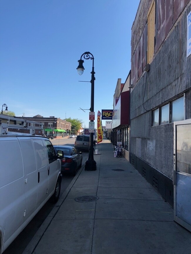
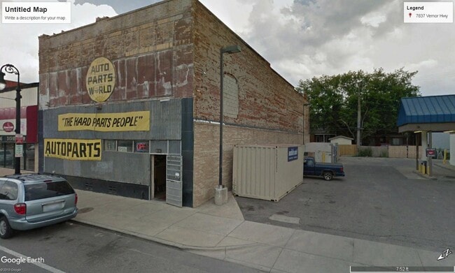
7815 W Vernor Hwy, Detroit, MI 48209
NEARBY LISTINGS FOR SALE OR LEASE
Property Detail
7815 W Vernor Hwy
20-0041989
Ferndale Ave
Storebuilding
S W VERNOR 63 THRU 65 E 0.083 FT OF 66 FERNDALE AVE SUB L30 P56 PLATS, W C R 20/349 60.083 X 100
X
Wayne
26163C0270F
Michigan
2024
0.14 AC
2025
Detroit W of Woodward
524200
Detroit
6,078 SF
Detroit-Warren-Dearborn, MI
DEMOGRAPHICS near 7815 W Vernor Hwy
1 Mile
3 Mile
5 Mile
2024 Total Population
17,982
88,790
275,457
2029 Population
17,516
87,152
271,286
Pop Growth 2024-2029
(2.59%)
(1.84%)
(1.51%)
Average Age
33
34
36
2024 Total Households
5,586
28,548
104,693
HH Growth 2024-2029
(2.67%)
(1.58%)
(1.17%)
Median Household Inc
$36,169
$34,874
$37,151
Avg Household Size
3.10
3.00
2.50
2024 Avg HH Vehicles
1.00
1.00
1.00
Median Home Value
$69,186
$84,801
$96,177
Median Year Built
1946
1947
1948
Nearby Places
Map Layers
Map Styles
 Street
 Aerial
- Restaurants
- Banks
- Shops
- Fitness
- Groceries
PUBLIC TRANSPORTATION
COMMUTER RAIL
DRIVE
WALK
Distance
14 min
6.3 mi
DRIVE
WALK
Distance
16 min
7.0 mi
AIRPORT
Windsor International
DRIVE
WALK
Distance
Windsor International
31 min
14.5 mi
Detroit Metro Wayne County
DRIVE
WALK
Distance
Detroit Metro Wayne County
31 min
18.8 mi
SALE & LEASE HISTORY
LISTING DATE
SALE/LEASE

Mar 31, 2023
For Lease
Jun 10, 2024
For Sale
Jul 31, 2023
For Sale
Jul 20, 2018
For Lease
Jul 19, 2018
For Sale
Feb 28, 2023
For Lease
Feb 28, 2023
For Sale
Dec 16, 2022
For Sale
Aug 17, 2021
For Sale
Aug 07, 2020
For Sale
Nearby Properties
Address
Land Use
TOTAL SIZE
Lot Size
Zoning
Address
Land Use
TOTAL SIZE
Lot Size
Zoning
6,620 SF
9.43 AC
B6
Address
Land Use
TOTAL SIZE
Lot Size
Zoning
590,116 SF
388.80 AC
ID
Address
Land Use
TOTAL SIZE
Lot Size
Zoning
153,040 SF
2.13 AC
BC
Address
Land Use
TOTAL SIZE
Lot Size
Zoning
2,822,007 SF
75.54 AC
ID
Address
Land Use
TOTAL SIZE
Lot Size
Zoning
309,661 SF
8.81 AC
M4
Address
Land Use
TOTAL SIZE
Lot Size
Zoning
1,076,924 SF
125.54 AC
ID
Address
Land Use
TOTAL SIZE
Lot Size
Zoning
102,646 SF
77.55 AC
ID
Address
Land Use
TOTAL SIZE
Lot Size
Zoning
452,876 SF
Address
Land Use
TOTAL SIZE
Lot Size
Zoning
80,861 SF
1.17 AC
BC
Address
Land Use
TOTAL SIZE
Lot Size
Zoning
111,008 SF
26.62 AC
IB
Address
Land Use
TOTAL SIZE
Lot Size
Zoning
365,040 SF
382 AC
M4
Address
Land Use
TOTAL SIZE
Lot Size
Zoning
520,522 SF
51.78 AC
M4
Address
Land Use
TOTAL SIZE
Lot Size
Zoning
590,652 SF
21.79 AC
TM
Address
Land Use
TOTAL SIZE
Lot Size
Zoning
191,460 SF
Address
Land Use
TOTAL SIZE
Lot Size
Zoning
342,272 SF
16.48 AC
M4
Address
Land Use
TOTAL SIZE
Lot Size
Zoning
303,705 SF
17.28 AC
ID
Address
Land Use
TOTAL SIZE
Lot Size
Zoning
381,532 SF
M4
Address
Land Use
TOTAL SIZE
Lot Size
Zoning
83,552 SF
20.32 AC
IC
Address
Land Use
TOTAL SIZE
Lot Size
Zoning
735,435 SF
37.86 AC
ID
Address
Land Use
TOTAL SIZE
Lot Size
Zoning
47,524 SF
Address
Land Use
TOTAL SIZE
Lot Size
Zoning
1,452 SF
19.24 AC
IC
Address
Land Use
TOTAL SIZE
Lot Size
Zoning
483,165 SF
22.98 AC
IB
Address
Land Use
TOTAL SIZE
Lot Size
Zoning
145,572 SF
58.41 AC
M4
Address
Land Use
TOTAL SIZE
Lot Size
Zoning
314,003 SF
26.32 AC
B6
Address
Land Use
TOTAL SIZE
Lot Size
Zoning
61,840 SF
M4
Address
Land Use
TOTAL SIZE
Lot Size
Zoning
336,958 SF
15.54 AC
IB
Address
Land Use
TOTAL SIZE
Lot Size
Zoning
193,114 SF
20.29 AC
M4
Address
Land Use
TOTAL SIZE
Lot Size
Zoning
290,849 SF
13.21 AC
IC
Address
Land Use
TOTAL SIZE
Lot Size
Zoning
52,964 SF
10.89 AC
Address
Land Use
TOTAL SIZE
Lot Size
Zoning
351,906 SF
42.21 AC
M4
The World's #1 Commercial Real Estate Marketplace
Connect with us
© 2025 CoStar Group
The information above has been obtained from sources believed reliable. While we do not doubt its accuracy we have not verified it and make no guarantee, warranty or representation about it. It is your responsibility to independently confirm its accuracy and completeness. Any projections, opinions, assumptions, or estimates used are for example only and do not represent the current or future performance of the property. The value of this transaction to you depends on tax and other factors which should be evaluated by your tax, financial, and legal advisors. You and your advisors should conduct a careful, independent investigation of the property to determine to your satisfaction the suitability of the property for your needs.