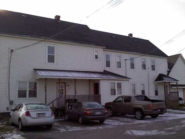
Property Record
784 Oliver St, North Tonawanda, NY 14120
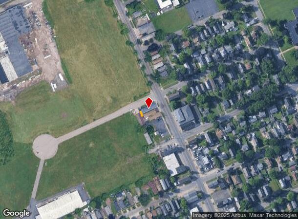
NEARBY LISTINGS FOR SALE OR LEASE
Property Detail
784 Oliver St
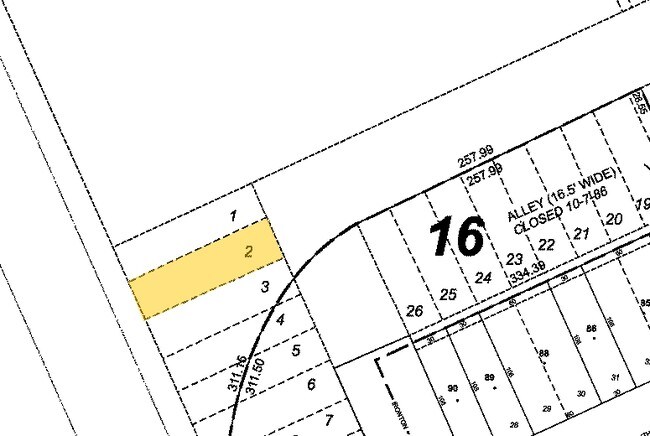
291200-181-052-0001-002-002
Niagara
Commercialacreage
New York
X
2.002
36029C0042J
Outlying Niagara County
2016
Buffalo/Niagara Falls
2024
Buffalo-Cheektowaga-Niagara Falls, NY
022901
DEMOGRAPHICS near 784 Oliver St
1 Mile
3 Mile
5 Mile
2024 Total Population
9,583
57,072
144,056
2029 Population
9,323
56,231
142,772
Pop Growth 2024-2029
(2.71%)
(1.47%)
(0.89%)
Average Age
42
43
43
2024 Total Households
4,481
25,621
64,312
HH Growth 2024-2029
(2.79%)
(1.57%)
(0.93%)
Median Household Inc
$56,690
$66,673
$67,342
Avg Household Size
2.10
2.20
2.20
2024 Avg HH Vehicles
2.00
2.00
2.00
Median Home Value
$137,634
$168,480
$178,750
Median Year Built
1947
1956
1959
Nearby Places
- Restaurants
- Banks
- Shops
- Fitness
- Groceries
PUBLIC TRANSPORTATION
AIRPORT
Niagara Falls International
DRIVE
WALK
Distance
Niagara Falls International
11 min
6.2 mi
Buffalo Niagara International
DRIVE
WALK
Distance
Buffalo Niagara International
24 min
13.6 mi
Freight Ports
Port of Toledo
DRIVE
WALK
Distance
Port of Toledo
378 min
318.2 mi
Nearby Properties
Address
Land Use
TOTAL SIZE
Lot Size
Zoning
Address
Land Use
TOTAL SIZE
Lot Size
Zoning
3,600 SF
72.50 AC
Address
Land Use
TOTAL SIZE
Lot Size
Zoning
223,916 SF
8.25 AC
R-C
Address
Land Use
TOTAL SIZE
Lot Size
Zoning
4,707 SF
13.60 AC
WD NT
Address
Land Use
TOTAL SIZE
Lot Size
Zoning
368,190 SF
98.37 AC
R1D
Address
Land Use
TOTAL SIZE
Lot Size
Zoning
173,303 SF
24.40 AC
R1-2
Address
Land Use
TOTAL SIZE
Lot Size
Zoning
2,474 SF
24.84 AC
Address
Land Use
TOTAL SIZE
Lot Size
Zoning
67,000 SF
6.50 AC
Address
Land Use
TOTAL SIZE
Lot Size
Zoning
137,878 SF
23.60 AC
R1-2
Address
Land Use
TOTAL SIZE
Lot Size
Zoning
107,490 SF
3.55 AC
Address
Land Use
TOTAL SIZE
Lot Size
Zoning
81,224 SF
0.45 AC
Address
Land Use
TOTAL SIZE
Lot Size
Zoning
33,970 SF
9.70 AC
Address
Land Use
TOTAL SIZE
Lot Size
Zoning
135,140 SF
25.60 AC
Address
Land Use
TOTAL SIZE
Lot Size
Zoning
Address
Land Use
TOTAL SIZE
Lot Size
Zoning
Address
Land Use
TOTAL SIZE
Lot Size
Zoning
175,793 SF
27.30 AC
M-1
Address
Land Use
TOTAL SIZE
Lot Size
Zoning
137,200 SF
3.56 AC
WD
Address
Land Use
TOTAL SIZE
Lot Size
Zoning
1,323 SF
26.39 AC
R-2
Address
Land Use
TOTAL SIZE
Lot Size
Zoning
96,458 SF
7.94 AC
GB
Address
Land Use
TOTAL SIZE
Lot Size
Zoning
47,400 SF
10.03 AC
MS
Address
Land Use
TOTAL SIZE
Lot Size
Zoning
34,100 SF
15.75 AC
C-1
Address
Land Use
TOTAL SIZE
Lot Size
Zoning
51,232 SF
2.55 AC
WD
Address
Land Use
TOTAL SIZE
Lot Size
Zoning
51,232 SF
1.62 AC
WD
Address
Land Use
TOTAL SIZE
Lot Size
Zoning
109,732 SF
10.50 AC
Address
Land Use
TOTAL SIZE
Lot Size
Zoning
217,735 SF
34.80 AC
Address
Land Use
TOTAL SIZE
Lot Size
Zoning
39,654 SF
4.33 AC
R-2
Address
Land Use
TOTAL SIZE
Lot Size
Zoning
74,215 SF
26.80 AC
05000
Address
Land Use
TOTAL SIZE
Lot Size
Zoning
8.20 AC
R2
Address
Land Use
TOTAL SIZE
Lot Size
Zoning
60,985 SF
4.38 AC
C-1
Address
Land Use
TOTAL SIZE
Lot Size
Zoning
21,993 SF
5.70 AC
Address
Land Use
TOTAL SIZE
Lot Size
Zoning
36,984 SF
20.90 AC
The World's #1 Commercial Real Estate Marketplace
Connect with us
© 2025 CoStar Group
The information above has been obtained from sources believed reliable. While we do not doubt its accuracy we have not verified it and make no guarantee, warranty or representation about it. It is your responsibility to independently confirm its accuracy and completeness. Any projections, opinions, assumptions, or estimates used are for example only and do not represent the current or future performance of the property. The value of this transaction to you depends on tax and other factors which should be evaluated by your tax, financial, and legal advisors. You and your advisors should conduct a careful, independent investigation of the property to determine to your satisfaction the suitability of the property for your needs.