Property Record
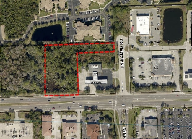
7820 N Wickham Rd, Melbourne, FL 32940
NEARBY LISTINGS FOR SALE OR LEASE
Property Detail
7820 N Wickham Rd
26-36-11-00-00504.0-0000.00
Acreage
Restaurantdrivein
PART OF S 1/2 OF SW 1/4 AS DESC IN ORB 2493 PG 1265 EXC ORB 4039 PG 1687 & ORB 7661 PG 2803
A
Brevard
12009C0505G
Florida
2024
1.63 AC
2025
Brevard County
064128
Orlando
3,200 SF
Palm Bay-Melbourne-Titusville, FL
DEMOGRAPHICS near 7820 N Wickham Rd
1 Mile
3 Mile
5 Mile
2024 Total Population
7,237
45,949
80,718
2029 Population
7,902
50,799
88,672
Pop Growth 2024-2029
+ 9.19%
+ 10.56%
+ 9.85%
Average Age
47
47
46
2024 Total Households
3,254
19,202
33,269
HH Growth 2024-2029
+ 9.07%
+ 10.19%
+ 9.54%
Median Household Inc
$78,291
$96,647
$95,261
Avg Household Size
2.20
2.30
2.40
2024 Avg HH Vehicles
2.00
2.00
2.00
Median Home Value
$339,203
$375,535
$374,226
Median Year Built
1995
2001
2000
Nearby Places
- Restaurants
- Banks
- Shops
- Fitness
- Groceries
PUBLIC TRANSPORTATION
AIRPORT
Melbourne Orlando International
DRIVE
WALK
Distance
Melbourne Orlando International
26 min
15.5 mi
Freight Ports
Port Canaveral
DRIVE
WALK
Distance
Port Canaveral
34 min
25.0 mi
Nearby Properties
Address
Land Use
TOTAL SIZE
Lot Size
Zoning
Address
Land Use
TOTAL SIZE
Lot Size
Zoning
453,736 SF
50 AC
PUD
Address
Land Use
TOTAL SIZE
Lot Size
Zoning
520,272 SF
17.31 AC
Address
Land Use
TOTAL SIZE
Lot Size
Zoning
354,864 SF
26.76 AC
PIP
Address
Land Use
TOTAL SIZE
Lot Size
Zoning
460,019 SF
11.64 AC
Address
Land Use
TOTAL SIZE
Lot Size
Zoning
406,986 SF
30.50 AC
PUD
Address
Land Use
TOTAL SIZE
Lot Size
Zoning
381,303 SF
9.93 AC
Address
Land Use
TOTAL SIZE
Lot Size
Zoning
395,806 SF
12.95 AC
Address
Land Use
TOTAL SIZE
Lot Size
Zoning
359,896 SF
13.29 AC
Address
Land Use
TOTAL SIZE
Lot Size
Zoning
358,615 SF
14.78 AC
PUD
Address
Land Use
TOTAL SIZE
Lot Size
Zoning
276,647 SF
2.39 AC
Address
Land Use
TOTAL SIZE
Lot Size
Zoning
386,565 SF
11.90 AC
Address
Land Use
TOTAL SIZE
Lot Size
Zoning
308,045 SF
45.57 AC
PUD
Address
Land Use
TOTAL SIZE
Lot Size
Zoning
353,805 SF
44.02 AC
PUD
Address
Land Use
TOTAL SIZE
Lot Size
Zoning
439,660 SF
38.05 AC
PUD
Address
Land Use
TOTAL SIZE
Lot Size
Zoning
224,695 SF
5.26 AC
Address
Land Use
TOTAL SIZE
Lot Size
Zoning
269,541 SF
17.80 AC
PUD
Address
Land Use
TOTAL SIZE
Lot Size
Zoning
134,562 SF
18.25 AC
BU1
Address
Land Use
TOTAL SIZE
Lot Size
Zoning
244,587 SF
8.49 AC
Address
Land Use
TOTAL SIZE
Lot Size
Zoning
375,112 SF
30.84 AC
PUD
Address
Land Use
TOTAL SIZE
Lot Size
Zoning
202,791 SF
32.03 AC
GML
Address
Land Use
TOTAL SIZE
Lot Size
Zoning
136,205 SF
28.71 AC
PUD
Address
Land Use
TOTAL SIZE
Lot Size
Zoning
324,509 SF
23.54 AC
GMLI
Address
Land Use
TOTAL SIZE
Lot Size
Zoning
125,958 SF
17.10 AC
Address
Land Use
TOTAL SIZE
Lot Size
Zoning
162,977 SF
11.44 AC
GML
Address
Land Use
TOTAL SIZE
Lot Size
Zoning
110,664 SF
10 AC
PUD
Address
Land Use
TOTAL SIZE
Lot Size
Zoning
114,906 SF
16.85 AC
PUD
Address
Land Use
TOTAL SIZE
Lot Size
Zoning
113,498 SF
37.57 AC
PUD
Address
Land Use
TOTAL SIZE
Lot Size
Zoning
96,110 SF
49.65 AC
INH
Address
Land Use
TOTAL SIZE
Lot Size
Zoning
110,902 SF
10.67 AC
Address
Land Use
TOTAL SIZE
Lot Size
Zoning
213,915 SF
27.13 AC
BU1
The World's #1 Commercial Real Estate Marketplace
Connect with us
© 2025 CoStar Group
The information above has been obtained from sources believed reliable. While we do not doubt its accuracy we have not verified it and make no guarantee, warranty or representation about it. It is your responsibility to independently confirm its accuracy and completeness. Any projections, opinions, assumptions, or estimates used are for example only and do not represent the current or future performance of the property. The value of this transaction to you depends on tax and other factors which should be evaluated by your tax, financial, and legal advisors. You and your advisors should conduct a careful, independent investigation of the property to determine to your satisfaction the suitability of the property for your needs.