Property Record
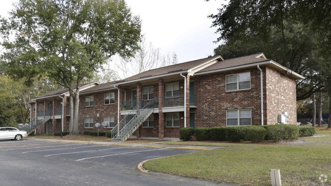
7844 Gregory Dr, Jacksonville, FL 32210


Property Detail
7844 Gregory Dr
013810-0000
5-93 11-3S-25E 17.25 JACKSONVILLE HEIGHTS PT TRACTS 6,8 RECD O/R 9494-2490
Countyproperty
Duval
RMD-D
Florida
AE The base floodplain where base flood elevations are provided. AE Zones are now used on new format FIRMs instead of A1-A30 Zones.
17.56 AC
0
Jacksonville Heights
2026
Jacksonville (Florida)
012704
Jacksonville, FL
197,792 SF
NEARBY LISTINGS FOR SALE OR LEASE
DEMOGRAPHICS near 7844 Gregory Dr
1 mile
3 mile
5 mile
2025 Total Population
14,103
85,526
189,533
2030 Population
14,913
90,721
201,356
Pop Growth 2025-2030
+ 5.74%
+ 6.07%
+ 6.24%
Average Age
36
38
38
2025 Total Households
5,098
32,051
73,085
HH Growth 2025-2030
+ 5.98%
+ 6.40%
+ 6.52%
Median Household Inc
$61,017
$57,537
$66,989
Avg Household Size
2.70
2.60
2.50
2025 Avg HH Vehicles
2.00
2.00
2.00
Median Home Value
$203,716
$227,908
$266,964
Median Year Built
1991
1983
1985
Nearby Places
Map Layers
Map Styles
 Street
 Aerial
Layers
 Traffic
 Biking
Places
Listings with unknown addresses are not visible on the map
- Restaurants
- Banks
- Shops
- Fitness
- Groceries
PUBLIC TRANSPORTATION
AIRPORT
Jacksonville International
Drive
Walk
Distance
Jacksonville International
32 min
21.4 mi
Freight Ports
Jacksonville Port
Drive
Walk
Distance
Jacksonville Port
24 min
13.9 mi
Nearby Properties
Address
Land Use
TOTAL SIZE
Lot Size
Zoning
Address
Land Use
TOTAL SIZE
Lot Size
Zoning
744,280 SF
53.40 AC
RMD-D
Address
Land Use
TOTAL SIZE
Lot Size
Zoning
185,662 SF
1,416.80 AC
PBF-3
Address
Land Use
TOTAL SIZE
Lot Size
Zoning
212,428 SF
15.41 AC
PUD
Address
Land Use
TOTAL SIZE
Lot Size
Zoning
321,547 SF
17.17 AC
PUD
Address
Land Use
TOTAL SIZE
Lot Size
Zoning
307,960 SF
18.52 AC
PUD
Address
Land Use
TOTAL SIZE
Lot Size
Zoning
375,127 SF
18.65 AC
PUD
Address
Land Use
TOTAL SIZE
Lot Size
Zoning
179,916 SF
12.19 AC
RMD-D
Address
Land Use
TOTAL SIZE
Lot Size
Zoning
310,972 SF
19.91 AC
RMD-D
Address
Land Use
TOTAL SIZE
Lot Size
Zoning
188,666 SF
17.76 AC
PUD
Address
Land Use
TOTAL SIZE
Lot Size
Zoning
139,435 SF
7.15 AC
CCG-2
Address
Land Use
TOTAL SIZE
Lot Size
Zoning
309,137 SF
20.09 AC
RMD-D
Address
Land Use
TOTAL SIZE
Lot Size
Zoning
64,013 SF
8.37 AC
PUD
Address
Land Use
TOTAL SIZE
Lot Size
Zoning
272,076 SF
54.84 AC
PUD
Address
Land Use
TOTAL SIZE
Lot Size
Zoning
206,513 SF
9.83 AC
RMD-D
Address
Land Use
TOTAL SIZE
Lot Size
Zoning
231,044 SF
10.94 AC
RMD-D
Address
Land Use
TOTAL SIZE
Lot Size
Zoning
137,636 SF
9.73 AC
RMD-D
Address
Land Use
TOTAL SIZE
Lot Size
Zoning
171,412 SF
16.44 AC
RMD-D
Address
Land Use
TOTAL SIZE
Lot Size
Zoning
229,441 SF
17.48 AC
PUD
Address
Land Use
TOTAL SIZE
Lot Size
Zoning
169,084 SF
13 AC
CCG-1
Address
Land Use
TOTAL SIZE
Lot Size
Zoning
209,238 SF
10.31 AC
RMD-D
Address
Land Use
TOTAL SIZE
Lot Size
Zoning
193,478 SF
10.13 AC
RMD-D
Address
Land Use
TOTAL SIZE
Lot Size
Zoning
59,810 SF
11.90 AC
CCG-2
Address
Land Use
TOTAL SIZE
Lot Size
Zoning
74,046 SF
7.21 AC
PUD
Address
Land Use
TOTAL SIZE
Lot Size
Zoning
73,769 SF
8.87 AC
CCG-1
Address
Land Use
TOTAL SIZE
Lot Size
Zoning
75,247 SF
14.90 AC
CCG-1
Address
Land Use
TOTAL SIZE
Lot Size
Zoning
141,403 SF
11.36 AC
PUD
Address
Land Use
TOTAL SIZE
Lot Size
Zoning
130,339 SF
8.07 AC
RMD-D
Address
Land Use
TOTAL SIZE
Lot Size
Zoning
131,247 SF
5.68 AC
PBF-2
Address
Land Use
TOTAL SIZE
Lot Size
Zoning
136,029 SF
4.96 AC
RMD-D
The World's #1 Commercial Real Estate Marketplace
Connect with us
© 2026 CoStar Group
The information above has been obtained from sources believed reliable. While we do not doubt its accuracy we have not verified it and make no guarantee, warranty or representation about it. It is your responsibility to independently confirm its accuracy and completeness. Any projections, opinions, assumptions, or estimates used are for example only and do not represent the current or future performance of the property. The value of this transaction to you depends on tax and other factors which should be evaluated by your tax, financial, and legal advisors. You and your advisors should conduct a careful, independent investigation of the property to determine to your satisfaction the suitability of the property for your needs.