Property Record
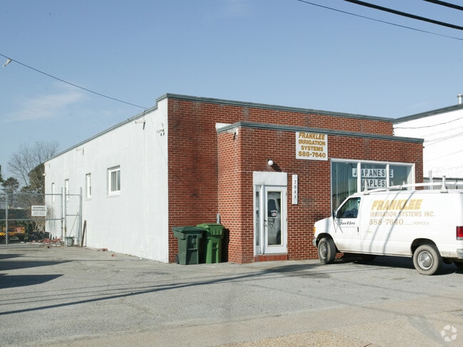
7849 Azalea Garden Rd, Norfolk, VA 23518

NEARBY LISTINGS FOR SALE OR LEASE
Property Detail
7849 Azalea Garden Rd
46691000
Saratoga Sd
Commercialnec
1 SARATOGA SEC 1
X
Norfolk City
5101040037H
Virginia
2025
0.20 AC
2025
Airport/Northampton
006605
Hampton Roads
2,257 SF
Virginia Beach-Norfolk-Newport News, VA-NC
DEMOGRAPHICS near 7849 Azalea Garden Rd
1 Mile
3 Mile
5 Mile
2024 Total Population
9,833
82,925
215,786
2029 Population
9,532
80,986
211,198
Pop Growth 2024-2029
(3.06%)
(2.34%)
(2.13%)
Average Age
41
38
38
2024 Total Households
4,025
34,808
84,993
HH Growth 2024-2029
(3.50%)
(2.63%)
(2.44%)
Median Household Inc
$75,265
$62,929
$63,344
Avg Household Size
2.40
2.30
2.30
2024 Avg HH Vehicles
2.00
2.00
2.00
Median Home Value
$259,183
$238,391
$253,409
Median Year Built
1960
1966
1969
Nearby Places
Map Layers
Map Styles
 Street
 Aerial
- Restaurants
- Banks
- Shops
- Fitness
- Groceries
PUBLIC TRANSPORTATION
AIRPORT
Norfolk International
DRIVE
WALK
Distance
Norfolk International
6 min
2.1 mi
Newport News/Williamsburg International
DRIVE
WALK
Distance
Newport News/Williamsburg International
39 min
26.4 mi
SALE & LEASE HISTORY
LISTING DATE
SALE/LEASE

Sep 29, 2021
For Sale
Dec 03, 2024
For Sale
Aug 10, 2022
For Lease
Nearby Properties
Address
Land Use
TOTAL SIZE
Lot Size
Zoning
Address
Land Use
TOTAL SIZE
Lot Size
Zoning
10 SF
207.44 AC
I2
Address
Land Use
TOTAL SIZE
Lot Size
Zoning
116,476 SF
947.43 AC
Address
Land Use
TOTAL SIZE
Lot Size
Zoning
52.36 AC
Address
Land Use
TOTAL SIZE
Lot Size
Zoning
30,036 SF
50.39 AC
Address
Land Use
TOTAL SIZE
Lot Size
Zoning
132 SF
71.89 AC
Address
Land Use
TOTAL SIZE
Lot Size
Zoning
40.37 AC
R6
Address
Land Use
TOTAL SIZE
Lot Size
Zoning
15.12 AC
Address
Land Use
TOTAL SIZE
Lot Size
Zoning
434,920 SF
8.35 AC
A36
Address
Land Use
TOTAL SIZE
Lot Size
Zoning
321,691 SF
30.58 AC
Address
Land Use
TOTAL SIZE
Lot Size
Zoning
340,291 SF
18.77 AC
O1
Address
Land Use
TOTAL SIZE
Lot Size
Zoning
1 SF
17.15 AC
A24
Address
Land Use
TOTAL SIZE
Lot Size
Zoning
319,444 SF
19.02 AC
O1
Address
Land Use
TOTAL SIZE
Lot Size
Zoning
167,279 SF
9.97 AC
IN1
Address
Land Use
TOTAL SIZE
Lot Size
Zoning
6,572 SF
23.41 AC
Address
Land Use
TOTAL SIZE
Lot Size
Zoning
Address
Land Use
TOTAL SIZE
Lot Size
Zoning
1,020 SF
13.45 AC
R11
Address
Land Use
TOTAL SIZE
Lot Size
Zoning
19.47 AC
86
Address
Land Use
TOTAL SIZE
Lot Size
Zoning
27,840 SF
5.80 AC
R11
Address
Land Use
TOTAL SIZE
Lot Size
Zoning
100,550 SF
1.72 AC
Address
Land Use
TOTAL SIZE
Lot Size
Zoning
1,980 SF
1.87 AC
Address
Land Use
TOTAL SIZE
Lot Size
Zoning
179,912 SF
9.08 AC
A36
Address
Land Use
TOTAL SIZE
Lot Size
Zoning
170,152 SF
6.07 AC
PDMU1
Address
Land Use
TOTAL SIZE
Lot Size
Zoning
6.96 AC
R11
Address
Land Use
TOTAL SIZE
Lot Size
Zoning
25,880 SF
31.21 AC
91
Address
Land Use
TOTAL SIZE
Lot Size
Zoning
176,075 SF
7.30 AC
C2
Address
Land Use
TOTAL SIZE
Lot Size
Zoning
40,323 SF
2.60 AC
Address
Land Use
TOTAL SIZE
Lot Size
Zoning
28,584 SF
7.76 AC
BC1
Address
Land Use
TOTAL SIZE
Lot Size
Zoning
1 SF
0.01 AC
A24
Address
Land Use
TOTAL SIZE
Lot Size
Zoning
15,898 SF
9.91 AC
IN1
Address
Land Use
TOTAL SIZE
Lot Size
Zoning
21.65 AC
The World's #1 Commercial Real Estate Marketplace
Connect with us
© 2026 CoStar Group
The information above has been obtained from sources believed reliable. While we do not doubt its accuracy we have not verified it and make no guarantee, warranty or representation about it. It is your responsibility to independently confirm its accuracy and completeness. Any projections, opinions, assumptions, or estimates used are for example only and do not represent the current or future performance of the property. The value of this transaction to you depends on tax and other factors which should be evaluated by your tax, financial, and legal advisors. You and your advisors should conduct a careful, independent investigation of the property to determine to your satisfaction the suitability of the property for your needs.