Property Record
735 Adamson Dr, Monroe, GA 30655

NEARBY LISTINGS FOR SALE OR LEASE
-
-
View all Monroe listings for sale on LoopNet.com
Property Detail
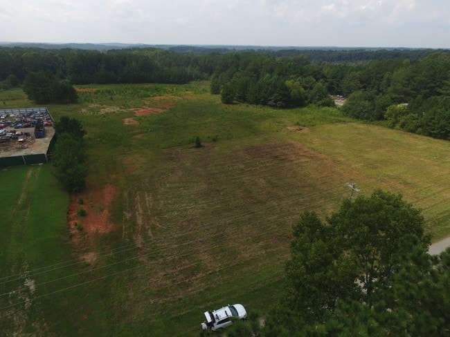
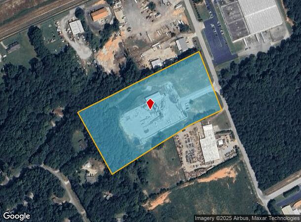
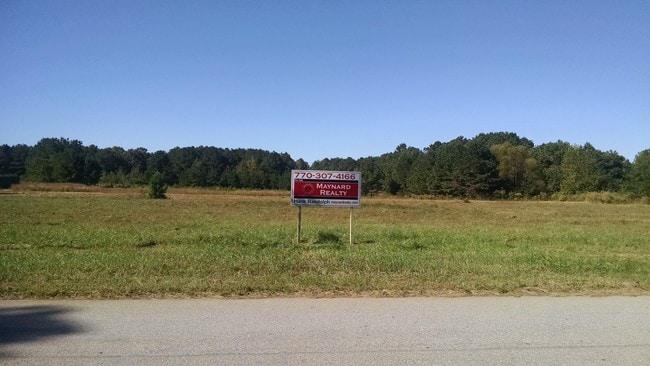
735 Adamson Dr
C135000000018A00
09171-County Industrial
Officebuilding
#1AB 8.52AC
A
Walton
13297C0139F
Georgia
2024
8.52 AC
2025
Walton County
110702
Atlanta
4,000 SF
Atlanta-Sandy Springs-Roswell, GA
DEMOGRAPHICS near 735 Adamson Dr
1 Mile
3 Mile
5 Mile
2024 Total Population
1,850
18,177
31,030
2029 Population
2,189
21,136
36,054
Pop Growth 2024-2029
+ 18.32%
+ 16.28%
+ 16.19%
Average Age
42
39
40
2024 Total Households
723
6,949
11,448
HH Growth 2024-2029
+ 18.67%
+ 16.65%
+ 16.57%
Median Household Inc
$67,894
$43,686
$57,108
Avg Household Size
2.50
2.60
2.60
2024 Avg HH Vehicles
2.00
2.00
2.00
Median Home Value
$280,937
$217,011
$237,020
Median Year Built
1998
1985
1990
Nearby Places
Map Layers
Map Styles
 Street
 Aerial
- Restaurants
- Banks
- Shops
- Fitness
- Groceries
SALE & LEASE HISTORY
LISTING DATE
SALE/LEASE

Sep 24, 2016
For Sale
Nov 28, 2016
For Sale
Nearby Properties
Address
Land Use
TOTAL SIZE
Lot Size
Zoning
Address
Land Use
TOTAL SIZE
Lot Size
Zoning
63,172 SF
225.97 AC
R1 P
Address
Land Use
TOTAL SIZE
Lot Size
Zoning
9,424 SF
76 AC
MIX WP2
Address
Land Use
TOTAL SIZE
Lot Size
Zoning
122,949 SF
28.37 AC
R1 P
Address
Land Use
TOTAL SIZE
Lot Size
Zoning
188,663 SF
25.40 AC
B3
Address
Land Use
TOTAL SIZE
Lot Size
Zoning
2,736 SF
8.96 AC
P
Address
Land Use
TOTAL SIZE
Lot Size
Zoning
468,275 SF
59.49 AC
I1
Address
Land Use
TOTAL SIZE
Lot Size
Zoning
29,161 SF
42.44 AC
B2 R1 R2
Address
Land Use
TOTAL SIZE
Lot Size
Zoning
4,319 SF
12.16 AC
PRD
Address
Land Use
TOTAL SIZE
Lot Size
Zoning
78,644 SF
9.90 AC
B3
Address
Land Use
TOTAL SIZE
Lot Size
Zoning
58,980 SF
8.84 AC
PCD
Address
Land Use
TOTAL SIZE
Lot Size
Zoning
2,640 SF
64.81 AC
R1A
Address
Land Use
TOTAL SIZE
Lot Size
Zoning
2,900 SF
30.02 AC
M1
Address
Land Use
TOTAL SIZE
Lot Size
Zoning
7,200 SF
18 AC
A1
Address
Land Use
TOTAL SIZE
Lot Size
Zoning
52,185 SF
3.64 AC
PCD
Address
Land Use
TOTAL SIZE
Lot Size
Zoning
27,300 SF
8 AC
PCD
Address
Land Use
TOTAL SIZE
Lot Size
Zoning
45,428 SF
8.11 AC
B3
Address
Land Use
TOTAL SIZE
Lot Size
Zoning
90,557 SF
11.46 AC
B3
Address
Land Use
TOTAL SIZE
Lot Size
Zoning
104,104 SF
17.55 AC
R1A
Address
Land Use
TOTAL SIZE
Lot Size
Zoning
37,600 SF
5.96 AC
B2
Address
Land Use
TOTAL SIZE
Lot Size
Zoning
3,321 SF
9.58 AC
M1
Address
Land Use
TOTAL SIZE
Lot Size
Zoning
3,912 SF
221.14 AC
MIX
Address
Land Use
TOTAL SIZE
Lot Size
Zoning
2,576 SF
23.95 AC
I1
Address
Land Use
TOTAL SIZE
Lot Size
Zoning
24,553 SF
5.32 AC
P
Address
Land Use
TOTAL SIZE
Lot Size
Zoning
30,722 SF
2.54 AC
B2
Address
Land Use
TOTAL SIZE
Lot Size
Zoning
4,830 SF
9.65 AC
PCD
Address
Land Use
TOTAL SIZE
Lot Size
Zoning
92,250 SF
3.64 AC
PCD
Address
Land Use
TOTAL SIZE
Lot Size
Zoning
15,522 SF
2.05 AC
B3
Address
Land Use
TOTAL SIZE
Lot Size
Zoning
32,343 SF
4.11 AC
P
Address
Land Use
TOTAL SIZE
Lot Size
Zoning
105.57 AC
B3 PCD
Address
Land Use
TOTAL SIZE
Lot Size
Zoning
11,953 SF
1.39 AC
B2
The World's #1 Commercial Real Estate Marketplace
Connect with us
© 2026 CoStar Group
The information above has been obtained from sources believed reliable. While we do not doubt its accuracy we have not verified it and make no guarantee, warranty or representation about it. It is your responsibility to independently confirm its accuracy and completeness. Any projections, opinions, assumptions, or estimates used are for example only and do not represent the current or future performance of the property. The value of this transaction to you depends on tax and other factors which should be evaluated by your tax, financial, and legal advisors. You and your advisors should conduct a careful, independent investigation of the property to determine to your satisfaction the suitability of the property for your needs.