Property Record
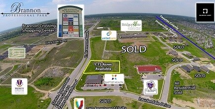
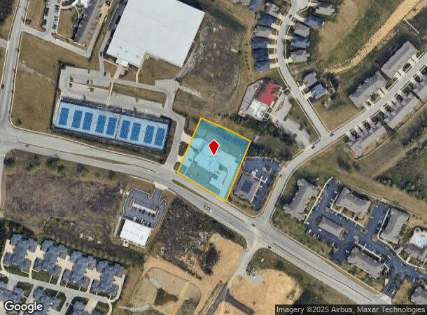
785 E Brannon Rd, Nicholasville, KY 40356
NEARBY LISTINGS FOR SALE OR LEASE
Property Detail
785 E Brannon Rd
Lexington-Fayette, KY
78D
078-00-00-002.00
Jessamine
Taxexempt
Kentucky
X
78d
2100670209F
28.31 AC
0
Jessamine County
2025
Lexington/Fayette
060200
DEMOGRAPHICS near 785 E Brannon Rd
1 Mile
3 Mile
5 Mile
2024 Total Population
6,944
64,346
138,028
2029 Population
7,038
64,252
137,880
Pop Growth 2024-2029
+ 1.35%
(0.15%)
(0.11%)
Average Age
40
38
40
2024 Total Households
2,601
27,892
58,801
HH Growth 2024-2029
+ 1.77%
(0.18%)
(0.21%)
Median Household Inc
$95,980
$63,902
$68,663
Avg Household Size
2.60
2.30
2.30
2024 Avg HH Vehicles
2.00
2.00
2.00
Median Home Value
$290,341
$241,379
$260,547
Median Year Built
1999
1987
1983
Nearby Places
Map Layers
Map Styles
 Street
 Aerial
- Restaurants
- Banks
- Shops
- Fitness
- Groceries
PUBLIC TRANSPORTATION
AIRPORT
Blue Grass
DRIVE
WALK
Distance
Blue Grass
21 min
12.0 mi
Freight Ports
Port of Toledo
DRIVE
WALK
Distance
Port of Toledo
348 min
295.2 mi
Nearby Properties
Address
Land Use
TOTAL SIZE
Lot Size
Zoning
Address
Land Use
TOTAL SIZE
Lot Size
Zoning
318,370 SF
17.79 AC
B-6P
Address
Land Use
TOTAL SIZE
Lot Size
Zoning
4,299 SF
18.43 AC
R-4
Address
Land Use
TOTAL SIZE
Lot Size
Zoning
8,001 SF
32.59 AC
MU-3
Address
Land Use
TOTAL SIZE
Lot Size
Zoning
144,866 SF
14.83 AC
B-6P
Address
Land Use
TOTAL SIZE
Lot Size
Zoning
238,393 SF
9.83 AC
B-6P
Address
Land Use
TOTAL SIZE
Lot Size
Zoning
5,650 SF
22.46 AC
R-3
Address
Land Use
TOTAL SIZE
Lot Size
Zoning
22.10 AC
R-3
Address
Land Use
TOTAL SIZE
Lot Size
Zoning
12,767 SF
14.39 AC
R-3
Address
Land Use
TOTAL SIZE
Lot Size
Zoning
41,040 SF
14.77 AC
R-4
Address
Land Use
TOTAL SIZE
Lot Size
Zoning
184,756 SF
4.43 AC
MU-3
Address
Land Use
TOTAL SIZE
Lot Size
Zoning
91,484 SF
14.72 AC
B-6P
Address
Land Use
TOTAL SIZE
Lot Size
Zoning
7,402 SF
18.83 AC
R-4
Address
Land Use
TOTAL SIZE
Lot Size
Zoning
41,132 SF
19 AC
Address
Land Use
TOTAL SIZE
Lot Size
Zoning
137,905 SF
23.79 AC
B-6P
Address
Land Use
TOTAL SIZE
Lot Size
Zoning
59,586 SF
5.37 AC
R-4
Address
Land Use
TOTAL SIZE
Lot Size
Zoning
4,859 SF
20.45 AC
R-3
Address
Land Use
TOTAL SIZE
Lot Size
Zoning
6.25 AC
A-U
Address
Land Use
TOTAL SIZE
Lot Size
Zoning
222,168 SF
26.49 AC
B-6P
Address
Land Use
TOTAL SIZE
Lot Size
Zoning
160,800 SF
74.22 AC
R-1C
Address
Land Use
TOTAL SIZE
Lot Size
Zoning
14,928 SF
8.75 AC
R-3
Address
Land Use
TOTAL SIZE
Lot Size
Zoning
2,770 SF
15.20 AC
R-4
Address
Land Use
TOTAL SIZE
Lot Size
Zoning
156,350 SF
18.83 AC
B-6P
Address
Land Use
TOTAL SIZE
Lot Size
Zoning
219,320 SF
8.35 AC
R-4
Address
Land Use
TOTAL SIZE
Lot Size
Zoning
4,992 SF
32.12 AC
Address
Land Use
TOTAL SIZE
Lot Size
Zoning
93,675 SF
10.32 AC
A-U
Address
Land Use
TOTAL SIZE
Lot Size
Zoning
2,316 SF
15.05 AC
R-4
Address
Land Use
TOTAL SIZE
Lot Size
Zoning
9,186 SF
12 AC
R-3
Address
Land Use
TOTAL SIZE
Lot Size
Zoning
4,452 SF
20.28 AC
R-4
Address
Land Use
TOTAL SIZE
Lot Size
Zoning
88,276 SF
10.97 AC
A-U
Address
Land Use
TOTAL SIZE
Lot Size
Zoning
12,484 SF
18.34 AC
R-4
The World's #1 Commercial Real Estate Marketplace
Connect with us
© 2026 CoStar Group
The information above has been obtained from sources believed reliable. While we do not doubt its accuracy we have not verified it and make no guarantee, warranty or representation about it. It is your responsibility to independently confirm its accuracy and completeness. Any projections, opinions, assumptions, or estimates used are for example only and do not represent the current or future performance of the property. The value of this transaction to you depends on tax and other factors which should be evaluated by your tax, financial, and legal advisors. You and your advisors should conduct a careful, independent investigation of the property to determine to your satisfaction the suitability of the property for your needs.