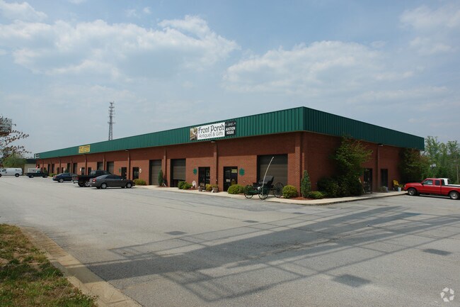
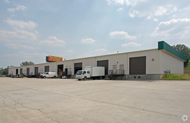
Property Record
785 Seaboard Dr, Dallas, GA 30132

Property Detail
785 Seaboard Dr
137.3.1.002.0000
REAL PROPERTY
Warehouse
Paulding
C2
Georgia
B and X Area of moderate flood hazard, usually the area between the limits of the 100-year and 500-year floods.
348
2025
5.03 AC
2025
I-20 W/Douglasville
120305
Atlanta
48,600 SF
Atlanta-Sandy Springs-Roswell, GA
NEARBY LISTINGS FOR SALE OR LEASE
DEMOGRAPHICS near 785 Seaboard Dr
1 mile
3 mile
5 mile
2025 Total Population
6,481
27,119
65,932
2030 Population
7,106
29,906
72,600
Pop Growth 2025-2030
+ 9.64%
+ 10.28%
+ 10.11%
Average Age
37
38
38
2025 Total Households
2,384
9,823
23,025
HH Growth 2025-2030
+ 9.73%
+ 10.36%
+ 10.19%
Median Household Inc
$68,584
$73,378
$85,001
Avg Household Size
2.70
2.70
2.80
2025 Avg HH Vehicles
2.00
2.00
2.00
Median Home Value
$293,585
$297,666
$308,287
Median Year Built
1998
2001
2000
Nearby Places
Map Layers
Map Styles
 Street
 Aerial
Layers
 Traffic
 Biking
Places
Listings with unknown addresses are not visible on the map
- Restaurants
- Banks
- Shops
- Fitness
- Groceries
PUBLIC TRANSPORTATION
AIRPORT
Hartsfield - Jackson Atlanta International
Drive
Walk
Distance
Hartsfield - Jackson Atlanta International
60 min
40.0 mi
Nearby Properties
Address
Land Use
TOTAL SIZE
Lot Size
Zoning
Address
Land Use
TOTAL SIZE
Lot Size
Zoning
83.40 AC
OMI
Address
Land Use
TOTAL SIZE
Lot Size
Zoning
62.35 AC
Address
Land Use
TOTAL SIZE
Lot Size
Zoning
133,468 SF
12.37 AC
MF1
Address
Land Use
TOTAL SIZE
Lot Size
Zoning
Address
Land Use
TOTAL SIZE
Lot Size
Zoning
25.11 AC
Address
Land Use
TOTAL SIZE
Lot Size
Zoning
179,316 SF
13.43 AC
MF1
Address
Land Use
TOTAL SIZE
Lot Size
Zoning
20.91 AC
Address
Land Use
TOTAL SIZE
Lot Size
Zoning
30.44 AC
Address
Land Use
TOTAL SIZE
Lot Size
Zoning
0.44 AC
CBD
Address
Land Use
TOTAL SIZE
Lot Size
Zoning
39,290 SF
10.56 AC
R4
Address
Land Use
TOTAL SIZE
Lot Size
Zoning
26,770 SF
3.62 AC
R1
Address
Land Use
TOTAL SIZE
Lot Size
Zoning
42,774 SF
7.61 AC
OMI
Address
Land Use
TOTAL SIZE
Lot Size
Zoning
0.56 AC
Address
Land Use
TOTAL SIZE
Lot Size
Zoning
8.59 AC
Address
Land Use
TOTAL SIZE
Lot Size
Zoning
71,416 SF
8.58 AC
B2
Address
Land Use
TOTAL SIZE
Lot Size
Zoning
128.92 AC
Address
Land Use
TOTAL SIZE
Lot Size
Zoning
62,175 SF
4.39 AC
I1
Address
Land Use
TOTAL SIZE
Lot Size
Zoning
57,800 SF
10.48 AC
MF1
Address
Land Use
TOTAL SIZE
Lot Size
Zoning
33,024 SF
5.41 AC
TH
Address
Land Use
TOTAL SIZE
Lot Size
Zoning
7.37 AC
Address
Land Use
TOTAL SIZE
Lot Size
Zoning
63,420 SF
6.49 AC
MF1
Address
Land Use
TOTAL SIZE
Lot Size
Zoning
4,838 SF
3.42 AC
Address
Land Use
TOTAL SIZE
Lot Size
Zoning
91,806 SF
10.75 AC
I2
Address
Land Use
TOTAL SIZE
Lot Size
Zoning
62,098 SF
5.88 AC
DC2
Address
Land Use
TOTAL SIZE
Lot Size
Zoning
0.43 AC
CBD
Address
Land Use
TOTAL SIZE
Lot Size
Zoning
0.23 AC
CBD
Address
Land Use
TOTAL SIZE
Lot Size
Zoning
55,000 SF
7.01 AC
Address
Land Use
TOTAL SIZE
Lot Size
Zoning
21,200 SF
2.23 AC
I1
Address
Land Use
TOTAL SIZE
Lot Size
Zoning
113,742 SF
5.14 AC
C2
Address
Land Use
TOTAL SIZE
Lot Size
Zoning
23,206 SF
7.30 AC
R2
The World's #1 Commercial Real Estate Marketplace
Connect with us
© 2026 CoStar Group
The information above has been obtained from sources believed reliable. While we do not doubt its accuracy we have not verified it and make no guarantee, warranty or representation about it. It is your responsibility to independently confirm its accuracy and completeness. Any projections, opinions, assumptions, or estimates used are for example only and do not represent the current or future performance of the property. The value of this transaction to you depends on tax and other factors which should be evaluated by your tax, financial, and legal advisors. You and your advisors should conduct a careful, independent investigation of the property to determine to your satisfaction the suitability of the property for your needs.