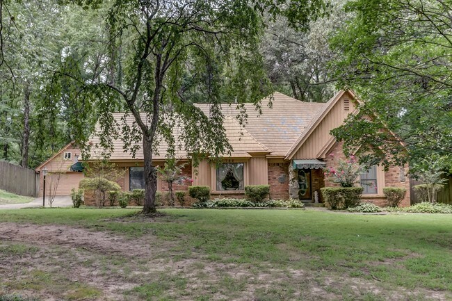
Property Record
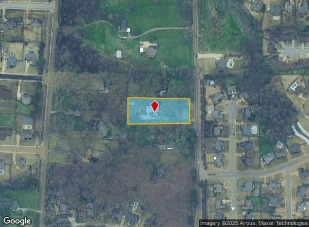
785 Highway 51 S, Hernando, MS 38632
NEARBY LISTINGS FOR SALE OR LEASE
Property Detail
785 Highway 51 S
Memphis, TN-MS-AR
DeSoto
3081010000003703
Mississippi
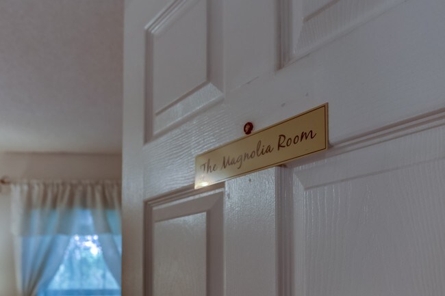
Singlefamilyresidentialassumed
1.50 AC
X
Outlying DeSoto Cnty
28033C0230H
Memphis
3,131 SF
DEMOGRAPHICS near 785 Highway 51 S
1 Mile
3 Mile
5 Mile
2024 Total Population
3,698
17,942
30,525
2029 Population
4,056
19,557
33,402
Pop Growth 2024-2029
+ 9.68%
+ 9.00%
+ 9.43%
Average Age
38
39
39
2024 Total Households
1,329
6,400
10,729
HH Growth 2024-2029
+ 9.56%
+ 8.97%
+ 9.40%
Median Household Inc
$75,995
$64,504
$83,705
Avg Household Size
2.70
2.70
2.80
2024 Avg HH Vehicles
2.00
2.00
2.00
Median Home Value
$259,358
$275,912
$278,565
Median Year Built
2000
1999
2000
Nearby Places
Map Layers
Map Styles
 Street
 Aerial
- Restaurants
- Banks
- Shops
- Fitness
- Groceries
PUBLIC TRANSPORTATION
AIRPORT
Memphis International
DRIVE
WALK
Distance
Memphis International
22 min
16.2 mi
Freight Ports
Port of Shreveport
DRIVE
WALK
Distance
Port of Shreveport
423 min
389.9 mi
SALE & LEASE HISTORY
LISTING DATE
SALE/LEASE

Aug 23, 2017
For Sale
Nearby Properties
Address
Land Use
TOTAL SIZE
Lot Size
Zoning
Address
Land Use
TOTAL SIZE
Lot Size
Zoning
436,932 SF
153.19 AC
M-1
Address
Land Use
TOTAL SIZE
Lot Size
Zoning
19,367 SF
20.34 AC
PUD
Address
Land Use
TOTAL SIZE
Lot Size
Zoning
158,963 SF
20.07 AC
PUD
Address
Land Use
TOTAL SIZE
Lot Size
Zoning
120,095 SF
19.42 AC
C-2
Address
Land Use
TOTAL SIZE
Lot Size
Zoning
242,220 SF
27.54 AC
M-2
Address
Land Use
TOTAL SIZE
Lot Size
Zoning
64,797 SF
13.91 AC
M-1
Address
Land Use
TOTAL SIZE
Lot Size
Zoning
13,533 SF
1.50 AC
PUD
Address
Land Use
TOTAL SIZE
Lot Size
Zoning
71,484 SF
6.45 AC
C-2
Address
Land Use
TOTAL SIZE
Lot Size
Zoning
37,622 SF
5.63 AC
PUD
Address
Land Use
TOTAL SIZE
Lot Size
Zoning
12,002 SF
1.15 AC
M-1
Address
Land Use
TOTAL SIZE
Lot Size
Zoning
18,556 SF
5.50 AC
C-2
Address
Land Use
TOTAL SIZE
Lot Size
Zoning
45,515 SF
2.60 AC
C-2
Address
Land Use
TOTAL SIZE
Lot Size
Zoning
55,903 SF
5.70 AC
C-4
Address
Land Use
TOTAL SIZE
Lot Size
Zoning
3.12 AC
PUD
Address
Land Use
TOTAL SIZE
Lot Size
Zoning
54,098 SF
9.27 AC
M-1
Address
Land Use
TOTAL SIZE
Lot Size
Zoning
53,623 SF
2.69 AC
C-2
Address
Land Use
TOTAL SIZE
Lot Size
Zoning
15.10 AC
C-2
Address
Land Use
TOTAL SIZE
Lot Size
Zoning
24,163 SF
1.97 AC
C-2
Address
Land Use
TOTAL SIZE
Lot Size
Zoning
45,789 SF
10 AC
M-2
Address
Land Use
TOTAL SIZE
Lot Size
Zoning
12,201 SF
3.44 AC
M-1
Address
Land Use
TOTAL SIZE
Lot Size
Zoning
100,000 SF
9.90 AC
M-2
Address
Land Use
TOTAL SIZE
Lot Size
Zoning
23,530 SF
9.35 AC
M-1
Address
Land Use
TOTAL SIZE
Lot Size
Zoning
35,000 SF
4.72 AC
PUD
Address
Land Use
TOTAL SIZE
Lot Size
Zoning
46,498 SF
8.26 AC
M-1
Address
Land Use
TOTAL SIZE
Lot Size
Zoning
30,009 SF
4.31 AC
M-1
Address
Land Use
TOTAL SIZE
Lot Size
Zoning
20,386 SF
3.24 AC
C-4
Address
Land Use
TOTAL SIZE
Lot Size
Zoning
37,074 SF
5.46 AC
C-2
Address
Land Use
TOTAL SIZE
Lot Size
Zoning
44,973 SF
4 AC
M-2
Address
Land Use
TOTAL SIZE
Lot Size
Zoning
40,831 SF
6.11 AC
C-2
Address
Land Use
TOTAL SIZE
Lot Size
Zoning
8,076 SF
4.04 AC
C-2
The World's #1 Commercial Real Estate Marketplace
Connect with us
© 2025 CoStar Group
The information above has been obtained from sources believed reliable. While we do not doubt its accuracy we have not verified it and make no guarantee, warranty or representation about it. It is your responsibility to independently confirm its accuracy and completeness. Any projections, opinions, assumptions, or estimates used are for example only and do not represent the current or future performance of the property. The value of this transaction to you depends on tax and other factors which should be evaluated by your tax, financial, and legal advisors. You and your advisors should conduct a careful, independent investigation of the property to determine to your satisfaction the suitability of the property for your needs.