Property Record
7850 Commons Park Cir Nw, Concord, NC 28027


NEARBY LISTINGS FOR SALE OR LEASE
Property Detail
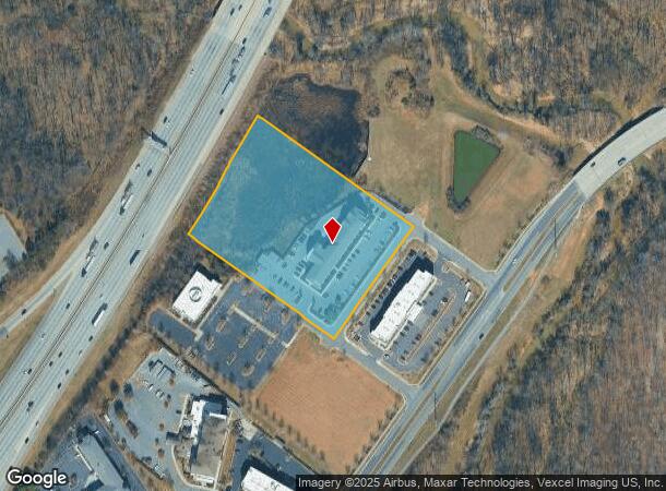
7850 Commons Park Cir Nw
4599-04-5882-0000
Concord Mills
Hotelormotel
LT 1 WEDDINGTON ROAD COMMONS
AE
Cabarrus
3710459900K
North Carolina
2025
1
2025
4.81 AC
042602
Other Market Areas
53,329 SF
Charlotte-Concord-Gastonia, NC-SC
DEMOGRAPHICS near 7850 Commons Park Cir Nw
1 Mile
3 Mile
5 Mile
2024 Total Population
944
31,937
117,498
2029 Population
1,075
35,035
129,304
Pop Growth 2024-2029
+ 13.88%
+ 9.70%
+ 10.05%
Average Age
35
35
34
2024 Total Households
463
11,447
43,634
HH Growth 2024-2029
+ 14.25%
+ 9.91%
+ 10.24%
Median Household Inc
$55,178
$77,331
$69,126
Avg Household Size
2.00
2.80
2.70
2024 Avg HH Vehicles
2.00
2.00
2.00
Median Home Value
$175,675
$209,777
$194,896
Median Year Built
2006
2001
2000
Nearby Places
Map Layers
Map Styles
 Street
 Aerial
- Restaurants
- Banks
- Shops
- Fitness
- Groceries
PUBLIC TRANSPORTATION
AIRPORT
Concord-Padgett Regional
DRIVE
WALK
Distance
Concord-Padgett Regional
8 min
3.1 mi
Charlotte/Douglas International
DRIVE
WALK
Distance
Charlotte/Douglas International
33 min
22.1 mi
Freight Ports
North Charleston Terminal
DRIVE
WALK
Distance
North Charleston Terminal
246 min
214.4 mi
Nearby Properties
Address
Land Use
TOTAL SIZE
Lot Size
Zoning
Address
Land Use
TOTAL SIZE
Lot Size
Zoning
701,530 SF
143.45 AC
C-2
Address
Land Use
TOTAL SIZE
Lot Size
Zoning
154,304 SF
857.72 AC
PID
Address
Land Use
TOTAL SIZE
Lot Size
Zoning
381,490 SF
29.24 AC
C-2
Address
Land Use
TOTAL SIZE
Lot Size
Zoning
374,697 SF
12.46 AC
Address
Land Use
TOTAL SIZE
Lot Size
Zoning
324,349 SF
4.69 AC
C-2
Address
Land Use
TOTAL SIZE
Lot Size
Zoning
14,742 SF
587.28 AC
I-1
Address
Land Use
TOTAL SIZE
Lot Size
Zoning
375,242 SF
25.64 AC
CC
Address
Land Use
TOTAL SIZE
Lot Size
Zoning
33,090 SF
19.43 AC
C-2
Address
Land Use
TOTAL SIZE
Lot Size
Zoning
26,733 SF
48.78 AC
C-2
Address
Land Use
TOTAL SIZE
Lot Size
Zoning
29,658 SF
17.25 AC
MX-IB
Address
Land Use
TOTAL SIZE
Lot Size
Zoning
30,586 SF
54.10 AC
C-2
Address
Land Use
TOTAL SIZE
Lot Size
Zoning
57,268 SF
25.88 AC
C-2
Address
Land Use
TOTAL SIZE
Lot Size
Zoning
5,048 SF
26.66 AC
C-2
Address
Land Use
TOTAL SIZE
Lot Size
Zoning
300,275 SF
20.78 AC
MX2
Address
Land Use
TOTAL SIZE
Lot Size
Zoning
31,248 SF
21.72 AC
C-2
Address
Land Use
TOTAL SIZE
Lot Size
Zoning
260,820 SF
14.72 AC
R3
Address
Land Use
TOTAL SIZE
Lot Size
Zoning
276,620 SF
19.76 AC
R3
Address
Land Use
TOTAL SIZE
Lot Size
Zoning
43,005 SF
97.30 AC
RM-2
Address
Land Use
TOTAL SIZE
Lot Size
Zoning
360,683 SF
16.84 AC
R12MF
Address
Land Use
TOTAL SIZE
Lot Size
Zoning
62,780 SF
21.89 AC
Address
Land Use
TOTAL SIZE
Lot Size
Zoning
262,196 SF
21.30 AC
Address
Land Use
TOTAL SIZE
Lot Size
Zoning
289,262 SF
14.50 AC
CC
Address
Land Use
TOTAL SIZE
Lot Size
Zoning
22,198 SF
18.46 AC
C-2
Address
Land Use
TOTAL SIZE
Lot Size
Zoning
282,743 SF
25.96 AC
NS
Address
Land Use
TOTAL SIZE
Lot Size
Zoning
245,838 SF
6.13 AC
Address
Land Use
TOTAL SIZE
Lot Size
Zoning
350,339 SF
77.60 AC
RM-1
Address
Land Use
TOTAL SIZE
Lot Size
Zoning
322,202 SF
17.29 AC
R22MF
Address
Land Use
TOTAL SIZE
Lot Size
Zoning
249,618 SF
63.24 AC
RL
Address
Land Use
TOTAL SIZE
Lot Size
Zoning
600,000 SF
27.59 AC
I-2-CD
Address
Land Use
TOTAL SIZE
Lot Size
Zoning
190,305 SF
7.20 AC
CC
The World's #1 Commercial Real Estate Marketplace
Connect with us
© 2025 CoStar Group
The information above has been obtained from sources believed reliable. While we do not doubt its accuracy we have not verified it and make no guarantee, warranty or representation about it. It is your responsibility to independently confirm its accuracy and completeness. Any projections, opinions, assumptions, or estimates used are for example only and do not represent the current or future performance of the property. The value of this transaction to you depends on tax and other factors which should be evaluated by your tax, financial, and legal advisors. You and your advisors should conduct a careful, independent investigation of the property to determine to your satisfaction the suitability of the property for your needs.