Property Record
7851 Crary Station Rd, Semmes, AL 36575


Property Detail
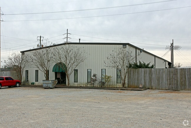
7851 Crary Station Rd
Mobile, AL
LOT 27 NORTH SCHILLINGER IND COMM PARK MBK 42 P 71 #SEC 36 T3S R3W #MP24 07 36 0 000
24-07-36-0-000-001.027
MOBILE
Autorepair
Alabama
B and X Area of moderate flood hazard, usually the area between the limits of the 100-year and 500-year floods.
27
2025
1.39 AC
2025
Outlying Mobile County
006306
Mobile
7,200 SF
NEARBY LISTINGS FOR SALE OR LEASE
-
-
View all Semmes listings for sale on LoopNet.com
DEMOGRAPHICS near 7851 Crary Station Rd
1 mile
3 mile
5 mile
2025 Total Population
2,868
21,053
54,707
2030 Population
2,859
20,856
54,053
Pop Growth 2025-2030
(0.31%)
(0.94%)
(1.20%)
Average Age
39
40
39
2025 Total Households
1,080
7,753
20,079
HH Growth 2025-2030
(0.37%)
(0.98%)
(1.32%)
Median Household Inc
$73,433
$72,451
$60,814
Avg Household Size
2.60
2.70
2.50
2025 Avg HH Vehicles
2.00
2.00
2.00
Median Home Value
$160,730
$197,846
$182,528
Median Year Built
1985
1988
1983
Nearby Places
Map Layers
Map Styles
 Street
 Aerial
Transit
 Traffic
 Biking
Places
Listings with unknown addresses are not visible on the map
- Restaurants
- Banks
- Shops
- Fitness
- Groceries
PUBLIC TRANSPORTATION
AIRPORT
Mobile Regional
Drive
Walk
Distance
Mobile Regional
13 min
5.3 mi
Mobile International
Drive
Walk
Distance
Mobile International
29 min
18.2 mi
Nearby Properties
Address
Land Use
TOTAL SIZE
Lot Size
Zoning
Address
Land Use
TOTAL SIZE
Lot Size
Zoning
120,284 SF
15.36 AC
Address
Land Use
TOTAL SIZE
Lot Size
Zoning
180,836 SF
28.59 AC
Address
Land Use
TOTAL SIZE
Lot Size
Zoning
12,800 SF
160.22 AC
Address
Land Use
TOTAL SIZE
Lot Size
Zoning
29,904 SF
6.70 AC
Address
Land Use
TOTAL SIZE
Lot Size
Zoning
63,771 SF
12.85 AC
Address
Land Use
TOTAL SIZE
Lot Size
Zoning
89,430 SF
70.53 AC
Address
Land Use
TOTAL SIZE
Lot Size
Zoning
3,200 SF
119 AC
Address
Land Use
TOTAL SIZE
Lot Size
Zoning
30,358 SF
5 AC
Address
Land Use
TOTAL SIZE
Lot Size
Zoning
20,485 SF
148.31 AC
Address
Land Use
TOTAL SIZE
Lot Size
Zoning
6,990 SF
13.15 AC
Address
Land Use
TOTAL SIZE
Lot Size
Zoning
9,296 SF
9.88 AC
Address
Land Use
TOTAL SIZE
Lot Size
Zoning
2,052 SF
119.74 AC
Address
Land Use
TOTAL SIZE
Lot Size
Zoning
51,452 SF
9 AC
Address
Land Use
TOTAL SIZE
Lot Size
Zoning
50,216 SF
41.91 AC
Address
Land Use
TOTAL SIZE
Lot Size
Zoning
6,650 SF
8.39 AC
Address
Land Use
TOTAL SIZE
Lot Size
Zoning
22,046 SF
4.62 AC
Address
Land Use
TOTAL SIZE
Lot Size
Zoning
37,632 SF
5.40 AC
Address
Land Use
TOTAL SIZE
Lot Size
Zoning
29,484 SF
38.99 AC
Address
Land Use
TOTAL SIZE
Lot Size
Zoning
122.39 AC
Address
Land Use
TOTAL SIZE
Lot Size
Zoning
35,926 SF
9.17 AC
Address
Land Use
TOTAL SIZE
Lot Size
Zoning
47,798 SF
4.83 AC
Address
Land Use
TOTAL SIZE
Lot Size
Zoning
69,989 SF
6.70 AC
Address
Land Use
TOTAL SIZE
Lot Size
Zoning
48,516 SF
4.64 AC
Address
Land Use
TOTAL SIZE
Lot Size
Zoning
21,725 SF
18.56 AC
Address
Land Use
TOTAL SIZE
Lot Size
Zoning
9,450 SF
9.49 AC
Address
Land Use
TOTAL SIZE
Lot Size
Zoning
25,498 SF
2.53 AC
Address
Land Use
TOTAL SIZE
Lot Size
Zoning
45,000 SF
5 AC
Address
Land Use
TOTAL SIZE
Lot Size
Zoning
36,394 SF
8.70 AC
Address
Land Use
TOTAL SIZE
Lot Size
Zoning
35,490 SF
6 AC
Address
Land Use
TOTAL SIZE
Lot Size
Zoning
39,198 SF
29.62 AC
The World's #1 Commercial Real Estate Marketplace
Connect with us
© 2026 CoStar Group
The information above has been obtained from sources believed reliable. While we do not doubt its accuracy we have not verified it and make no guarantee, warranty or representation about it. It is your responsibility to independently confirm its accuracy and completeness. Any projections, opinions, assumptions, or estimates used are for example only and do not represent the current or future performance of the property. The value of this transaction to you depends on tax and other factors which should be evaluated by your tax, financial, and legal advisors. You and your advisors should conduct a careful, independent investigation of the property to determine to your satisfaction the suitability of the property for your needs.