Property Record
78555 Darby Rd, Bermuda Dunes, CA 92203


Save to a Folder
{{folder.Name}}
{{folder.ListingIds.length}} Properties
{{folder.ListingIds.length}} Property
Create a New Folder
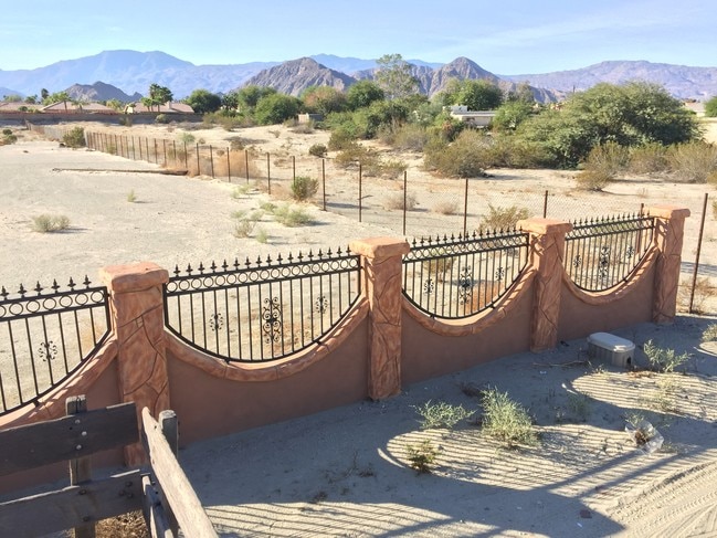
Property Detail
78555 Darby Rd
609-062-001
1.59 ACRES IN POR PAR 20 RS 015/032
Agriculturalland
Riverside
R112000
California
B and X Area of moderate flood hazard, usually the area between the limits of the 100-year and 500-year floods.
20
2025
1.59 AC
2026
Coachella Valley
045214
Inland Empire (California)
588 SF
Riverside-San Bernardino-Ontario, CA
NEARBY LISTINGS FOR SALE OR LEASE
DEMOGRAPHICS near 78555 Darby Rd
1 mile
3 mile
5 mile
2025 Total Population
12,291
71,566
179,564
2030 Population
12,929
76,165
190,095
Pop Growth 2025-2030
+ 5.19%
+ 6.43%
+ 5.86%
Average Age
43
48
46
2025 Total Households
5,001
30,188
71,447
HH Growth 2025-2030
+ 4.82%
+ 6.64%
+ 6.28%
Median Household Inc
$90,807
$90,764
$89,300
Avg Household Size
2.40
2.30
2.40
2025 Avg HH Vehicles
2.00
2.00
2.00
Median Home Value
$676,753
$664,108
$644,278
Median Year Built
1992
1994
1993
Nearby Places
Map Layers
Map Styles
 Street
 Aerial
Layers
 Traffic
 Biking
Places
Listings with unknown addresses are not visible on the map
- Restaurants
- Banks
- Shops
- Fitness
- Groceries
PUBLIC TRANSPORTATION
AIRPORT
Palm Springs International
Drive
Walk
Distance
Palm Springs International
25 min
17.6 mi
Freight Ports
Port of San Diego
Drive
Walk
Distance
Port of San Diego
171 min
141.7 mi
SALE & LEASE HISTORY
LISTING DATE
SALE/LEASE

May 18, 2021
For Sale
Aug 22, 2017
For Lease
Nearby Properties
Address
Land Use
TOTAL SIZE
Lot Size
Zoning
Address
Land Use
TOTAL SIZE
Lot Size
Zoning
51.81 AC
Address
Land Use
TOTAL SIZE
Lot Size
Zoning
2,169 SF
21.30 AC
Address
Land Use
TOTAL SIZE
Lot Size
Zoning
42,225 SF
20.83 AC
HW
Address
Land Use
TOTAL SIZE
Lot Size
Zoning
21,992 SF
16.71 AC
Address
Land Use
TOTAL SIZE
Lot Size
Zoning
110,000 SF
39.46 AC
Address
Land Use
TOTAL SIZE
Lot Size
Zoning
162,192 SF
15.42 AC
Address
Land Use
TOTAL SIZE
Lot Size
Zoning
160,365 SF
6.98 AC
PC2
Address
Land Use
TOTAL SIZE
Lot Size
Zoning
110,354 SF
14.15 AC
RH
Address
Land Use
TOTAL SIZE
Lot Size
Zoning
284,977 SF
23.95 AC
Address
Land Use
TOTAL SIZE
Lot Size
Zoning
233,006 SF
19.12 AC
Address
Land Use
TOTAL SIZE
Lot Size
Zoning
92,591 SF
4.56 AC
Address
Land Use
TOTAL SIZE
Lot Size
Zoning
229,800 SF
3.89 AC
Address
Land Use
TOTAL SIZE
Lot Size
Zoning
13.85 AC
Address
Land Use
TOTAL SIZE
Lot Size
Zoning
133,690 SF
6.61 AC
RM
Address
Land Use
TOTAL SIZE
Lot Size
Zoning
139,456 SF
8.02 AC
R-3
Address
Land Use
TOTAL SIZE
Lot Size
Zoning
208,171 SF
16.83 AC
CBOOK
Address
Land Use
TOTAL SIZE
Lot Size
Zoning
42,000 SF
3.20 AC
CR
Address
Land Use
TOTAL SIZE
Lot Size
Zoning
96,384 SF
9.90 AC
SPZONE
Address
Land Use
TOTAL SIZE
Lot Size
Zoning
144,647 SF
16.60 AC
Address
Land Use
TOTAL SIZE
Lot Size
Zoning
131,298 SF
10.06 AC
CPS
Address
Land Use
TOTAL SIZE
Lot Size
Zoning
52,971 SF
7.29 AC
Address
Land Use
TOTAL SIZE
Lot Size
Zoning
83,753 SF
2.77 AC
RM
Address
Land Use
TOTAL SIZE
Lot Size
Zoning
158,234 SF
7.38 AC
IP
Address
Land Use
TOTAL SIZE
Lot Size
Zoning
81,004 SF
2.99 AC
Address
Land Use
TOTAL SIZE
Lot Size
Zoning
99,301 SF
Address
Land Use
TOTAL SIZE
Lot Size
Zoning
47,305 SF
7.24 AC
RC
Address
Land Use
TOTAL SIZE
Lot Size
Zoning
162,335 SF
13.66 AC
Address
Land Use
TOTAL SIZE
Lot Size
Zoning
165,798 SF
4.08 AC
Address
Land Use
TOTAL SIZE
Lot Size
Zoning
70,397 SF
3.20 AC
M
Address
Land Use
TOTAL SIZE
Lot Size
Zoning
103,618 SF
10.51 AC
The World's #1 Commercial Real Estate Marketplace
Connect with us
© 2026 CoStar Group
The information above has been obtained from sources believed reliable. While we do not doubt its accuracy we have not verified it and make no guarantee, warranty or representation about it. It is your responsibility to independently confirm its accuracy and completeness. Any projections, opinions, assumptions, or estimates used are for example only and do not represent the current or future performance of the property. The value of this transaction to you depends on tax and other factors which should be evaluated by your tax, financial, and legal advisors. You and your advisors should conduct a careful, independent investigation of the property to determine to your satisfaction the suitability of the property for your needs.