Property Record
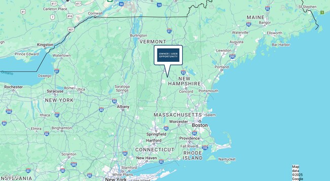
786 Methodist Hill Rd, Enfield, NH 03748


Property Detail
786 Methodist Hill Rd
EFLD-000006-000021-000003
Grafton
Commercialnec
New Hampshire
C/I -
3
A Areas with a 1% annual chance of flooding and a 26% chance of flooding over the life of a 30-year mortgage.
7.20 AC
2025
Concord/New Hampshire North Area
2025
Other Market Areas
961500
Lebanon-Claremont, NH-VT
1,458 SF
NEARBY LISTINGS FOR SALE OR LEASE
-
-
View all Enfield listings for sale on LoopNet.com
DEMOGRAPHICS near 786 Methodist Hill Rd
1 mile
3 mile
5 mile
2025 Total Population
79
2,978
12,845
2030 Population
80
2,952
12,726
Pop Growth 2025-2030
+ 1.27%
(0.87%)
(0.93%)
Average Age
49
46
44
2025 Total Households
37
1,328
5,960
HH Growth 2025-2030
+ 2.70%
(0.90%)
(0.84%)
Median Household Inc
$137,500
$112,050
$99,702
Avg Household Size
2.10
2.20
2.10
2025 Avg HH Vehicles
2.00
2.00
2.00
Median Home Value
$483,333
$465,172
$428,362
Median Year Built
1977
1978
1977
Nearby Places
Map Layers
Map Styles
 Street
 Aerial
Layers
 Traffic
 Biking
Places
Listings with unknown addresses are not visible on the map
- Restaurants
- Banks
- Shops
- Fitness
- Groceries
PUBLIC TRANSPORTATION
COMMUTER RAIL
White River Junction Amtrak Station (Vermonter - Amtrak)
Drive
Walk
Distance
White River Junction Amtrak Station (Vermonter - Amtrak)
15 min
9.2 mi
Freight Ports
Portland, ME
Drive
Walk
Distance
Portland, ME
187 min
158.3 mi
SALE & LEASE HISTORY
LISTING DATE
SALE/LEASE

Jun 11, 2025
For Sale
Nearby Properties
Address
Land Use
TOTAL SIZE
Lot Size
Zoning
Address
Land Use
TOTAL SIZE
Lot Size
Zoning
106,069 SF
19.42 AC
R3
Address
Land Use
TOTAL SIZE
Lot Size
Zoning
21.75 AC
R3
Address
Land Use
TOTAL SIZE
Lot Size
Zoning
13,366 SF
3.60 AC
RL1
Address
Land Use
TOTAL SIZE
Lot Size
Zoning
5,560 SF
319.10 AC
C/I -
Address
Land Use
TOTAL SIZE
Lot Size
Zoning
8,628 SF
29.78 AC
R5 - R
Address
Land Use
TOTAL SIZE
Lot Size
Zoning
1,696 SF
2.72 AC
R1 W/O
Address
Land Use
TOTAL SIZE
Lot Size
Zoning
40,000 SF
6 AC
GC
Address
Land Use
TOTAL SIZE
Lot Size
Zoning
3.20 AC
GC
Address
Land Use
TOTAL SIZE
Lot Size
Zoning
11,950 SF
4.03 AC
C/I -
Address
Land Use
TOTAL SIZE
Lot Size
Zoning
1,050 SF
2.94 AC
RL1
Address
Land Use
TOTAL SIZE
Lot Size
Zoning
24,224 SF
4.42 AC
R1 W/O
Address
Land Use
TOTAL SIZE
Lot Size
Zoning
1,199 SF
23.60 AC
R1 W/O
Address
Land Use
TOTAL SIZE
Lot Size
Zoning
3,450 SF
4.50 AC
C/I -
Address
Land Use
TOTAL SIZE
Lot Size
Zoning
5,187 SF
5.92 AC
RL2
Address
Land Use
TOTAL SIZE
Lot Size
Zoning
13,789 SF
4.30 AC
R1 W/O
Address
Land Use
TOTAL SIZE
Lot Size
Zoning
6,240 SF
27 AC
R1 W/O
Address
Land Use
TOTAL SIZE
Lot Size
Zoning
2,356 SF
214.34 AC
RL2
Address
Land Use
TOTAL SIZE
Lot Size
Zoning
3,120 SF
7.68 AC
C/I -
Address
Land Use
TOTAL SIZE
Lot Size
Zoning
1,836 SF
5.10 AC
C/I -
Address
Land Use
TOTAL SIZE
Lot Size
Zoning
2,916 SF
0.55 AC
R1 W/O
Address
Land Use
TOTAL SIZE
Lot Size
Zoning
194 AC
RL2
Address
Land Use
TOTAL SIZE
Lot Size
Zoning
12,002 SF
22 AC
R5 - R
Address
Land Use
TOTAL SIZE
Lot Size
Zoning
1,080 AC
R1 W/O
Address
Land Use
TOTAL SIZE
Lot Size
Zoning
6,230 SF
0.42 AC
R1 - W
Address
Land Use
TOTAL SIZE
Lot Size
Zoning
9,886 SF
0.49 AC
R1 W/O
Address
Land Use
TOTAL SIZE
Lot Size
Zoning
4,374 SF
75 AC
C - CO
Address
Land Use
TOTAL SIZE
Lot Size
Zoning
1,251 SF
2 AC
C/I -
Address
Land Use
TOTAL SIZE
Lot Size
Zoning
12,968 SF
1.01 AC
R1 W/O
Address
Land Use
TOTAL SIZE
Lot Size
Zoning
2,214 SF
0.33 AC
RL-2
The World's #1 Commercial Real Estate Marketplace
Connect with us
© 2026 CoStar Group
The information above has been obtained from sources believed reliable. While we do not doubt its accuracy we have not verified it and make no guarantee, warranty or representation about it. It is your responsibility to independently confirm its accuracy and completeness. Any projections, opinions, assumptions, or estimates used are for example only and do not represent the current or future performance of the property. The value of this transaction to you depends on tax and other factors which should be evaluated by your tax, financial, and legal advisors. You and your advisors should conduct a careful, independent investigation of the property to determine to your satisfaction the suitability of the property for your needs.