Property Record
8028 W 188Th St W, Lakeville, MN 55044


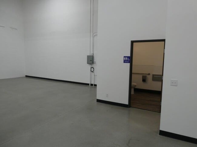

Current Lease Availabilities
NEARBY LISTINGS FOR SALE OR LEASE
Property Detail
8028 W 188Th St W
Los Angeles-Long Beach-Glendale, CA
Gould Tract
5827-008-069
FOR DESC SEE ASSESSORS MAPS POR IN TRA MR 42-65 AND POR IN TR LS 15-44
Lightindustrial
Los Angeles
X
California
06037C1375F
8
2024
1.14 AC
2025
Upper San Gabriel Valley
460200
Los Angeles
26,092 SF
DEMOGRAPHICS near 8028 W 188Th St W
1 Mile
3 Mile
5 Mile
2024 Total Population
13,365
108,973
314,116
2029 Population
12,838
105,398
303,951
Pop Growth 2024-2029
(3.94%)
(3.28%)
(3.24%)
Average Age
41
42
42
2024 Total Households
4,123
39,428
120,674
HH Growth 2024-2029
(4.24%)
(3.43%)
(3.43%)
Median Household Inc
$98,759
$99,981
$101,299
Avg Household Size
3.00
2.60
2.50
2024 Avg HH Vehicles
2.00
2.00
2.00
Median Home Value
$816,833
$1,012,641
$1,012,269
Median Year Built
1948
1953
1955
Nearby Places
Map Layers
Map Styles
 Street
 Aerial
- Restaurants
- Banks
- Shops
- Fitness
- Groceries
PUBLIC TRANSPORTATION
AIRPORT
Bob Hope
DRIVE
WALK
Distance
Bob Hope
24 min
15.8 mi
Los Angeles International
DRIVE
WALK
Distance
Los Angeles International
42 min
27.2 mi
Long Beach (Daugherty Field)
DRIVE
WALK
Distance
Long Beach (Daugherty Field)
44 min
28.7 mi
Freight Ports
Port of Long Beach
DRIVE
WALK
Distance
Port of Long Beach
46 min
31.6 mi
Nearby Properties
Address
Land Use
TOTAL SIZE
Lot Size
Zoning
Address
Land Use
TOTAL SIZE
Lot Size
Zoning
643,699 SF
9.73 AC
PSC-
Address
Land Use
TOTAL SIZE
Lot Size
Zoning
1,067,590 SF
7.22 AC
PSC-
Address
Land Use
TOTAL SIZE
Lot Size
Zoning
262,988 SF
1.42 AC
PSR*
Address
Land Use
TOTAL SIZE
Lot Size
Zoning
278,741 SF
1.21 AC
PSC*
Address
Land Use
TOTAL SIZE
Lot Size
Zoning
407,027 SF
3.91 AC
PSC-
Address
Land Use
TOTAL SIZE
Lot Size
Zoning
588,972 SF
2.59 AC
PSC-
Address
Land Use
TOTAL SIZE
Lot Size
Zoning
236,801 SF
1.67 AC
PSC-
Address
Land Use
TOTAL SIZE
Lot Size
Zoning
246,000 SF
5.67 AC
PSC-
Address
Land Use
TOTAL SIZE
Lot Size
Zoning
749,874 SF
4.74 AC
PSC-
Address
Land Use
TOTAL SIZE
Lot Size
Zoning
233,424 SF
1.67 AC
PSC-
Address
Land Use
TOTAL SIZE
Lot Size
Zoning
335,753 SF
8.19 AC
LCA1
Address
Land Use
TOTAL SIZE
Lot Size
Zoning
266,947 SF
10.91 AC
PSC2
Address
Land Use
TOTAL SIZE
Lot Size
Zoning
100,653 SF
1.41 AC
PSC-
Address
Land Use
TOTAL SIZE
Lot Size
Zoning
139,416 SF
10.27 AC
PSR*
Address
Land Use
TOTAL SIZE
Lot Size
Zoning
220,402 SF
1.35 AC
PSC-
Address
Land Use
TOTAL SIZE
Lot Size
Zoning
225,995 SF
10.86 AC
PSC2*
Address
Land Use
TOTAL SIZE
Lot Size
Zoning
345,558 SF
2.88 AC
PSC-
Address
Land Use
TOTAL SIZE
Lot Size
Zoning
250,257 SF
2.43 AC
PSC-
Address
Land Use
TOTAL SIZE
Lot Size
Zoning
10.85 AC
PSC-
Address
Land Use
TOTAL SIZE
Lot Size
Zoning
52,970 SF
0.84 AC
PSC-
Address
Land Use
TOTAL SIZE
Lot Size
Zoning
118,260 SF
10.85 AC
PSC-
Address
Land Use
TOTAL SIZE
Lot Size
Zoning
89,554 SF
6.09 AC
PSR*
Address
Land Use
TOTAL SIZE
Lot Size
Zoning
98,922 SF
0.96 AC
PSC-
Address
Land Use
TOTAL SIZE
Lot Size
Zoning
178,502 SF
0.61 AC
PSC*
Address
Land Use
TOTAL SIZE
Lot Size
Zoning
65,757 SF
0.91 AC
PSC-
Address
Land Use
TOTAL SIZE
Lot Size
Zoning
100,611 SF
5.06 AC
PSC-
Address
Land Use
TOTAL SIZE
Lot Size
Zoning
25,161 SF
0.58 AC
PSC-
Address
Land Use
TOTAL SIZE
Lot Size
Zoning
199,136 SF
2.25 AC
PSC
Address
Land Use
TOTAL SIZE
Lot Size
Zoning
127,827 SF
14.79 AC
PSC*
Address
Land Use
TOTAL SIZE
Lot Size
Zoning
124,631 SF
0.97 AC
PSC
The World's #1 Commercial Real Estate Marketplace
Connect with us
© 2026 CoStar Group
The information above has been obtained from sources believed reliable. While we do not doubt its accuracy we have not verified it and make no guarantee, warranty or representation about it. It is your responsibility to independently confirm its accuracy and completeness. Any projections, opinions, assumptions, or estimates used are for example only and do not represent the current or future performance of the property. The value of this transaction to you depends on tax and other factors which should be evaluated by your tax, financial, and legal advisors. You and your advisors should conduct a careful, independent investigation of the property to determine to your satisfaction the suitability of the property for your needs.