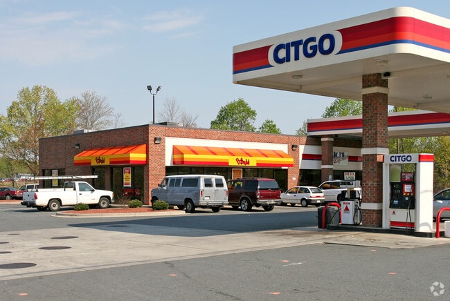
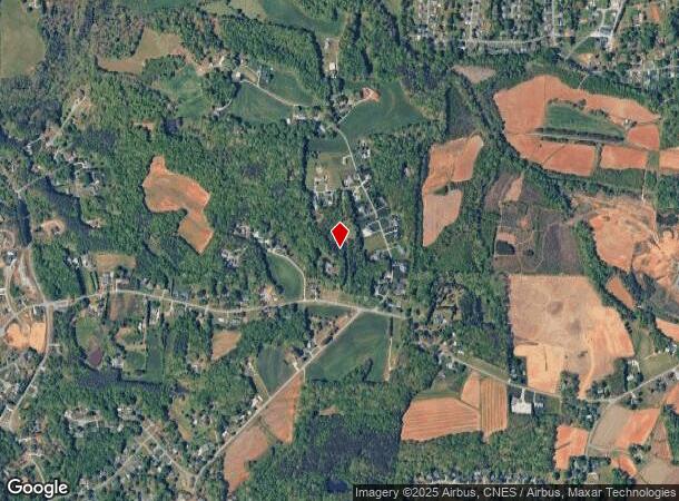
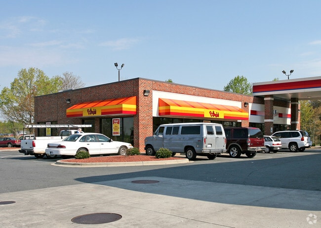
Property Record
7870 S Main St, King, NC 27021
Property Detail
7870 S Main St
Winston-Salem, NC
BOJANGLES/CITGO LO:003A BL:4728D
5991-75-1987
FORSYTH
Storebuilding
North Carolina
B2 KING
3a
B and X Area of moderate flood hazard, usually the area between the limits of the 100-year and 500-year floods.
0.65 AC
0
NW Forsyth County
2025
Greensboro/Winston-Salem
070503
NEARBY LISTINGS FOR SALE OR LEASE
DEMOGRAPHICS near 7870 S Main St
1 mile
3 mile
5 mile
2025 Total Population
1,612
13,423
28,919
2030 Population
1,655
13,852
29,905
Pop Growth 2025-2030
+ 2.67%
+ 3.20%
+ 3.41%
Average Age
45
44
43
2025 Total Households
746
5,713
12,103
HH Growth 2025-2030
+ 2.55%
+ 3.24%
+ 3.51%
Median Household Inc
$45,795
$66,262
$68,528
Avg Household Size
2.10
2.30
2.40
2025 Avg HH Vehicles
2.00
2.00
2.00
Median Home Value
$222,580
$236,791
$231,759
Median Year Built
1981
1988
1987
Nearby Places
Map Layers
Map Styles
 Street
 Aerial
Transit
 Traffic
 Biking
Places
Listings with unknown addresses are not visible on the map
- Restaurants
- Banks
- Shops
- Fitness
- Groceries
PUBLIC TRANSPORTATION
AIRPORT
Piedmont Triad International
Drive
Walk
Distance
Piedmont Triad International
52 min
34.3 mi
Freight Ports
Virginia Port Authority - Richmond
Drive
Walk
Distance
Virginia Port Authority - Richmond
279 min
238.0 mi
Nearby Properties
Address
Land Use
TOTAL SIZE
Lot Size
Zoning
Address
Land Use
TOTAL SIZE
Lot Size
Zoning
70,969 SF
63.74 AC
R-20
Address
Land Use
TOTAL SIZE
Lot Size
Zoning
158,096 SF
16.42 AC
L-I
Address
Land Use
TOTAL SIZE
Lot Size
Zoning
34,444 SF
44.38 AC
B-2,R-MF-T
Address
Land Use
TOTAL SIZE
Lot Size
Zoning
34,444 SF
44.12 AC
B-2,R-MF-T
Address
Land Use
TOTAL SIZE
Lot Size
Zoning
17,714 SF
5.39 AC
R-15
Address
Land Use
TOTAL SIZE
Lot Size
Zoning
51,393 SF
4.68 AC
R-MF
Address
Land Use
TOTAL SIZE
Lot Size
Zoning
56,034 SF
9.68 AC
B-2
Address
Land Use
TOTAL SIZE
Lot Size
Zoning
30,836 SF
9.33 AC
L-I
Address
Land Use
TOTAL SIZE
Lot Size
Zoning
80,634 SF
8.59 AC
B-2
Address
Land Use
TOTAL SIZE
Lot Size
Zoning
34,510 SF
13.74 AC
B-2
Address
Land Use
TOTAL SIZE
Lot Size
Zoning
43,423 SF
9.86 AC
B-2-CU
Address
Land Use
TOTAL SIZE
Lot Size
Zoning
33,170 SF
4.76 AC
R-R
Address
Land Use
TOTAL SIZE
Lot Size
Zoning
48,042 SF
14.98 AC
R-20
Address
Land Use
TOTAL SIZE
Lot Size
Zoning
35,040 SF
3.51 AC
L-I
Address
Land Use
TOTAL SIZE
Lot Size
Zoning
32,160 SF
8.30 AC
O-I
Address
Land Use
TOTAL SIZE
Lot Size
Zoning
18,930 SF
2.20 AC
L-I
Address
Land Use
TOTAL SIZE
Lot Size
Zoning
29,553 SF
14.80 AC
R-15
Address
Land Use
TOTAL SIZE
Lot Size
Zoning
12,244 SF
18.58 AC
B-2
Address
Land Use
TOTAL SIZE
Lot Size
Zoning
26,334 SF
22 AC
R-20
Address
Land Use
TOTAL SIZE
Lot Size
Zoning
37,604 SF
4.82 AC
R-MF
Address
Land Use
TOTAL SIZE
Lot Size
Zoning
5,250 SF
2.74 AC
B-2
Address
Land Use
TOTAL SIZE
Lot Size
Zoning
9,930 SF
1.65 AC
B-2
Address
Land Use
TOTAL SIZE
Lot Size
Zoning
24,363 SF
1.75 AC
B-2
Address
Land Use
TOTAL SIZE
Lot Size
Zoning
13,516 SF
16.65 AC
R-A
Address
Land Use
TOTAL SIZE
Lot Size
Zoning
126.47 AC
R-A
Address
Land Use
TOTAL SIZE
Lot Size
Zoning
4,316 SF
3.23 AC
R-MF-A
Address
Land Use
TOTAL SIZE
Lot Size
Zoning
12,523 SF
2 AC
R-15
Address
Land Use
TOTAL SIZE
Lot Size
Zoning
9,312 SF
3 AC
L-I
Address
Land Use
TOTAL SIZE
Lot Size
Zoning
14.09 AC
L-I
Address
Land Use
TOTAL SIZE
Lot Size
Zoning
6,500 SF
2.11 AC
B-2
The World's #1 Commercial Real Estate Marketplace
Connect with us
© 2026 CoStar Group
The information above has been obtained from sources believed reliable. While we do not doubt its accuracy we have not verified it and make no guarantee, warranty or representation about it. It is your responsibility to independently confirm its accuracy and completeness. Any projections, opinions, assumptions, or estimates used are for example only and do not represent the current or future performance of the property. The value of this transaction to you depends on tax and other factors which should be evaluated by your tax, financial, and legal advisors. You and your advisors should conduct a careful, independent investigation of the property to determine to your satisfaction the suitability of the property for your needs.