Property Record
788 Amity Rd, Bethany, CT 06524

NEARBY LISTINGS FOR SALE OR LEASE
-
-
View all Bethany listings for sale on LoopNet.com
Property Detail
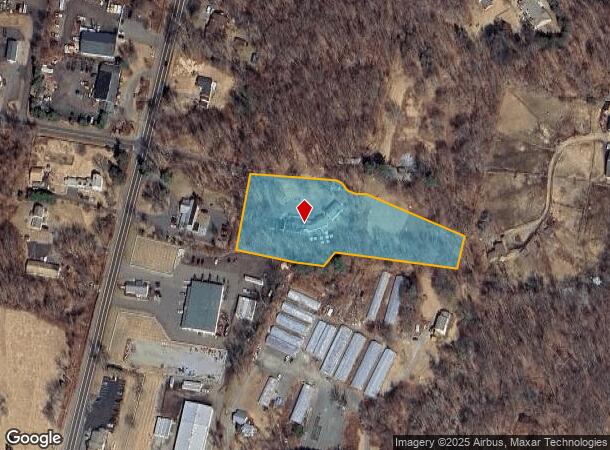
788 Amity Rd
BETH-000116-000055-000011B-LT000004
New Haven
Commercialnec
Connecticut
X
11b-lt4
09009C0280H
3.72 AC
2025
Woodbridge
2025
Westchester/So Connecticut
161100
New Haven, CT
DEMOGRAPHICS near 788 Amity Rd
1 mile
3 mile
5 mile
2024 Total Population
1,180
13,169
60,019
2029 Population
1,184
13,218
60,042
Pop Growth 2024-2029
+ 0.34%
+ 0.37%
+ 0.04%
Average Age
45
44
41
2024 Total Households
445
5,044
21,540
HH Growth 2024-2029
+ 0.22%
+ 0.32%
(0.03%)
Median Household Inc
$142,187
$110,179
$111,655
Avg Household Size
2.60
2.50
2.60
2024 Avg HH Vehicles
3.00
2.00
2.00
Median Home Value
$409,032
$287,353
$293,196
Median Year Built
1971
1979
1972
Nearby Places
Map Layers
Map Styles
 Street
 Aerial
Transit
 Traffic
 Biking
Places
Listings with unknown addresses are not visible on the map
- Restaurants
- Banks
- Shops
- Fitness
- Groceries
PUBLIC TRANSPORTATION
COMMUTER RAIL
Naugatuck Station (New Haven Line - Metro-North Commuter Railroad Company (Metro-North))
Drive
Walk
Distance
Naugatuck Station (New Haven Line - Metro-North Commuter Railroad Company (Metro-North))
12 min
5.7 mi
Beacon Falls Station (New Haven Line - Metro-North Commuter Railroad Company (Metro-North))
Drive
Walk
Distance
Beacon Falls Station (New Haven Line - Metro-North Commuter Railroad Company (Metro-North))
11 min
5.8 mi
AIRPORT
Tweed/New Haven
Drive
Walk
Distance
Tweed/New Haven
29 min
16.7 mi
Freight Ports
Port of New Haven
Drive
Walk
Distance
Port of New Haven
24 min
13.9 mi
Nearby Properties
Address
Land Use
TOTAL SIZE
Lot Size
Zoning
Address
Land Use
TOTAL SIZE
Lot Size
Zoning
123,288 SF
1.81 AC
BA
Address
Land Use
TOTAL SIZE
Lot Size
Zoning
145,226 SF
28.56 AC
R8
Address
Land Use
TOTAL SIZE
Lot Size
Zoning
28.70 AC
R-65
Address
Land Use
TOTAL SIZE
Lot Size
Zoning
50.90 AC
R-65
Address
Land Use
TOTAL SIZE
Lot Size
Zoning
188.50 AC
R-65
Address
Land Use
TOTAL SIZE
Lot Size
Zoning
41,056 SF
6.17 AC
RA1
Address
Land Use
TOTAL SIZE
Lot Size
Zoning
6.47 AC
R15
Address
Land Use
TOTAL SIZE
Lot Size
Zoning
18,750 SF
4.16 AC
I1
Address
Land Use
TOTAL SIZE
Lot Size
Zoning
6.77 AC
RA1
Address
Land Use
TOTAL SIZE
Lot Size
Zoning
25,211 SF
7.38 AC
R15
Address
Land Use
TOTAL SIZE
Lot Size
Zoning
26 AC
R15
Address
Land Use
TOTAL SIZE
Lot Size
Zoning
5 AC
RA1
Address
Land Use
TOTAL SIZE
Lot Size
Zoning
34,137 SF
1.20 AC
DD
Address
Land Use
TOTAL SIZE
Lot Size
Zoning
8,964 SF
35.19 AC
R2
Address
Land Use
TOTAL SIZE
Lot Size
Zoning
18,387 SF
138.50 AC
B&I
Address
Land Use
TOTAL SIZE
Lot Size
Zoning
509 AC
R-65
Address
Land Use
TOTAL SIZE
Lot Size
Zoning
1,568 SF
11.18 AC
B&I
Address
Land Use
TOTAL SIZE
Lot Size
Zoning
2,400 SF
33.04 AC
R2
Address
Land Use
TOTAL SIZE
Lot Size
Zoning
39.25 AC
B
Address
Land Use
TOTAL SIZE
Lot Size
Zoning
521.89 AC
R1
Address
Land Use
TOTAL SIZE
Lot Size
Zoning
13.08 AC
R65
Address
Land Use
TOTAL SIZE
Lot Size
Zoning
1.10 AC
R15
Address
Land Use
TOTAL SIZE
Lot Size
Zoning
2,740 SF
1.68 AC
NHRDD
Address
Land Use
TOTAL SIZE
Lot Size
Zoning
11.11 AC
R-130
Address
Land Use
TOTAL SIZE
Lot Size
Zoning
1,560 SF
2.76 AC
R15
Address
Land Use
TOTAL SIZE
Lot Size
Zoning
6.50 AC
R65
Address
Land Use
TOTAL SIZE
Lot Size
Zoning
3.67 AC
B&I
Address
Land Use
TOTAL SIZE
Lot Size
Zoning
88.05 AC
R2
Address
Land Use
TOTAL SIZE
Lot Size
Zoning
8.37 AC
R-130
Address
Land Use
TOTAL SIZE
Lot Size
Zoning
8,717 SF
20.30 AC
R-65
The World's #1 Commercial Real Estate Marketplace
Connect with us
© 2026 CoStar Group
The information above has been obtained from sources believed reliable. While we do not doubt its accuracy we have not verified it and make no guarantee, warranty or representation about it. It is your responsibility to independently confirm its accuracy and completeness. Any projections, opinions, assumptions, or estimates used are for example only and do not represent the current or future performance of the property. The value of this transaction to you depends on tax and other factors which should be evaluated by your tax, financial, and legal advisors. You and your advisors should conduct a careful, independent investigation of the property to determine to your satisfaction the suitability of the property for your needs.