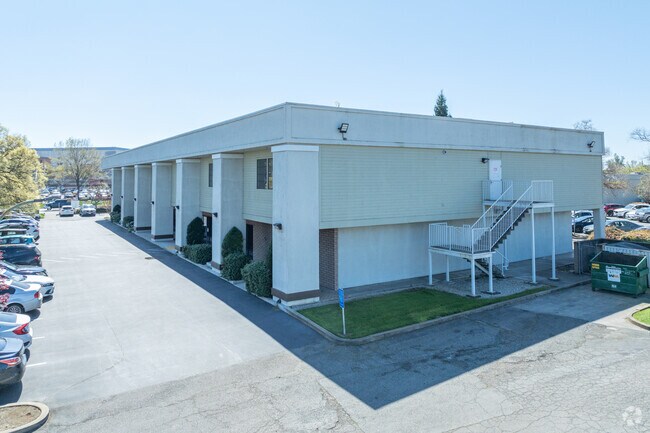
Property Record
7880 Alta Valley Dr, Sacramento, CA 95823
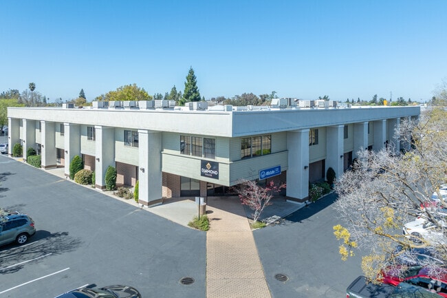

This Property Is For Sale
NEARBY LISTINGS FOR SALE OR LEASE
Property Detail
7880 Alta Valley Dr
Sacramento-Roseville-Folsom, CA
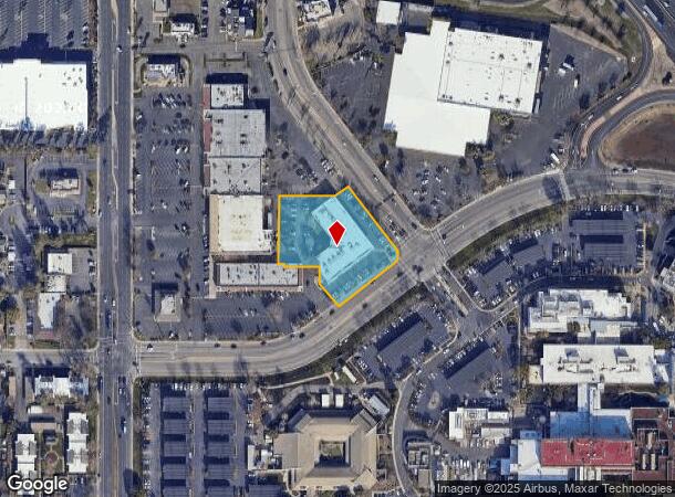
Parcel Map
117-0330-006
PARCEL MAP, LOT A
Medicalbuilding
Sacramento
X
California
06067C0306H
a
2024
1.59 AC
2025
South Sacramento
009641
Sacramento
34,351 SF
DEMOGRAPHICS near 7880 Alta Valley Dr
1 Mile
3 Mile
5 Mile
2024 Total Population
24,324
180,395
379,896
2029 Population
24,423
181,212
381,828
Pop Growth 2024-2029
+ 0.41%
+ 0.45%
+ 0.51%
Average Age
37
37
37
2024 Total Households
7,880
53,083
116,813
HH Growth 2024-2029
+ 0.33%
+ 0.41%
+ 0.46%
Median Household Inc
$52,385
$66,036
$73,549
Avg Household Size
2.90
3.20
3.10
2024 Avg HH Vehicles
2.00
2.00
2.00
Median Home Value
$315,232
$368,937
$417,572
Median Year Built
1981
1985
1985
Nearby Places
Map Layers
Map Styles
 Street
 Aerial
- Restaurants
- Banks
- Shops
- Fitness
- Groceries
PUBLIC TRANSPORTATION
AIRPORT
Sacramento International
DRIVE
WALK
Distance
Sacramento International
31 min
21.3 mi
Freight Ports
Port of Stockton
DRIVE
WALK
Distance
Port of Stockton
53 min
42.8 mi
Nearby Properties
Address
Land Use
TOTAL SIZE
Lot Size
Zoning
Address
Land Use
TOTAL SIZE
Lot Size
Zoning
728,235 SF
29.15 AC
H-R
Address
Land Use
TOTAL SIZE
Lot Size
Zoning
25,000 SF
13.42 AC
RD-30
Address
Land Use
TOTAL SIZE
Lot Size
Zoning
303,529 SF
10.28 AC
R-3A-PUD R
Address
Land Use
TOTAL SIZE
Lot Size
Zoning
169,610 SF
11.49 AC
H-PUD
Address
Land Use
TOTAL SIZE
Lot Size
Zoning
187,080 SF
10.01 AC
SPA M-1
Address
Land Use
TOTAL SIZE
Lot Size
Zoning
10.35 AC
SC
Address
Land Use
TOTAL SIZE
Lot Size
Zoning
198,112 SF
19.62 AC
M-1 M-1 (N
Address
Land Use
TOTAL SIZE
Lot Size
Zoning
7.55 AC
SPA
Address
Land Use
TOTAL SIZE
Lot Size
Zoning
281,404 SF
21.43 AC
M-2
Address
Land Use
TOTAL SIZE
Lot Size
Zoning
249,868 SF
15.23 AC
R-2B-R
Address
Land Use
TOTAL SIZE
Lot Size
Zoning
433,006 SF
4.55 AC
R-2B C-2-R
Address
Land Use
TOTAL SIZE
Lot Size
Zoning
0.12 AC
SPA
Address
Land Use
TOTAL SIZE
Lot Size
Zoning
319,485 SF
16.35 AC
M-2S
Address
Land Use
TOTAL SIZE
Lot Size
Zoning
433,006 SF
8.70 AC
R-2B C-2-R
Address
Land Use
TOTAL SIZE
Lot Size
Zoning
213,445 SF
18.25 AC
SC
Address
Land Use
TOTAL SIZE
Lot Size
Zoning
158,710 SF
14.02 AC
M-1 (NPA)
Address
Land Use
TOTAL SIZE
Lot Size
Zoning
179,487 SF
9.83 AC
R-2B-R-PUD
Address
Land Use
TOTAL SIZE
Lot Size
Zoning
138,779 SF
44.77 AC
M-2S
Address
Land Use
TOTAL SIZE
Lot Size
Zoning
120,868 SF
53.03 AC
SPA
Address
Land Use
TOTAL SIZE
Lot Size
Zoning
135,197 SF
15.70 AC
LC
Address
Land Use
TOTAL SIZE
Lot Size
Zoning
92,120 SF
6.91 AC
GC
Address
Land Use
TOTAL SIZE
Lot Size
Zoning
55,344 SF
4.75 AC
M-2S
Address
Land Use
TOTAL SIZE
Lot Size
Zoning
148,007 SF
9.09 AC
RD-20
Address
Land Use
TOTAL SIZE
Lot Size
Zoning
86,094 SF
6.17 AC
H-PUD
Address
Land Use
TOTAL SIZE
Lot Size
Zoning
182,916 SF
10.66 AC
RD-20
Address
Land Use
TOTAL SIZE
Lot Size
Zoning
135,408 SF
13.31 AC
SC
Address
Land Use
TOTAL SIZE
Lot Size
Zoning
5.29 AC
M-2S
Address
Land Use
TOTAL SIZE
Lot Size
Zoning
433,006 SF
4.13 AC
R-2B
Address
Land Use
TOTAL SIZE
Lot Size
Zoning
144,849 SF
5.72 AC
R-3
Address
Land Use
TOTAL SIZE
Lot Size
Zoning
69,411 SF
7.21 AC
OB
The World's #1 Commercial Real Estate Marketplace
Connect with us
© 2026 CoStar Group
The information above has been obtained from sources believed reliable. While we do not doubt its accuracy we have not verified it and make no guarantee, warranty or representation about it. It is your responsibility to independently confirm its accuracy and completeness. Any projections, opinions, assumptions, or estimates used are for example only and do not represent the current or future performance of the property. The value of this transaction to you depends on tax and other factors which should be evaluated by your tax, financial, and legal advisors. You and your advisors should conduct a careful, independent investigation of the property to determine to your satisfaction the suitability of the property for your needs.