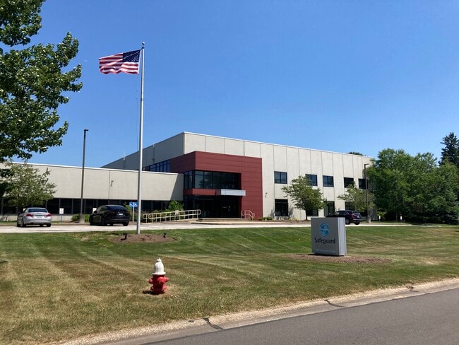
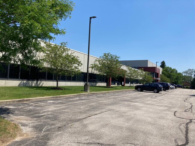
Property Record
7887 Hub Pkwy, Cleveland, OH 44125
Current Lease Availabilities
NEARBY LISTINGS FOR SALE OR LEASE
Property Detail
7887 Hub Pkwy
Cleveland-Elyria, OH
Hpc#2
573-26-007
TR 5 2 HPC#2 0006 ALL 57326013
Lightindustrial
Cuyahoga
X
Ohio
39153C0030F
6
2024
3.74 AC
2024
South
192900
Cleveland
67,200 SF
DEMOGRAPHICS near 7887 Hub Pkwy
1 Mile
3 Mile
5 Mile
2024 Total Population
492
28,780
113,956
2029 Population
474
28,222
111,191
Pop Growth 2024-2029
(3.66%)
(1.94%)
(2.43%)
Average Age
48
45
43
2024 Total Households
197
12,355
48,450
HH Growth 2024-2029
(4.06%)
(1.93%)
(2.53%)
Median Household Inc
$112,500
$67,992
$65,327
Avg Household Size
2.50
2.30
2.30
2024 Avg HH Vehicles
2.00
2.00
2.00
Median Home Value
$279,120
$226,655
$174,785
Median Year Built
1978
1967
1960
Nearby Places
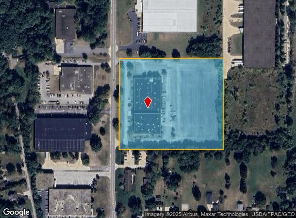
Map Layers
Map Styles
 Street
 Aerial
- Restaurants
- Banks
- Shops
- Fitness
- Groceries
PUBLIC TRANSPORTATION
COMMUTER RAIL
Canal Exploration Center (National Park Scenic Railway - Cuyahoga Valley Scenic Railroad)
DRIVE
WALK
Distance
Canal Exploration Center (National Park Scenic Railway - Cuyahoga Valley Scenic Railroad)
5 min
2.0 mi
Brecksville (National Park Scenic Railway - Cuyahoga Valley Scenic Railroad)
DRIVE
WALK
Distance
Brecksville (National Park Scenic Railway - Cuyahoga Valley Scenic Railroad)
12 min
4.7 mi
AIRPORT
Cleveland-Hopkins International
DRIVE
WALK
Distance
Cleveland-Hopkins International
32 min
18.2 mi
Freight Ports
Port of Toledo
DRIVE
WALK
Distance
Port of Toledo
146 min
119.1 mi
Nearby Properties
Address
Land Use
TOTAL SIZE
Lot Size
Zoning
Address
Land Use
TOTAL SIZE
Lot Size
Zoning
376,124 SF
71.73 AC
Address
Land Use
TOTAL SIZE
Lot Size
Zoning
307,703 SF
47.05 AC
U-5
Address
Land Use
TOTAL SIZE
Lot Size
Zoning
228,253 SF
32.51 AC
C-F
Address
Land Use
TOTAL SIZE
Lot Size
Zoning
227,141 SF
23.76 AC
U-4
Address
Land Use
TOTAL SIZE
Lot Size
Zoning
260,000 SF
38.18 AC
U-5A
Address
Land Use
TOTAL SIZE
Lot Size
Zoning
137,795 SF
37.09 AC
R-4
Address
Land Use
TOTAL SIZE
Lot Size
Zoning
65,108 SF
24.93 AC
I/O
Address
Land Use
TOTAL SIZE
Lot Size
Zoning
124,224 SF
25.99 AC
U-1
Address
Land Use
TOTAL SIZE
Lot Size
Zoning
350,592 SF
25.29 AC
O/I
Address
Land Use
TOTAL SIZE
Lot Size
Zoning
37.77 AC
U-5A
Address
Land Use
TOTAL SIZE
Lot Size
Zoning
56,002 SF
6.76 AC
U-5
Address
Land Use
TOTAL SIZE
Lot Size
Zoning
99,916 SF
4.72 AC
U-3
Address
Land Use
TOTAL SIZE
Lot Size
Zoning
127,224 SF
10 AC
IG
Address
Land Use
TOTAL SIZE
Lot Size
Zoning
148,264 SF
13.20 AC
U-5A
Address
Land Use
TOTAL SIZE
Lot Size
Zoning
136,516 SF
19.64 AC
IG
Address
Land Use
TOTAL SIZE
Lot Size
Zoning
19.98 AC
R2
Address
Land Use
TOTAL SIZE
Lot Size
Zoning
127,930 SF
8.08 AC
Address
Land Use
TOTAL SIZE
Lot Size
Zoning
116,800 SF
10 AC
IG
Address
Land Use
TOTAL SIZE
Lot Size
Zoning
222,528 SF
12.86 AC
IG
Address
Land Use
TOTAL SIZE
Lot Size
Zoning
94,883 SF
5.52 AC
CRL
Address
Land Use
TOTAL SIZE
Lot Size
Zoning
81.60 AC
1F-2
Address
Land Use
TOTAL SIZE
Lot Size
Zoning
32,640 SF
6.90 AC
Address
Land Use
TOTAL SIZE
Lot Size
Zoning
128.27 AC
C-F
Address
Land Use
TOTAL SIZE
Lot Size
Zoning
8,760 SF
7.99 AC
R-4
Address
Land Use
TOTAL SIZE
Lot Size
Zoning
32,720 SF
7.85 AC
R-4
Address
Land Use
TOTAL SIZE
Lot Size
Zoning
172,257 SF
0.23 AC
O/I
Address
Land Use
TOTAL SIZE
Lot Size
Zoning
83,809 SF
9.27 AC
U-4
Address
Land Use
TOTAL SIZE
Lot Size
Zoning
135.02 AC
1F-3
Address
Land Use
TOTAL SIZE
Lot Size
Zoning
93,296 SF
4.52 AC
U-5
Address
Land Use
TOTAL SIZE
Lot Size
Zoning
90.06 AC
1F-2
The World's #1 Commercial Real Estate Marketplace
Connect with us
© 2026 CoStar Group
The information above has been obtained from sources believed reliable. While we do not doubt its accuracy we have not verified it and make no guarantee, warranty or representation about it. It is your responsibility to independently confirm its accuracy and completeness. Any projections, opinions, assumptions, or estimates used are for example only and do not represent the current or future performance of the property. The value of this transaction to you depends on tax and other factors which should be evaluated by your tax, financial, and legal advisors. You and your advisors should conduct a careful, independent investigation of the property to determine to your satisfaction the suitability of the property for your needs.