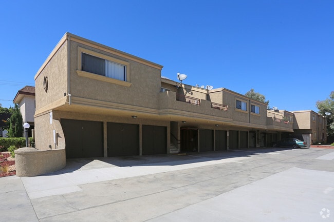
Property Record
7891 Stark Dr, Huntington Beach, CA 92647

NEARBY LISTINGS FOR SALE OR LEASE
Property Detail
7891 Stark Dr
Anaheim-Santa Ana-Irvine, CA
Tract No. 417 City Of Huntington Beach
142-082-36
N TR 417 BLK LOT 62
Multifamilydwelling
Orange
X
California
06059C0251J
62
2024
0.20 AC
2025
Huntington Beach
099410
Orange County (California)
DEMOGRAPHICS near 7891 Stark Dr
1 Mile
3 Mile
5 Mile
2024 Total Population
29,357
221,980
527,902
2029 Population
29,171
219,320
521,174
Pop Growth 2024-2029
(0.63%)
(1.20%)
(1.27%)
Average Age
40
42
42
2024 Total Households
10,758
73,045
172,709
HH Growth 2024-2029
(0.70%)
(1.31%)
(1.34%)
Median Household Inc
$91,473
$88,729
$92,679
Avg Household Size
2.60
2.90
2.90
2024 Avg HH Vehicles
2.00
2.00
2.00
Median Home Value
$737,774
$784,164
$784,801
Median Year Built
1974
1970
1970
Nearby Places
Map Layers
Map Styles
 Street
 Aerial
- Restaurants
- Banks
- Shops
- Fitness
- Groceries
PUBLIC TRANSPORTATION
AIRPORT
John Wayne/Orange County
DRIVE
WALK
Distance
John Wayne/Orange County
13 min
8.5 mi
Long Beach (Daugherty Field)
DRIVE
WALK
Distance
Long Beach (Daugherty Field)
18 min
14.3 mi
Los Angeles International
DRIVE
WALK
Distance
Los Angeles International
36 min
33.0 mi
Freight Ports
Port of Long Beach
DRIVE
WALK
Distance
Port of Long Beach
1 min
11.6 mi
SALE & LEASE HISTORY
LISTING DATE
SALE/LEASE

Sep 24, 2016
For Sale
Nearby Properties
Address
Land Use
TOTAL SIZE
Lot Size
Zoning
Address
Land Use
TOTAL SIZE
Lot Size
Zoning
Address
Land Use
TOTAL SIZE
Lot Size
Zoning
Address
Land Use
TOTAL SIZE
Lot Size
Zoning
352,956 SF
16.70 AC
Address
Land Use
TOTAL SIZE
Lot Size
Zoning
Address
Land Use
TOTAL SIZE
Lot Size
Zoning
Address
Land Use
TOTAL SIZE
Lot Size
Zoning
263,121 SF
14.05 AC
Address
Land Use
TOTAL SIZE
Lot Size
Zoning
Address
Land Use
TOTAL SIZE
Lot Size
Zoning
Address
Land Use
TOTAL SIZE
Lot Size
Zoning
Address
Land Use
TOTAL SIZE
Lot Size
Zoning
292,787 SF
4.95 AC
Address
Land Use
TOTAL SIZE
Lot Size
Zoning
Address
Land Use
TOTAL SIZE
Lot Size
Zoning
207,271 SF
9.09 AC
Address
Land Use
TOTAL SIZE
Lot Size
Zoning
Address
Land Use
TOTAL SIZE
Lot Size
Zoning
Address
Land Use
TOTAL SIZE
Lot Size
Zoning
Address
Land Use
TOTAL SIZE
Lot Size
Zoning
Address
Land Use
TOTAL SIZE
Lot Size
Zoning
35.40 AC
Address
Land Use
TOTAL SIZE
Lot Size
Zoning
Address
Land Use
TOTAL SIZE
Lot Size
Zoning
4.86 AC
Address
Land Use
TOTAL SIZE
Lot Size
Zoning
Address
Land Use
TOTAL SIZE
Lot Size
Zoning
23.41 AC
Address
Land Use
TOTAL SIZE
Lot Size
Zoning
168,744 SF
7.61 AC
Address
Land Use
TOTAL SIZE
Lot Size
Zoning
214,935 SF
9.31 AC
Address
Land Use
TOTAL SIZE
Lot Size
Zoning
151,679 SF
8.71 AC
Address
Land Use
TOTAL SIZE
Lot Size
Zoning
Address
Land Use
TOTAL SIZE
Lot Size
Zoning
5.76 AC
Address
Land Use
TOTAL SIZE
Lot Size
Zoning
5,159 SF
17.44 AC
Address
Land Use
TOTAL SIZE
Lot Size
Zoning
203,886 SF
12.32 AC
Address
Land Use
TOTAL SIZE
Lot Size
Zoning
186,794 SF
8.10 AC
R4
Address
Land Use
TOTAL SIZE
Lot Size
Zoning
178,964 SF
11.62 AC
The World's #1 Commercial Real Estate Marketplace
Connect with us
© 2025 CoStar Group
The information above has been obtained from sources believed reliable. While we do not doubt its accuracy we have not verified it and make no guarantee, warranty or representation about it. It is your responsibility to independently confirm its accuracy and completeness. Any projections, opinions, assumptions, or estimates used are for example only and do not represent the current or future performance of the property. The value of this transaction to you depends on tax and other factors which should be evaluated by your tax, financial, and legal advisors. You and your advisors should conduct a careful, independent investigation of the property to determine to your satisfaction the suitability of the property for your needs.