Property Record
7895 T N Skiles Rd, Ponder, TX 76259
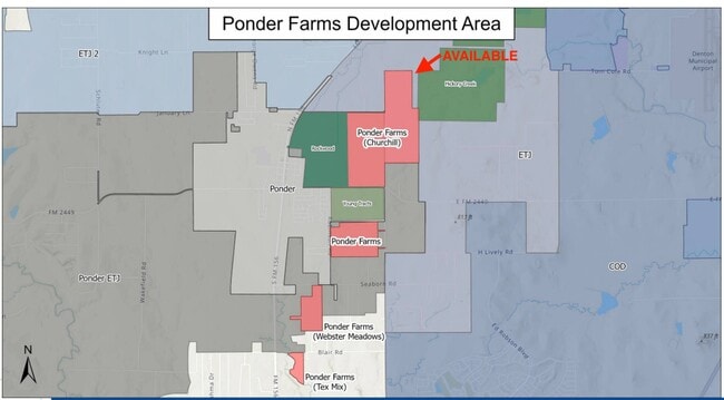

This Property Is For Sale
Property Detail
7895 T N Skiles Rd
R623224
LINAM ADDITION BLK A LOT 2
Agriculturalland
DENTON
14-E3
Texas
B and X Area of moderate flood hazard, usually the area between the limits of the 100-year and 500-year floods.
2
2024
21.81 AC
2025
Denton
020310
Dallas/Ft Worth
30,000 SF
Dallas-Fort Worth-Arlington, TX
NEARBY LISTINGS FOR SALE OR LEASE
DEMOGRAPHICS near 7895 T N Skiles Rd
1 mile
3 mile
5 mile
2025 Total Population
49
5,144
19,499
2030 Population
56
5,851
22,053
Pop Growth 2025-2030
+ 14.29%
+ 13.74%
+ 13.10%
Average Age
56
40
47
2025 Total Households
22
1,740
7,601
HH Growth 2025-2030
+ 13.64%
+ 14.08%
+ 13.43%
Median Household Inc
$104,167
$109,309
$112,333
Avg Household Size
2.30
3.00
2.60
2025 Avg HH Vehicles
2.00
2.00
2.00
Median Home Value
$673,077
$508,394
$498,163
Median Year Built
2010
2008
2008
Nearby Places
Map Layers
Map Styles
 Street
 Aerial
Transit
 Traffic
 Biking
Places
Listings with unknown addresses are not visible on the map
- Restaurants
- Banks
- Shops
- Fitness
- Groceries
PUBLIC TRANSPORTATION
AIRPORT
Dallas-Fort Worth International
Drive
Walk
Distance
Dallas-Fort Worth International
54 min
36.5 mi
Freight Ports
Port of Shreveport
Drive
Walk
Distance
Port of Shreveport
272 min
243.1 mi
Nearby Properties
Address
Land Use
TOTAL SIZE
Lot Size
Zoning
Address
Land Use
TOTAL SIZE
Lot Size
Zoning
89,150 SF
21.36 AC
Address
Land Use
TOTAL SIZE
Lot Size
Zoning
25,650 SF
12.14 AC
Address
Land Use
TOTAL SIZE
Lot Size
Zoning
53,384 SF
19.62 AC
Address
Land Use
TOTAL SIZE
Lot Size
Zoning
98,000 SF
23.23 AC
Address
Land Use
TOTAL SIZE
Lot Size
Zoning
50,522 SF
58.73 AC
Address
Land Use
TOTAL SIZE
Lot Size
Zoning
84,627 SF
106.54 AC
Address
Land Use
TOTAL SIZE
Lot Size
Zoning
55,250 SF
10 AC
Address
Land Use
TOTAL SIZE
Lot Size
Zoning
59,000 SF
10 AC
Address
Land Use
TOTAL SIZE
Lot Size
Zoning
52,000 SF
11.10 AC
Address
Land Use
TOTAL SIZE
Lot Size
Zoning
49,000 SF
18.63 AC
Address
Land Use
TOTAL SIZE
Lot Size
Zoning
14,329 SF
1.03 AC
Address
Land Use
TOTAL SIZE
Lot Size
Zoning
32,800 SF
5.93 AC
Address
Land Use
TOTAL SIZE
Lot Size
Zoning
15,867 SF
4.77 AC
Address
Land Use
TOTAL SIZE
Lot Size
Zoning
74,283 SF
10.15 AC
Address
Land Use
TOTAL SIZE
Lot Size
Zoning
60,850 SF
8.99 AC
Address
Land Use
TOTAL SIZE
Lot Size
Zoning
141.65 AC
Address
Land Use
TOTAL SIZE
Lot Size
Zoning
20,527 SF
10 AC
Address
Land Use
TOTAL SIZE
Lot Size
Zoning
55,150 SF
6.47 AC
Address
Land Use
TOTAL SIZE
Lot Size
Zoning
6,368 SF
155.59 AC
Address
Land Use
TOTAL SIZE
Lot Size
Zoning
98.62 AC
Address
Land Use
TOTAL SIZE
Lot Size
Zoning
36,292 SF
2.20 AC
Address
Land Use
TOTAL SIZE
Lot Size
Zoning
86.25 AC
Address
Land Use
TOTAL SIZE
Lot Size
Zoning
41 SF
21.76 AC
Address
Land Use
TOTAL SIZE
Lot Size
Zoning
12,850 SF
Address
Land Use
TOTAL SIZE
Lot Size
Zoning
6,264 SF
3.21 AC
Address
Land Use
TOTAL SIZE
Lot Size
Zoning
102.90 AC
Address
Land Use
TOTAL SIZE
Lot Size
Zoning
36,287 SF
2.75 AC
Address
Land Use
TOTAL SIZE
Lot Size
Zoning
182.76 AC
Address
Land Use
TOTAL SIZE
Lot Size
Zoning
26,985 SF
3.03 AC
The World's #1 Commercial Real Estate Marketplace
Connect with us
© 2026 CoStar Group
The information above has been obtained from sources believed reliable. While we do not doubt its accuracy we have not verified it and make no guarantee, warranty or representation about it. It is your responsibility to independently confirm its accuracy and completeness. Any projections, opinions, assumptions, or estimates used are for example only and do not represent the current or future performance of the property. The value of this transaction to you depends on tax and other factors which should be evaluated by your tax, financial, and legal advisors. You and your advisors should conduct a careful, independent investigation of the property to determine to your satisfaction the suitability of the property for your needs.