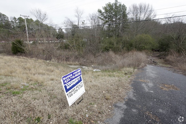
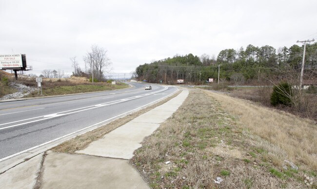
Property Record
79 Highway 41, Ringgold, GA 30736

Property Detail
79 Highway 41
Chattanooga, TN-GA
LOT 1 JONES AND FOSTER PLAT 23 /156
0019A-015
CATOOSA
Commercialacreage
Georgia
C-1
1
B and X Area of moderate flood hazard, usually the area between the limits of the 100-year and 500-year floods.
2.56 AC
2025
Catoosa County
2025
Chattanooga
030402
NEARBY LISTINGS FOR SALE OR LEASE
DEMOGRAPHICS near 79 Highway 41
1 mile
3 mile
5 mile
2025 Total Population
3,626
43,360
120,324
2030 Population
3,789
44,889
124,414
Pop Growth 2025-2030
+ 4.50%
+ 3.53%
+ 3.40%
Average Age
42
41
41
2025 Total Households
1,528
18,239
50,364
HH Growth 2025-2030
+ 4.78%
+ 3.70%
+ 3.57%
Median Household Inc
$66,641
$64,995
$66,688
Avg Household Size
2.30
2.30
2.30
2025 Avg HH Vehicles
2.00
2.00
2.00
Median Home Value
$279,117
$256,317
$265,231
Median Year Built
1988
1984
1978
Nearby Places
Map Layers
Map Styles
 Street
 Aerial
Layers
 Traffic
 Biking
Places
Listings with unknown addresses are not visible on the map
- Restaurants
- Banks
- Shops
- Fitness
- Groceries
PUBLIC TRANSPORTATION
AIRPORT
Lovell Field
Drive
Walk
Distance
Lovell Field
14 min
6.6 mi
Freight Ports
Georgia Ports - Savannah
Drive
Walk
Distance
Georgia Ports - Savannah
397 min
356.0 mi
Nearby Properties
Address
Land Use
TOTAL SIZE
Lot Size
Zoning
Address
Land Use
TOTAL SIZE
Lot Size
Zoning
43,488 SF
27.72 AC
R3
Address
Land Use
TOTAL SIZE
Lot Size
Zoning
25,436 SF
21.34 AC
R3
Address
Land Use
TOTAL SIZE
Lot Size
Zoning
20,964 SF
17.72 AC
R1
Address
Land Use
TOTAL SIZE
Lot Size
Zoning
15,808 SF
19.50 AC
R2
Address
Land Use
TOTAL SIZE
Lot Size
Zoning
4,390 SF
36.30 AC
R3
Address
Land Use
TOTAL SIZE
Lot Size
Zoning
181,612 SF
14.10 AC
Address
Land Use
TOTAL SIZE
Lot Size
Zoning
790,207 SF
53.84 AC
C2
Address
Land Use
TOTAL SIZE
Lot Size
Zoning
176.54 AC
R1
Address
Land Use
TOTAL SIZE
Lot Size
Zoning
21,280 SF
7.67 AC
Address
Land Use
TOTAL SIZE
Lot Size
Zoning
233,109 SF
18.99 AC
FOR C-1
Address
Land Use
TOTAL SIZE
Lot Size
Zoning
18,360 SF
9.60 AC
R3
Address
Land Use
TOTAL SIZE
Lot Size
Zoning
85,068 SF
9.57 AC
Address
Land Use
TOTAL SIZE
Lot Size
Zoning
27,144 SF
5.62 AC
R3
Address
Land Use
TOTAL SIZE
Lot Size
Zoning
57,700 SF
21.13 AC
R1
Address
Land Use
TOTAL SIZE
Lot Size
Zoning
88,285 SF
7 AC
R3
Address
Land Use
TOTAL SIZE
Lot Size
Zoning
67,735 SF
17.32 AC
M1
Address
Land Use
TOTAL SIZE
Lot Size
Zoning
209,168 SF
23.28 AC
C2
Address
Land Use
TOTAL SIZE
Lot Size
Zoning
135,954 SF
11.83 AC
R3
Address
Land Use
TOTAL SIZE
Lot Size
Zoning
15,968 SF
9.50 AC
Address
Land Use
TOTAL SIZE
Lot Size
Zoning
66,027 SF
2.84 AC
C2
Address
Land Use
TOTAL SIZE
Lot Size
Zoning
151,314 SF
6.60 AC
Address
Land Use
TOTAL SIZE
Lot Size
Zoning
139,638 SF
16.69 AC
FOR C-2
Address
Land Use
TOTAL SIZE
Lot Size
Zoning
7,680 SF
11.06 AC
Address
Land Use
TOTAL SIZE
Lot Size
Zoning
68,060 SF
6.17 AC
R2
Address
Land Use
TOTAL SIZE
Lot Size
Zoning
109,933 SF
5 AC
Address
Land Use
TOTAL SIZE
Lot Size
Zoning
20,400 SF
13.90 AC
R4
Address
Land Use
TOTAL SIZE
Lot Size
Zoning
57,719 SF
5.30 AC
R4
Address
Land Use
TOTAL SIZE
Lot Size
Zoning
103,668 SF
5.37 AC
C2
Address
Land Use
TOTAL SIZE
Lot Size
Zoning
83,082 SF
6.25 AC
C2
Address
Land Use
TOTAL SIZE
Lot Size
Zoning
7,678 SF
13.79 AC
R2
The World's #1 Commercial Real Estate Marketplace
Connect with us
© 2026 CoStar Group
The information above has been obtained from sources believed reliable. While we do not doubt its accuracy we have not verified it and make no guarantee, warranty or representation about it. It is your responsibility to independently confirm its accuracy and completeness. Any projections, opinions, assumptions, or estimates used are for example only and do not represent the current or future performance of the property. The value of this transaction to you depends on tax and other factors which should be evaluated by your tax, financial, and legal advisors. You and your advisors should conduct a careful, independent investigation of the property to determine to your satisfaction the suitability of the property for your needs.