Property Record
79 Inverness Dr E, Englewood, CO 80112

This Property Is For Sale
NEARBY LISTINGS FOR SALE OR LEASE
Property Detail
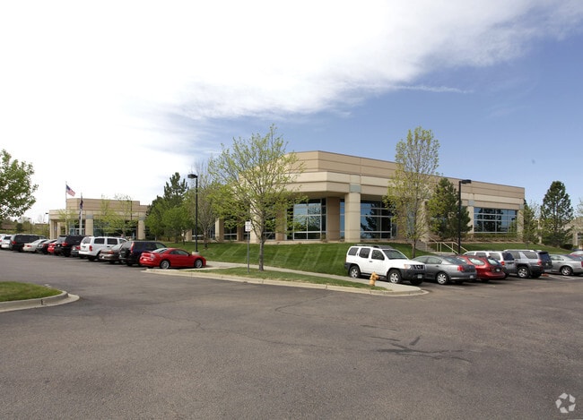
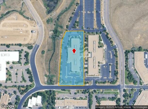
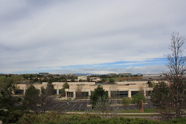
79 Inverness Dr E
Denver-Aurora-Centennial, CO
Inverness Sub 26Th Flg
2075-26-3-21-003
SUBDIVISIONCD 036034 SUBDIVISIONNAME INVERNESS SUB 26TH FLG BLOCK 001 LOT 003 LOT 3 BLK 1 INVERNESS SUB 26TH FLG
Officebuilding
Arapahoe
X
Colorado
08005C0478L
003,3
2024
4.46 AC
2025
Inverness
006864
Denver
50,320 SF
DEMOGRAPHICS near 79 Inverness Dr E
1 mile
3 mile
5 mile
2024 Total Population
3,553
60,045
227,924
2029 Population
3,637
62,127
239,591
Pop Growth 2024-2029
+ 2.36%
+ 3.47%
+ 5.12%
Average Age
37
39
40
2024 Total Households
2,078
25,393
92,895
HH Growth 2024-2029
+ 2.26%
+ 3.95%
+ 5.30%
Median Household Inc
$101,489
$107,034
$109,187
Avg Household Size
1.70
2.30
2.40
2024 Avg HH Vehicles
1.00
2.00
2.00
Median Home Value
$772,865
$693,525
$637,405
Median Year Built
2010
1994
1994
Nearby Places
Map Layers
Map Styles
 Street
 Aerial
Transit
 Traffic
 Biking
Places
Listings with unknown addresses are not visible on the map
- Restaurants
- Banks
- Shops
- Fitness
- Groceries
PUBLIC TRANSPORTATION
AIRPORT
Denver International
Drive
Walk
Distance
Denver International
39 min
30.4 mi
Nearby Properties
Address
Land Use
TOTAL SIZE
Lot Size
Zoning
Address
Land Use
TOTAL SIZE
Lot Size
Zoning
709,725 SF
15.21 AC
Address
Land Use
TOTAL SIZE
Lot Size
Zoning
709,725 SF
29.14 AC
Address
Land Use
TOTAL SIZE
Lot Size
Zoning
344,259 SF
5.18 AC
Address
Land Use
TOTAL SIZE
Lot Size
Zoning
92,346 SF
4.22 AC
Address
Land Use
TOTAL SIZE
Lot Size
Zoning
260,667 SF
19.72 AC
Address
Land Use
TOTAL SIZE
Lot Size
Zoning
313,812 SF
5.24 AC
GMC
Address
Land Use
TOTAL SIZE
Lot Size
Zoning
1,666,986 SF
11.12 AC
Address
Land Use
TOTAL SIZE
Lot Size
Zoning
637,459 SF
4.94 AC
AMU
Address
Land Use
TOTAL SIZE
Lot Size
Zoning
252,760 SF
3.63 AC
Address
Land Use
TOTAL SIZE
Lot Size
Zoning
959,756 SF
5.52 AC
PUD
Address
Land Use
TOTAL SIZE
Lot Size
Zoning
453,595 SF
26.08 AC
PUD
Address
Land Use
TOTAL SIZE
Lot Size
Zoning
1,210,850 SF
13.65 AC
AMU
Address
Land Use
TOTAL SIZE
Lot Size
Zoning
29,070 SF
308.89 AC
Address
Land Use
TOTAL SIZE
Lot Size
Zoning
305,198 SF
34.41 AC
PUD
Address
Land Use
TOTAL SIZE
Lot Size
Zoning
186,993 SF
16.22 AC
Address
Land Use
TOTAL SIZE
Lot Size
Zoning
284,862 SF
23.37 AC
PUD
Address
Land Use
TOTAL SIZE
Lot Size
Zoning
162,758 SF
11.21 AC
Address
Land Use
TOTAL SIZE
Lot Size
Zoning
246,768 SF
12.37 AC
PUD
Address
Land Use
TOTAL SIZE
Lot Size
Zoning
134,316 SF
26.52 AC
Address
Land Use
TOTAL SIZE
Lot Size
Zoning
247,689 SF
26.15 AC
AMU
Address
Land Use
TOTAL SIZE
Lot Size
Zoning
139,291 SF
8.63 AC
AMU
Address
Land Use
TOTAL SIZE
Lot Size
Zoning
332,114 SF
3.24 AC
GTC
Address
Land Use
TOTAL SIZE
Lot Size
Zoning
546,774 SF
8.81 AC
PUD
Address
Land Use
TOTAL SIZE
Lot Size
Zoning
216,853 SF
5.42 AC
PUD
Address
Land Use
TOTAL SIZE
Lot Size
Zoning
163,443 SF
14.39 AC
Address
Land Use
TOTAL SIZE
Lot Size
Zoning
650,416 SF
33.37 AC
LI
Address
Land Use
TOTAL SIZE
Lot Size
Zoning
224,978 SF
18.99 AC
Address
Land Use
TOTAL SIZE
Lot Size
Zoning
304,620 SF
23.95 AC
AMU
Address
Land Use
TOTAL SIZE
Lot Size
Zoning
395,438 SF
6.49 AC
AMU
Address
Land Use
TOTAL SIZE
Lot Size
Zoning
231,715 SF
5.58 AC
The World's #1 Commercial Real Estate Marketplace
Connect with us
© 2026 CoStar Group
The information above has been obtained from sources believed reliable. While we do not doubt its accuracy we have not verified it and make no guarantee, warranty or representation about it. It is your responsibility to independently confirm its accuracy and completeness. Any projections, opinions, assumptions, or estimates used are for example only and do not represent the current or future performance of the property. The value of this transaction to you depends on tax and other factors which should be evaluated by your tax, financial, and legal advisors. You and your advisors should conduct a careful, independent investigation of the property to determine to your satisfaction the suitability of the property for your needs.