Property Record
79 Main St, Vineyard Haven, MA 02568
Save to a Folder
{{folder.Name}}
{{folder.ListingIds.length}} Properties
{{folder.ListingIds.length}} Property
Create a New Folder
Property Detail
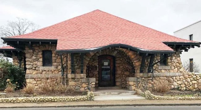
79 Main St
TISB-000007D-000000-000006
DUKES
Apartment
Massachusetts
AE The base floodplain where base flood elevations are provided. AE Zones are now used on new format FIRMs instead of A1-A30 Zones.
7.3
2025
0.38 AC
2025
Cape Cod
200100
Other Market Areas
3,012 SF
Vineyard Haven, MA
NEARBY LISTINGS FOR SALE OR LEASE
-
-
View all Vineyard Haven listings for sale on LoopNet.com
DEMOGRAPHICS near 79 Main St
1 mile
3 mile
5 mile
2025 Total Population
2,296
11,625
14,380
2030 Population
2,026
11,835
14,375
Pop Growth 2025-2030
(11.76%)
+ 1.81%
(0.03%)
Average Age
46
46
46
2025 Total Households
1,014
5,040
6,177
HH Growth 2025-2030
(11.93%)
+ 1.69%
(0.06%)
Median Household Inc
$73,370
$136,492
$136,250
Avg Household Size
2.20
2.20
2.30
2025 Avg HH Vehicles
2.00
2.00
2.00
Median Home Value
$1,017,143
$1,029,550
$1,050,809
Median Year Built
1978
1983
1984
Nearby Places
Map Layers
Map Styles
 Street
 Aerial
Layers
 Traffic
 Biking
Places
Listings with unknown addresses are not visible on the map
- Restaurants
- Banks
- Shops
- Fitness
- Groceries
PUBLIC TRANSPORTATION
AIRPORT
Martha's Vineyard
Drive
Walk
Distance
Martha's Vineyard
16 min
6.5 mi
Freight Ports
Port of New Bedford Harbor
Drive
Walk
Distance
Port of New Bedford Harbor
114 min
54.1 mi
SALE & LEASE HISTORY
LISTING DATE
SALE/LEASE

Apr 29, 2019
For Sale
Apr 29, 2019
For Sale
Nearby Properties
Address
Land Use
TOTAL SIZE
Lot Size
Zoning
Address
Land Use
TOTAL SIZE
Lot Size
Zoning
160,000 SF
23.70 AC
R3
Address
Land Use
TOTAL SIZE
Lot Size
Zoning
87,330 SF
27.82 AC
Address
Land Use
TOTAL SIZE
Lot Size
Zoning
14.09 AC
R1
Address
Land Use
TOTAL SIZE
Lot Size
Zoning
67,798 SF
5.15 AC
Address
Land Use
TOTAL SIZE
Lot Size
Zoning
28,841 SF
5 AC
R3
Address
Land Use
TOTAL SIZE
Lot Size
Zoning
166.30 AC
R3
Address
Land Use
TOTAL SIZE
Lot Size
Zoning
1.70 AC
R1
Address
Land Use
TOTAL SIZE
Lot Size
Zoning
1,378 SF
2.17 AC
Address
Land Use
TOTAL SIZE
Lot Size
Zoning
4,855 SF
17.50 AC
Address
Land Use
TOTAL SIZE
Lot Size
Zoning
3,448 SF
1.20 AC
RU
Address
Land Use
TOTAL SIZE
Lot Size
Zoning
7,883 SF
1.33 AC
Address
Land Use
TOTAL SIZE
Lot Size
Zoning
8,604 SF
2.28 AC
Address
Land Use
TOTAL SIZE
Lot Size
Zoning
2,749 SF
1.78 AC
Address
Land Use
TOTAL SIZE
Lot Size
Zoning
2,943 SF
1.39 AC
Address
Land Use
TOTAL SIZE
Lot Size
Zoning
5,687 SF
8.50 AC
Address
Land Use
TOTAL SIZE
Lot Size
Zoning
1.75 AC
Address
Land Use
TOTAL SIZE
Lot Size
Zoning
1.39 AC
Address
Land Use
TOTAL SIZE
Lot Size
Zoning
1,314 SF
1.56 AC
Address
Land Use
TOTAL SIZE
Lot Size
Zoning
4,223 SF
3.90 AC
RU
Address
Land Use
TOTAL SIZE
Lot Size
Zoning
7,144 SF
1.43 AC
R1
Address
Land Use
TOTAL SIZE
Lot Size
Zoning
3,580 SF
22 AC
Address
Land Use
TOTAL SIZE
Lot Size
Zoning
3,686 SF
0.85 AC
Address
Land Use
TOTAL SIZE
Lot Size
Zoning
0.67 AC
Address
Land Use
TOTAL SIZE
Lot Size
Zoning
0.67 AC
Address
Land Use
TOTAL SIZE
Lot Size
Zoning
0.66 AC
Address
Land Use
TOTAL SIZE
Lot Size
Zoning
Address
Land Use
TOTAL SIZE
Lot Size
Zoning
35,680 SF
4.43 AC
Address
Land Use
TOTAL SIZE
Lot Size
Zoning
2,918 SF
2.30 AC
Address
Land Use
TOTAL SIZE
Lot Size
Zoning
4,860 SF
0.79 AC
Address
Land Use
TOTAL SIZE
Lot Size
Zoning
36.48 AC
R3
The World's #1 Commercial Real Estate Marketplace
Connect with us
© 2026 CoStar Group
The information above has been obtained from sources believed reliable. While we do not doubt its accuracy we have not verified it and make no guarantee, warranty or representation about it. It is your responsibility to independently confirm its accuracy and completeness. Any projections, opinions, assumptions, or estimates used are for example only and do not represent the current or future performance of the property. The value of this transaction to you depends on tax and other factors which should be evaluated by your tax, financial, and legal advisors. You and your advisors should conduct a careful, independent investigation of the property to determine to your satisfaction the suitability of the property for your needs.