Property Record
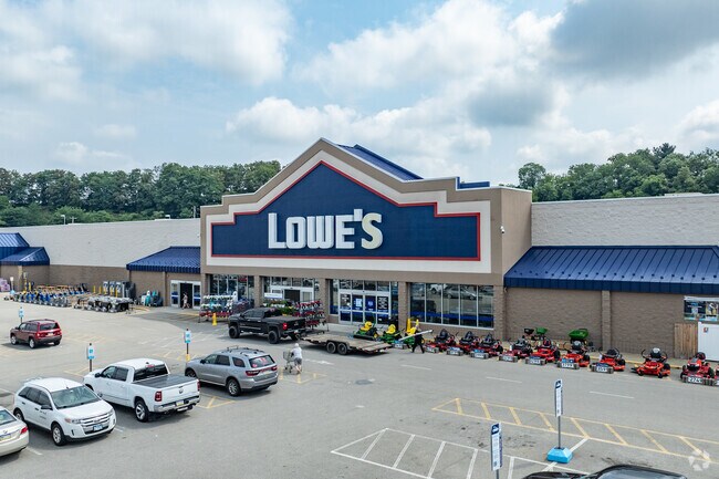
79 Matthew Dr, Uniontown, PA 15401

NEARBY LISTINGS FOR SALE OR LEASE
Property Detail
79 Matthew Dr
34-04-0056
16.4 AC STORE (LOWE'S)
Storebuilding
Fayette
X
Pennsylvania
42051C0344E
16.40 AC
2025
Fayette County
2025
Pittsburgh
262000
Pittsburgh, PA
95,052 SF
DEMOGRAPHICS near 79 Matthew Dr
1 mile
3 mile
5 mile
2024 Total Population
3,832
26,194
37,829
2029 Population
3,740
25,622
36,948
Pop Growth 2024-2029
(2.40%)
(2.18%)
(2.33%)
Average Age
45
44
44
2024 Total Households
1,655
11,466
16,442
HH Growth 2024-2029
(2.54%)
(2.33%)
(2.51%)
Median Household Inc
$57,187
$44,092
$45,181
Avg Household Size
2.20
2.20
2.20
2024 Avg HH Vehicles
2.00
2.00
2.00
Median Home Value
$143,384
$130,938
$132,951
Median Year Built
1955
1954
1955
Nearby Places
Map Layers
Map Styles
 Street
 Aerial
Transit
 Traffic
 Biking
Places
Listings with unknown addresses are not visible on the map
- Restaurants
- Banks
- Shops
- Fitness
- Groceries
Nearby Properties
Address
Land Use
TOTAL SIZE
Lot Size
Zoning
Address
Land Use
TOTAL SIZE
Lot Size
Zoning
339,020 SF
15.05 AC
Address
Land Use
TOTAL SIZE
Lot Size
Zoning
12,737 SF
12.98 AC
Address
Land Use
TOTAL SIZE
Lot Size
Zoning
29.65 AC
Address
Land Use
TOTAL SIZE
Lot Size
Zoning
7,600 SF
59.84 AC
Address
Land Use
TOTAL SIZE
Lot Size
Zoning
Address
Land Use
TOTAL SIZE
Lot Size
Zoning
21.85 AC
Address
Land Use
TOTAL SIZE
Lot Size
Zoning
3.34 AC
Address
Land Use
TOTAL SIZE
Lot Size
Zoning
8.28 AC
Address
Land Use
TOTAL SIZE
Lot Size
Zoning
13.30 AC
Address
Land Use
TOTAL SIZE
Lot Size
Zoning
776,069 SF
84.42 AC
Address
Land Use
TOTAL SIZE
Lot Size
Zoning
9.27 AC
Address
Land Use
TOTAL SIZE
Lot Size
Zoning
118,052 SF
5 AC
Address
Land Use
TOTAL SIZE
Lot Size
Zoning
88,666 SF
4.71 AC
Address
Land Use
TOTAL SIZE
Lot Size
Zoning
131,908 SF
22.48 AC
Address
Land Use
TOTAL SIZE
Lot Size
Zoning
113,588 SF
12.70 AC
Address
Land Use
TOTAL SIZE
Lot Size
Zoning
121,355 SF
18.12 AC
Address
Land Use
TOTAL SIZE
Lot Size
Zoning
10.70 AC
Address
Land Use
TOTAL SIZE
Lot Size
Zoning
18,000 SF
24.92 AC
Address
Land Use
TOTAL SIZE
Lot Size
Zoning
17.26 AC
Address
Land Use
TOTAL SIZE
Lot Size
Zoning
6.66 AC
Address
Land Use
TOTAL SIZE
Lot Size
Zoning
3.16 AC
Address
Land Use
TOTAL SIZE
Lot Size
Zoning
5.12 AC
Address
Land Use
TOTAL SIZE
Lot Size
Zoning
Address
Land Use
TOTAL SIZE
Lot Size
Zoning
58,038 SF
5.20 AC
Address
Land Use
TOTAL SIZE
Lot Size
Zoning
15.73 AC
Address
Land Use
TOTAL SIZE
Lot Size
Zoning
4,732 SF
17 AC
Address
Land Use
TOTAL SIZE
Lot Size
Zoning
Address
Land Use
TOTAL SIZE
Lot Size
Zoning
23,616 SF
146.08 AC
Address
Land Use
TOTAL SIZE
Lot Size
Zoning
137,286 SF
15.82 AC
Address
Land Use
TOTAL SIZE
Lot Size
Zoning
3.81 AC
The World's #1 Commercial Real Estate Marketplace
Connect with us
© 2026 CoStar Group
The information above has been obtained from sources believed reliable. While we do not doubt its accuracy we have not verified it and make no guarantee, warranty or representation about it. It is your responsibility to independently confirm its accuracy and completeness. Any projections, opinions, assumptions, or estimates used are for example only and do not represent the current or future performance of the property. The value of this transaction to you depends on tax and other factors which should be evaluated by your tax, financial, and legal advisors. You and your advisors should conduct a careful, independent investigation of the property to determine to your satisfaction the suitability of the property for your needs.