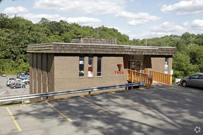
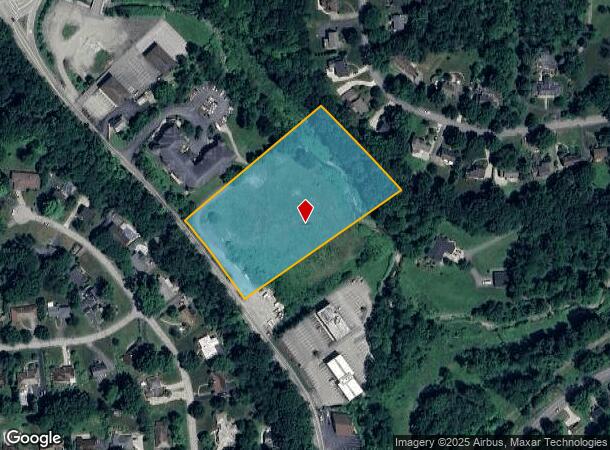
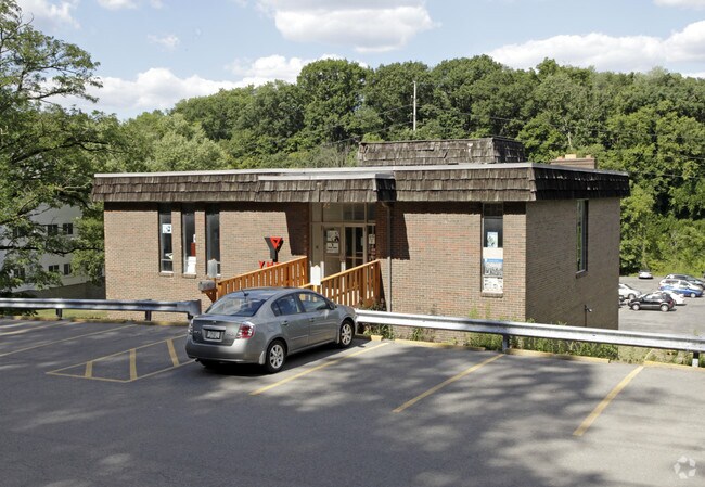
Property Record
51 Mcmurray Rd, Pittsburgh, PA 15241
NEARBY LISTINGS FOR SALE OR LEASE
Property Detail
51 Mcmurray Rd
Pittsburgh, PA
LOT 295.9XAVG550X339.45 RR MC MURRAY RD 1 STY BRK BLDG 79
0478-M-00182-0000-00
Allegheny
Vacantlandnec
Pennsylvania
AE
182
42125C0205E
3.02 AC
2024
South Pittsburgh/Rte 19
2025
Pittsburgh
474102
DEMOGRAPHICS near 51 Mcmurray Rd
1 Mile
3 Mile
5 Mile
2024 Total Population
7,035
72,477
184,091
2029 Population
6,825
70,838
180,103
Pop Growth 2024-2029
(2.99%)
(2.26%)
(2.17%)
Average Age
43
44
44
2024 Total Households
2,696
29,081
76,970
HH Growth 2024-2029
(3.00%)
(2.31%)
(2.28%)
Median Household Inc
$117,307
$110,810
$96,361
Avg Household Size
2.60
2.40
2.30
2024 Avg HH Vehicles
2.00
2.00
2.00
Median Home Value
$291,928
$277,804
$253,786
Median Year Built
1960
1964
1961
Nearby Places
Map Layers
Map Styles
 Street
 Aerial
- Restaurants
- Banks
- Shops
- Fitness
- Groceries
PUBLIC TRANSPORTATION
AIRPORT
Pittsburgh International
DRIVE
WALK
Distance
Pittsburgh International
35 min
19.7 mi
Freight Ports
Port of Baltimore
DRIVE
WALK
Distance
Port of Baltimore
290 min
245.2 mi
Nearby Properties
Address
Land Use
TOTAL SIZE
Lot Size
Zoning
Address
Land Use
TOTAL SIZE
Lot Size
Zoning
73.76 AC
Address
Land Use
TOTAL SIZE
Lot Size
Zoning
Address
Land Use
TOTAL SIZE
Lot Size
Zoning
31.68 AC
Address
Land Use
TOTAL SIZE
Lot Size
Zoning
40.46 AC
Address
Land Use
TOTAL SIZE
Lot Size
Zoning
69.28 AC
Address
Land Use
TOTAL SIZE
Lot Size
Zoning
28.26 AC
Address
Land Use
TOTAL SIZE
Lot Size
Zoning
239.25 AC
Address
Land Use
TOTAL SIZE
Lot Size
Zoning
10.49 AC
Address
Land Use
TOTAL SIZE
Lot Size
Zoning
58.24 AC
Address
Land Use
TOTAL SIZE
Lot Size
Zoning
7.19 AC
Address
Land Use
TOTAL SIZE
Lot Size
Zoning
31.39 AC
Address
Land Use
TOTAL SIZE
Lot Size
Zoning
24.33 AC
Address
Land Use
TOTAL SIZE
Lot Size
Zoning
Address
Land Use
TOTAL SIZE
Lot Size
Zoning
Address
Land Use
TOTAL SIZE
Lot Size
Zoning
Address
Land Use
TOTAL SIZE
Lot Size
Zoning
5.29 AC
Address
Land Use
TOTAL SIZE
Lot Size
Zoning
Address
Land Use
TOTAL SIZE
Lot Size
Zoning
7.66 AC
Address
Land Use
TOTAL SIZE
Lot Size
Zoning
21.96 AC
Address
Land Use
TOTAL SIZE
Lot Size
Zoning
26.91 AC
Address
Land Use
TOTAL SIZE
Lot Size
Zoning
6.79 AC
Address
Land Use
TOTAL SIZE
Lot Size
Zoning
9.73 AC
Address
Land Use
TOTAL SIZE
Lot Size
Zoning
20.79 AC
Address
Land Use
TOTAL SIZE
Lot Size
Zoning
201.61 AC
Address
Land Use
TOTAL SIZE
Lot Size
Zoning
12.03 AC
Address
Land Use
TOTAL SIZE
Lot Size
Zoning
8.95 AC
Address
Land Use
TOTAL SIZE
Lot Size
Zoning
0.12 AC
Address
Land Use
TOTAL SIZE
Lot Size
Zoning
9.45 AC
Address
Land Use
TOTAL SIZE
Lot Size
Zoning
7.78 AC
Address
Land Use
TOTAL SIZE
Lot Size
Zoning
0.12 AC
The World's #1 Commercial Real Estate Marketplace
Connect with us
© 2026 CoStar Group
The information above has been obtained from sources believed reliable. While we do not doubt its accuracy we have not verified it and make no guarantee, warranty or representation about it. It is your responsibility to independently confirm its accuracy and completeness. Any projections, opinions, assumptions, or estimates used are for example only and do not represent the current or future performance of the property. The value of this transaction to you depends on tax and other factors which should be evaluated by your tax, financial, and legal advisors. You and your advisors should conduct a careful, independent investigation of the property to determine to your satisfaction the suitability of the property for your needs.