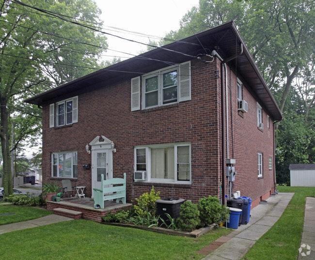
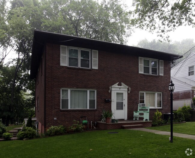
Property Record
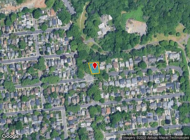
79 Rice Ave, Staten Island, NY 10314
NEARBY LISTINGS FOR SALE OR LEASE
Property Detail
79 Rice Ave
New York-Jersey City-White Plains, NY-NJ
Amended Map Blossom Heights
00326-0001
WESTERLY2 LOT4
Commercialofficeresidentialmixeduse
Staten Island
X
New York
3604970326F
1
2024
0.17 AC
2025
Staten Island
014700
Long Island (New York)
4,644 SF
DEMOGRAPHICS near 79 Rice Ave
1 Mile
3 Mile
5 Mile
2024 Total Population
36,301
302,364
528,531
2029 Population
35,967
296,898
515,333
Pop Growth 2024-2029
(0.92%)
(1.81%)
(2.50%)
Average Age
41
40
40
2024 Total Households
12,950
104,805
190,276
HH Growth 2024-2029
(0.96%)
(1.85%)
(2.73%)
Median Household Inc
$99,586
$79,581
$79,413
Avg Household Size
2.70
2.80
2.70
2024 Avg HH Vehicles
2.00
1.00
1.00
Median Home Value
$667,113
$620,424
$616,728
Median Year Built
1955
1965
1963
Nearby Places
Map Layers
Map Styles
 Street
 Aerial
- Restaurants
- Banks
- Shops
- Fitness
- Groceries
PUBLIC TRANSPORTATION
COMMUTER RAIL
Grasmere (Staten Island Railway - New York MTA Subway (The Subway))
DRIVE
WALK
Distance
Grasmere (Staten Island Railway - New York MTA Subway (The Subway))
6 min
2.8 mi
Old Town (Staten Island Railway - New York MTA Subway (The Subway))
DRIVE
WALK
Distance
Old Town (Staten Island Railway - New York MTA Subway (The Subway))
8 min
3.9 mi
AIRPORT
Newark Liberty International
DRIVE
WALK
Distance
Newark Liberty International
22 min
12.8 mi
LaGuardia
DRIVE
WALK
Distance
LaGuardia
38 min
22.7 mi
John F Kennedy International
DRIVE
WALK
Distance
John F Kennedy International
37 min
25.4 mi
Freight Ports
New York Container Terminal
DRIVE
WALK
Distance
New York Container Terminal
9 min
5.0 mi
Nearby Properties
Address
Land Use
TOTAL SIZE
Lot Size
Zoning
Address
Land Use
TOTAL SIZE
Lot Size
Zoning
633,280 SF
202.90 AC
R3-2
Address
Land Use
TOTAL SIZE
Lot Size
Zoning
22.49 AC
HC
Address
Land Use
TOTAL SIZE
Lot Size
Zoning
686,130 SF
189.62 AC
R3-2
Address
Land Use
TOTAL SIZE
Lot Size
Zoning
1.01 AC
Address
Land Use
TOTAL SIZE
Lot Size
Zoning
640,077 SF
19.34 AC
R3-1
Address
Land Use
TOTAL SIZE
Lot Size
Zoning
3.27 AC
Address
Land Use
TOTAL SIZE
Lot Size
Zoning
566,000 SF
103.31 AC
R3-2
Address
Land Use
TOTAL SIZE
Lot Size
Zoning
115.33 AC
IH
Address
Land Use
TOTAL SIZE
Lot Size
Zoning
1,502 SF
0.69 AC
C-1
Address
Land Use
TOTAL SIZE
Lot Size
Zoning
73.86 AC
IH
Address
Land Use
TOTAL SIZE
Lot Size
Zoning
538,240 SF
12.08 AC
R2
Address
Land Use
TOTAL SIZE
Lot Size
Zoning
494,840 SF
34.77 AC
R3-2
Address
Land Use
TOTAL SIZE
Lot Size
Zoning
521,405 SF
52.79 AC
R3-1
Address
Land Use
TOTAL SIZE
Lot Size
Zoning
418,012 SF
6.74 AC
R3-1
Address
Land Use
TOTAL SIZE
Lot Size
Zoning
111,000 SF
186.03 AC
PARK
Address
Land Use
TOTAL SIZE
Lot Size
Zoning
48.68 AC
IH
Address
Land Use
TOTAL SIZE
Lot Size
Zoning
492,962 SF
8.12 AC
M1-1
Address
Land Use
TOTAL SIZE
Lot Size
Zoning
19.26 AC
IH
Address
Land Use
TOTAL SIZE
Lot Size
Zoning
183,839 SF
9.74 AC
PARK
Address
Land Use
TOTAL SIZE
Lot Size
Zoning
23.72 AC
IH
Address
Land Use
TOTAL SIZE
Lot Size
Zoning
41.25 AC
IH
Address
Land Use
TOTAL SIZE
Lot Size
Zoning
3,179 SF
0.13 AC
Address
Land Use
TOTAL SIZE
Lot Size
Zoning
Address
Land Use
TOTAL SIZE
Lot Size
Zoning
183,215 SF
3.47 AC
C4-2
Address
Land Use
TOTAL SIZE
Lot Size
Zoning
Address
Land Use
TOTAL SIZE
Lot Size
Zoning
240 SF
47.41 AC
R3-2
Address
Land Use
TOTAL SIZE
Lot Size
Zoning
66.37 AC
PARK
Address
Land Use
TOTAL SIZE
Lot Size
Zoning
14.15 AC
Address
Land Use
TOTAL SIZE
Lot Size
Zoning
48,500 SF
61.98 AC
R3-2
Address
Land Use
TOTAL SIZE
Lot Size
Zoning
226,590 SF
5.52 AC
R3-2
The World's #1 Commercial Real Estate Marketplace
Connect with us
© 2025 CoStar Group
The information above has been obtained from sources believed reliable. While we do not doubt its accuracy we have not verified it and make no guarantee, warranty or representation about it. It is your responsibility to independently confirm its accuracy and completeness. Any projections, opinions, assumptions, or estimates used are for example only and do not represent the current or future performance of the property. The value of this transaction to you depends on tax and other factors which should be evaluated by your tax, financial, and legal advisors. You and your advisors should conduct a careful, independent investigation of the property to determine to your satisfaction the suitability of the property for your needs.