Property Record
79 River Rd, Cromwell, CT 06416


Property Detail
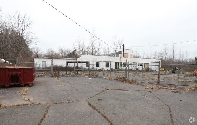
79 River Rd
CROM-000053-000063-000014
MIDDLESEX
Commercialacreage
Connecticut
DC
14
AE The base floodplain where base flood elevations are provided. AE Zones are now used on new format FIRMs instead of A1-A30 Zones.
9 AC
2025
NW Middlesex/Mid'town
2025
Hartford
570200
Hartford-West Hartford-East Hartford, CT
5,816 SF
NEARBY LISTINGS FOR SALE OR LEASE
DEMOGRAPHICS near 79 River Rd
1 mile
3 mile
5 mile
2025 Total Population
2,826
34,417
85,377
2030 Population
2,819
34,547
86,358
Pop Growth 2025-2030
(0.25%)
+ 0.38%
+ 1.15%
Average Age
44
42
42
2025 Total Households
1,134
14,663
35,723
HH Growth 2025-2030
(0.35%)
+ 0.38%
+ 1.14%
Median Household Inc
$69,946
$78,393
$85,777
Avg Household Size
2.20
2.20
2.20
2025 Avg HH Vehicles
2.00
2.00
2.00
Median Home Value
$288,272
$306,391
$329,611
Median Year Built
1955
1968
1973
Nearby Places
Map Layers
Map Styles
 Street
 Aerial
Transit
 Traffic
 Biking
Places
Listings with unknown addresses are not visible on the map
- Restaurants
- Banks
- Shops
- Fitness
- Groceries
PUBLIC TRANSPORTATION
COMMUTER RAIL
Berlin (Hartford Line - CONN DOT)
Drive
Walk
Distance
Berlin (Hartford Line - CONN DOT)
14 min
8.2 mi
Berlin Amtrak (Amtrak Hartford Line - Amtrak, Northeast Regional - Amtrak, Valley Flyer - Amtrak)
Drive
Walk
Distance
Berlin Amtrak (Amtrak Hartford Line - Amtrak, Northeast Regional - Amtrak, Valley Flyer - Amtrak)
14 min
8.2 mi
AIRPORT
Bradley International
Drive
Walk
Distance
Bradley International
50 min
31.4 mi
Tweed/New Haven
Drive
Walk
Distance
Tweed/New Haven
47 min
32.5 mi
Freight Ports
Port of New Haven
Drive
Walk
Distance
Port of New Haven
43 min
30.2 mi
Nearby Properties
Address
Land Use
TOTAL SIZE
Lot Size
Zoning
Address
Land Use
TOTAL SIZE
Lot Size
Zoning
65.89 AC
R-45
Address
Land Use
TOTAL SIZE
Lot Size
Zoning
33,524 SF
37.71 AC
ID
Address
Land Use
TOTAL SIZE
Lot Size
Zoning
0.56 AC
B-1
Address
Land Use
TOTAL SIZE
Lot Size
Zoning
2.33 AC
ID
Address
Land Use
TOTAL SIZE
Lot Size
Zoning
27.21 AC
M
Address
Land Use
TOTAL SIZE
Lot Size
Zoning
4.90 AC
ID
Address
Land Use
TOTAL SIZE
Lot Size
Zoning
19.49 AC
PRD
Address
Land Use
TOTAL SIZE
Lot Size
Zoning
7.79 AC
ID
Address
Land Use
TOTAL SIZE
Lot Size
Zoning
1.62 AC
ID
Address
Land Use
TOTAL SIZE
Lot Size
Zoning
65,615 SF
1.46 AC
ID
Address
Land Use
TOTAL SIZE
Lot Size
Zoning
92,766 SF
1.79 AC
ID
Address
Land Use
TOTAL SIZE
Lot Size
Zoning
27,152 SF
8.75 AC
R-25
Address
Land Use
TOTAL SIZE
Lot Size
Zoning
10.10 AC
IND
Address
Land Use
TOTAL SIZE
Lot Size
Zoning
3.58 AC
DVD
Address
Land Use
TOTAL SIZE
Lot Size
Zoning
3.24 AC
ID
Address
Land Use
TOTAL SIZE
Lot Size
Zoning
24.45 AC
HB
Address
Land Use
TOTAL SIZE
Lot Size
Zoning
13.28 AC
PRD
Address
Land Use
TOTAL SIZE
Lot Size
Zoning
102,239 SF
1.02 AC
B-1
Address
Land Use
TOTAL SIZE
Lot Size
Zoning
83,241 SF
52.65 AC
R-15
Address
Land Use
TOTAL SIZE
Lot Size
Zoning
161,959 SF
45.61 AC
R-25
Address
Land Use
TOTAL SIZE
Lot Size
Zoning
15,395 SF
158.10 AC
R-25
Address
Land Use
TOTAL SIZE
Lot Size
Zoning
88,369 SF
26 AC
R-15
Address
Land Use
TOTAL SIZE
Lot Size
Zoning
3.25 AC
ID
Address
Land Use
TOTAL SIZE
Lot Size
Zoning
80,627 SF
10.54 AC
HB
Address
Land Use
TOTAL SIZE
Lot Size
Zoning
146.96 AC
IND
Address
Land Use
TOTAL SIZE
Lot Size
Zoning
37.25 AC
R-25
Address
Land Use
TOTAL SIZE
Lot Size
Zoning
177,765 SF
1.10 AC
B-1
Address
Land Use
TOTAL SIZE
Lot Size
Zoning
2.98 AC
ID
Address
Land Use
TOTAL SIZE
Lot Size
Zoning
2.75 AC
ID
Address
Land Use
TOTAL SIZE
Lot Size
Zoning
58,398 SF
4.80 AC
R-15
The World's #1 Commercial Real Estate Marketplace
Connect with us
© 2026 CoStar Group
The information above has been obtained from sources believed reliable. While we do not doubt its accuracy we have not verified it and make no guarantee, warranty or representation about it. It is your responsibility to independently confirm its accuracy and completeness. Any projections, opinions, assumptions, or estimates used are for example only and do not represent the current or future performance of the property. The value of this transaction to you depends on tax and other factors which should be evaluated by your tax, financial, and legal advisors. You and your advisors should conduct a careful, independent investigation of the property to determine to your satisfaction the suitability of the property for your needs.