Property Record
79 Route 73, Voorhees, NJ 08043


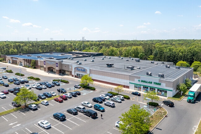

Current Lease Availabilities
Property Detail
79 Route 73
34-00272-0000-00005
CAMDEN
Commercialnec
New Jersey
MB
5
B and X Area of moderate flood hazard, usually the area between the limits of the 100-year and 500-year floods.
19.93 AC
2025
South Camden County
2025
Philadelphia
607505
Philadelphia-Camden-Wilmington, PA-NJ-DE-MD
202,484 SF
NEARBY LISTINGS FOR SALE OR LEASE
DEMOGRAPHICS near 79 Route 73
1 mile
3 mile
5 mile
2025 Total Population
6,630
48,683
156,227
2030 Population
6,719
49,591
159,592
Pop Growth 2025-2030
+ 1.34%
+ 1.87%
+ 2.15%
Average Age
42
41
42
2025 Total Households
2,249
18,293
61,078
HH Growth 2025-2030
+ 1.42%
+ 1.90%
+ 2.21%
Median Household Inc
$168,904
$98,587
$97,281
Avg Household Size
2.90
2.60
2.50
2025 Avg HH Vehicles
2.00
2.00
2.00
Median Home Value
$458,742
$396,590
$354,046
Median Year Built
1980
1977
1976
Nearby Places
Map Layers
Map Styles
 Street
 Aerial
Layers
 Traffic
 Biking
Places
Listings with unknown addresses are not visible on the map
- Restaurants
- Banks
- Shops
- Fitness
- Groceries
PUBLIC TRANSPORTATION
COMMUTER RAIL
Atco (Atlantic City Line - NJ Transit Commuter Rail (NJ Transit))
Drive
Walk
Distance
Atco (Atlantic City Line - NJ Transit Commuter Rail (NJ Transit))
8 min
4.7 mi
Lindenwold (Njt) (Atlantic City Line - NJ Transit Commuter Rail (NJ Transit))
Drive
Walk
Distance
Lindenwold (Njt) (Atlantic City Line - NJ Transit Commuter Rail (NJ Transit))
10 min
6.8 mi
AIRPORT
Philadelphia International
Drive
Walk
Distance
Philadelphia International
40 min
25.5 mi
Freight Ports
Broadway Terminal - Pier 5
Drive
Walk
Distance
Broadway Terminal - Pier 5
24 min
17.0 mi
Nearby Properties
Address
Land Use
TOTAL SIZE
Lot Size
Zoning
Address
Land Use
TOTAL SIZE
Lot Size
Zoning
58.91 AC
MB
Address
Land Use
TOTAL SIZE
Lot Size
Zoning
300,650 SF
58.91 AC
MB
Address
Land Use
TOTAL SIZE
Lot Size
Zoning
79.35 AC
CP
Address
Land Use
TOTAL SIZE
Lot Size
Zoning
60,132 SF
18.57 AC
RA
Address
Land Use
TOTAL SIZE
Lot Size
Zoning
16.61 AC
SH
Address
Land Use
TOTAL SIZE
Lot Size
Zoning
40,487 SF
32.42 AC
SH
Address
Land Use
TOTAL SIZE
Lot Size
Zoning
114,852 SF
12.73 AC
GB2
Address
Land Use
TOTAL SIZE
Lot Size
Zoning
44.34 AC
C1
Address
Land Use
TOTAL SIZE
Lot Size
Zoning
89,793 SF
5.08 AC
MB
Address
Land Use
TOTAL SIZE
Lot Size
Zoning
28.40 AC
Address
Land Use
TOTAL SIZE
Lot Size
Zoning
90,080 SF
5.22 AC
MB
Address
Land Use
TOTAL SIZE
Lot Size
Zoning
31.80 AC
Address
Land Use
TOTAL SIZE
Lot Size
Zoning
123,900 SF
3.43 AC
O3
Address
Land Use
TOTAL SIZE
Lot Size
Zoning
16,584 SF
1.82 AC
MB
Address
Land Use
TOTAL SIZE
Lot Size
Zoning
126,080 SF
TC-1
Address
Land Use
TOTAL SIZE
Lot Size
Zoning
132,728 SF
8.82 AC
GB2
Address
Land Use
TOTAL SIZE
Lot Size
Zoning
76,176 SF
4.36 AC
RR
Address
Land Use
TOTAL SIZE
Lot Size
Zoning
171,540 SF
0.02 AC
MB
Address
Land Use
TOTAL SIZE
Lot Size
Zoning
28,036 SF
8.52 AC
GB2
Address
Land Use
TOTAL SIZE
Lot Size
Zoning
24.84 AC
Address
Land Use
TOTAL SIZE
Lot Size
Zoning
75,581 SF
20 AC
MF
Address
Land Use
TOTAL SIZE
Lot Size
Zoning
100,800 SF
5.76 AC
O3
Address
Land Use
TOTAL SIZE
Lot Size
Zoning
118,180 SF
2.71 AC
MB
Address
Land Use
TOTAL SIZE
Lot Size
Zoning
54,658 SF
7.97 AC
O3
Address
Land Use
TOTAL SIZE
Lot Size
Zoning
16.71 AC
MF
Address
Land Use
TOTAL SIZE
Lot Size
Zoning
14.53 AC
C2
Address
Land Use
TOTAL SIZE
Lot Size
Zoning
4.67 AC
INST
Address
Land Use
TOTAL SIZE
Lot Size
Zoning
61,668 SF
18.72 AC
CP
Address
Land Use
TOTAL SIZE
Lot Size
Zoning
27.15 AC
C-1
The World's #1 Commercial Real Estate Marketplace
Connect with us
© 2026 CoStar Group
The information above has been obtained from sources believed reliable. While we do not doubt its accuracy we have not verified it and make no guarantee, warranty or representation about it. It is your responsibility to independently confirm its accuracy and completeness. Any projections, opinions, assumptions, or estimates used are for example only and do not represent the current or future performance of the property. The value of this transaction to you depends on tax and other factors which should be evaluated by your tax, financial, and legal advisors. You and your advisors should conduct a careful, independent investigation of the property to determine to your satisfaction the suitability of the property for your needs.