Property Record
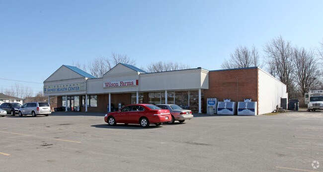
79 Telegraph Rd, Middleport, NY 14105


NEARBY LISTINGS FOR SALE OR LEASE
Property Detail
79 Telegraph Rd
Buffalo-Cheektowaga-Niagara Falls, NY
Holland Purchase
293601-085-020-0002-039-000
4 9 14 5
Storesoffices
Niagara
X
New York
36073C0255D
39.000
2025
1.60 AC
2024
Outlying Niagara County
024002
Buffalo/Niagara Falls
12,000 SF
DEMOGRAPHICS near 79 Telegraph Rd
1 Mile
3 Mile
5 Mile
2024 Total Population
1,842
3,168
11,064
2029 Population
1,810
3,092
10,784
Pop Growth 2024-2029
(1.74%)
(2.40%)
(2.53%)
Average Age
40
42
43
2024 Total Households
777
1,317
4,592
HH Growth 2024-2029
(1.80%)
(2.43%)
(2.55%)
Median Household Inc
$56,075
$65,719
$63,817
Avg Household Size
2.40
2.40
2.40
2024 Avg HH Vehicles
2.00
2.00
2.00
Median Home Value
$122,589
$145,854
$136,123
Median Year Built
1947
1948
1948
Nearby Places
Map Layers
Map Styles
 Street
 Aerial
- Restaurants
- Banks
- Shops
- Fitness
- Groceries
PUBLIC TRANSPORTATION
AIRPORT
Niagara Falls International
DRIVE
WALK
Distance
Niagara Falls International
38 min
27.2 mi
Buffalo Niagara International
DRIVE
WALK
Distance
Buffalo Niagara International
39 min
28.4 mi
Freight Ports
Albany, NY Port
DRIVE
WALK
Distance
Albany, NY Port
325 min
276.1 mi
Nearby Properties
Address
Land Use
TOTAL SIZE
Lot Size
Zoning
Address
Land Use
TOTAL SIZE
Lot Size
Zoning
114,038 SF
65.10 AC
01 - NOT Z
Address
Land Use
TOTAL SIZE
Lot Size
Zoning
82,664 SF
24.40 AC
R1
Address
Land Use
TOTAL SIZE
Lot Size
Zoning
Address
Land Use
TOTAL SIZE
Lot Size
Zoning
Address
Land Use
TOTAL SIZE
Lot Size
Zoning
65,059 SF
10.44 AC
RA
Address
Land Use
TOTAL SIZE
Lot Size
Zoning
Address
Land Use
TOTAL SIZE
Lot Size
Zoning
113,002 SF
13.92 AC
I1
Address
Land Use
TOTAL SIZE
Lot Size
Zoning
Address
Land Use
TOTAL SIZE
Lot Size
Zoning
39,516 SF
44.90 AC
I
Address
Land Use
TOTAL SIZE
Lot Size
Zoning
Address
Land Use
TOTAL SIZE
Lot Size
Zoning
Address
Land Use
TOTAL SIZE
Lot Size
Zoning
Address
Land Use
TOTAL SIZE
Lot Size
Zoning
Address
Land Use
TOTAL SIZE
Lot Size
Zoning
420.90 AC
RES/AG
Address
Land Use
TOTAL SIZE
Lot Size
Zoning
324.64 AC
Address
Land Use
TOTAL SIZE
Lot Size
Zoning
Address
Land Use
TOTAL SIZE
Lot Size
Zoning
4,064 SF
86.79 AC
RA
Address
Land Use
TOTAL SIZE
Lot Size
Zoning
Address
Land Use
TOTAL SIZE
Lot Size
Zoning
Address
Land Use
TOTAL SIZE
Lot Size
Zoning
20,148 SF
1.30 AC
R1
Address
Land Use
TOTAL SIZE
Lot Size
Zoning
18,742 SF
1.80 AC
R1
Address
Land Use
TOTAL SIZE
Lot Size
Zoning
Address
Land Use
TOTAL SIZE
Lot Size
Zoning
5,640 SF
5.15 AC
I1
Address
Land Use
TOTAL SIZE
Lot Size
Zoning
189.70 AC
P00
Address
Land Use
TOTAL SIZE
Lot Size
Zoning
62,448 SF
3.40 AC
I
Address
Land Use
TOTAL SIZE
Lot Size
Zoning
179 AC
Address
Land Use
TOTAL SIZE
Lot Size
Zoning
174.50 AC
P00
Address
Land Use
TOTAL SIZE
Lot Size
Zoning
5.20 AC
B
Address
Land Use
TOTAL SIZE
Lot Size
Zoning
1,800 SF
74.30 AC
P00
The World's #1 Commercial Real Estate Marketplace
Connect with us
© 2025 CoStar Group
The information above has been obtained from sources believed reliable. While we do not doubt its accuracy we have not verified it and make no guarantee, warranty or representation about it. It is your responsibility to independently confirm its accuracy and completeness. Any projections, opinions, assumptions, or estimates used are for example only and do not represent the current or future performance of the property. The value of this transaction to you depends on tax and other factors which should be evaluated by your tax, financial, and legal advisors. You and your advisors should conduct a careful, independent investigation of the property to determine to your satisfaction the suitability of the property for your needs.