Property Record
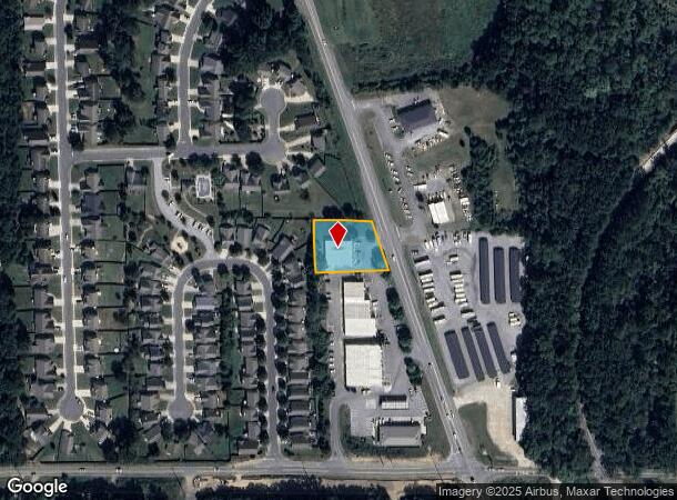
790 Burnt Hickory Rd Sw, Cartersville, GA 30120
NEARBY LISTINGS FOR SALE OR LEASE
Property Detail
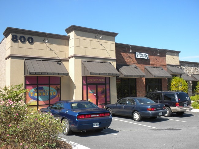
790 Burnt Hickory Rd Sw
0071-0274-004
Com - West/Highway 113
Commercialnec
TR 2 PLAT 74-12 SHOPPES AT HICKORY SPRINGS
X
Bartow
13015C0262H
Georgia
2024
0.66 AC
2024
Bartow/Cartersville
960502
Atlanta
5,628 SF
Atlanta-Sandy Springs-Roswell, GA
DEMOGRAPHICS near 790 Burnt Hickory Rd Sw
1 Mile
3 Mile
5 Mile
2024 Total Population
4,770
34,684
57,971
2029 Population
5,223
37,957
63,380
Pop Growth 2024-2029
+ 9.50%
+ 9.44%
+ 9.33%
Average Age
37
38
39
2024 Total Households
1,741
13,318
21,687
HH Growth 2024-2029
+ 9.30%
+ 9.20%
+ 9.10%
Median Household Inc
$76,047
$62,330
$67,728
Avg Household Size
2.60
2.50
2.60
2024 Avg HH Vehicles
2.00
2.00
2.00
Median Home Value
$227,778
$222,149
$228,201
Median Year Built
1994
1988
1991
Nearby Places
Map Layers
Map Styles
 Street
 Aerial
- Restaurants
- Banks
- Shops
- Fitness
- Groceries
SALE & LEASE HISTORY
LISTING DATE
SALE/LEASE

Sep 25, 2016
For Lease
Mar 07, 2017
For Lease
Nearby Properties
Address
Land Use
TOTAL SIZE
Lot Size
Zoning
Address
Land Use
TOTAL SIZE
Lot Size
Zoning
7,488 SF
38.49 AC
IN
Address
Land Use
TOTAL SIZE
Lot Size
Zoning
67,428 SF
36.96 AC
Address
Land Use
TOTAL SIZE
Lot Size
Zoning
134,528 SF
4.71 AC
IN
Address
Land Use
TOTAL SIZE
Lot Size
Zoning
Address
Land Use
TOTAL SIZE
Lot Size
Zoning
250,701 SF
15.17 AC
C1
Address
Land Use
TOTAL SIZE
Lot Size
Zoning
244,800 SF
17.44 AC
Address
Land Use
TOTAL SIZE
Lot Size
Zoning
Address
Land Use
TOTAL SIZE
Lot Size
Zoning
194,306 SF
126.40 AC
A1
Address
Land Use
TOTAL SIZE
Lot Size
Zoning
33,096 SF
15.80 AC
Address
Land Use
TOTAL SIZE
Lot Size
Zoning
104,757 SF
45 AC
IN
Address
Land Use
TOTAL SIZE
Lot Size
Zoning
Address
Land Use
TOTAL SIZE
Lot Size
Zoning
1,200 SF
25.69 AC
IN
Address
Land Use
TOTAL SIZE
Lot Size
Zoning
1,800 SF
102.03 AC
A1
Address
Land Use
TOTAL SIZE
Lot Size
Zoning
84,852 SF
6.78 AC
A1
Address
Land Use
TOTAL SIZE
Lot Size
Zoning
151,571 SF
25.82 AC
Address
Land Use
TOTAL SIZE
Lot Size
Zoning
3,696 SF
12 AC
IN
Address
Land Use
TOTAL SIZE
Lot Size
Zoning
211,708 SF
20.32 AC
Address
Land Use
TOTAL SIZE
Lot Size
Zoning
194,368 SF
25.02 AC
IN
Address
Land Use
TOTAL SIZE
Lot Size
Zoning
144,416 SF
40.01 AC
A1
Address
Land Use
TOTAL SIZE
Lot Size
Zoning
88,974 SF
5.42 AC
IN
Address
Land Use
TOTAL SIZE
Lot Size
Zoning
91,110 SF
17.09 AC
Address
Land Use
TOTAL SIZE
Lot Size
Zoning
Address
Land Use
TOTAL SIZE
Lot Size
Zoning
59,880 SF
12.83 AC
C1
Address
Land Use
TOTAL SIZE
Lot Size
Zoning
20,000 SF
9.63 AC
C1
Address
Land Use
TOTAL SIZE
Lot Size
Zoning
12,769 SF
4.44 AC
C1
Address
Land Use
TOTAL SIZE
Lot Size
Zoning
57,164 SF
4.88 AC
Address
Land Use
TOTAL SIZE
Lot Size
Zoning
9,560 SF
12 AC
R3
Address
Land Use
TOTAL SIZE
Lot Size
Zoning
13.86 AC
IN
Address
Land Use
TOTAL SIZE
Lot Size
Zoning
64,691 SF
6.95 AC
Address
Land Use
TOTAL SIZE
Lot Size
Zoning
68,829 SF
6.87 AC
The World's #1 Commercial Real Estate Marketplace
Connect with us
© 2025 CoStar Group
The information above has been obtained from sources believed reliable. While we do not doubt its accuracy we have not verified it and make no guarantee, warranty or representation about it. It is your responsibility to independently confirm its accuracy and completeness. Any projections, opinions, assumptions, or estimates used are for example only and do not represent the current or future performance of the property. The value of this transaction to you depends on tax and other factors which should be evaluated by your tax, financial, and legal advisors. You and your advisors should conduct a careful, independent investigation of the property to determine to your satisfaction the suitability of the property for your needs.