Property Record
7900 64Th Ave E, Palmetto, FL 34221
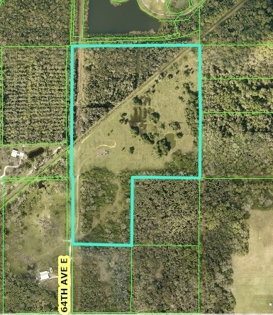

This Property Is For Sale
Property Detail
7900 64Th Ave E
6578-0000-9
NW1/4 OF NW1/4 LESS W 25 FT FOR RD R/W, NW1/4 OF SW1/4 OF NW1/4 LESS W 25 FT FOR RD R/W P-5 PI#6578.0000/9
Livestock
MANATEE
A-1 SUBURB
Florida
A Areas with a 1% annual chance of flooding and a 26% chance of flooding over the life of a 30-year mortgage.
48.46 AC
2023
Manatee
2025
Tampa/St Petersburg
001916
North Port-Bradenton-Sarasota, FL
NEARBY LISTINGS FOR SALE OR LEASE
DEMOGRAPHICS near 7900 64Th Ave E
1 mile
3 mile
5 mile
2025 Total Population
3,731
43,274
85,636
2030 Population
4,215
50,007
98,244
Pop Growth 2025-2030
+ 12.97%
+ 15.56%
+ 14.72%
Average Age
46
45
45
2025 Total Households
1,452
16,508
33,045
HH Growth 2025-2030
+ 13.15%
+ 15.74%
+ 14.58%
Median Household Inc
$104,514
$93,755
$88,983
Avg Household Size
2.50
2.50
2.50
2025 Avg HH Vehicles
2.00
2.00
2.00
Median Home Value
$409,692
$381,676
$391,901
Median Year Built
2005
2009
2007
Nearby Places
Map Layers
Map Styles
 Street
 Aerial
Layers
 Traffic
 Biking
Places
Listings with unknown addresses are not visible on the map
- Restaurants
- Banks
- Shops
- Fitness
- Groceries
PUBLIC TRANSPORTATION
AIRPORT
Sarasota/Bradenton International
Drive
Walk
Distance
Sarasota/Bradenton International
34 min
17.9 mi
St Pete-Clearwater International
Drive
Walk
Distance
St Pete-Clearwater International
54 min
35.5 mi
Tampa International
Drive
Walk
Distance
Tampa International
61 min
44.2 mi
Freight Ports
Port Manatee
Drive
Walk
Distance
Port Manatee
18 min
8.1 mi
Nearby Properties
Address
Land Use
TOTAL SIZE
Lot Size
Zoning
Address
Land Use
TOTAL SIZE
Lot Size
Zoning
294,300 SF
10.33 AC
PD-MU
Address
Land Use
TOTAL SIZE
Lot Size
Zoning
359,418 SF
16.36 AC
PD-C
Address
Land Use
TOTAL SIZE
Lot Size
Zoning
137.34 AC
Address
Land Use
TOTAL SIZE
Lot Size
Zoning
313,422 SF
47.93 AC
PD-C
Address
Land Use
TOTAL SIZE
Lot Size
Zoning
184,048 SF
21.11 AC
PD-MU
Address
Land Use
TOTAL SIZE
Lot Size
Zoning
608,665 SF
30 AC
PD-MU
Address
Land Use
TOTAL SIZE
Lot Size
Zoning
456,317 SF
46.75 AC
PD-R
Address
Land Use
TOTAL SIZE
Lot Size
Zoning
3,904 SF
94 AC
Address
Land Use
TOTAL SIZE
Lot Size
Zoning
312,546 SF
39.60 AC
A-1 SUBURB
Address
Land Use
TOTAL SIZE
Lot Size
Zoning
208,893 SF
12.17 AC
PD-MU
Address
Land Use
TOTAL SIZE
Lot Size
Zoning
136.89 AC
Address
Land Use
TOTAL SIZE
Lot Size
Zoning
50.25 AC
Address
Land Use
TOTAL SIZE
Lot Size
Zoning
124,400 SF
4.05 AC
PD-MU
Address
Land Use
TOTAL SIZE
Lot Size
Zoning
118,152 SF
30.66 AC
A-1 SUBURB
Address
Land Use
TOTAL SIZE
Lot Size
Zoning
6,552 SF
30.06 AC
RVP
Address
Land Use
TOTAL SIZE
Lot Size
Zoning
137,104 SF
10 AC
PD-EZ
Address
Land Use
TOTAL SIZE
Lot Size
Zoning
3.09 AC
PD-R
Address
Land Use
TOTAL SIZE
Lot Size
Zoning
64,800 SF
8.19 AC
Address
Land Use
TOTAL SIZE
Lot Size
Zoning
75,001 SF
18.15 AC
PD-C
Address
Land Use
TOTAL SIZE
Lot Size
Zoning
58,569 SF
19.67 AC
A GENERAL
Address
Land Use
TOTAL SIZE
Lot Size
Zoning
98,574 SF
5.60 AC
PD-MU
Address
Land Use
TOTAL SIZE
Lot Size
Zoning
40.84 AC
Address
Land Use
TOTAL SIZE
Lot Size
Zoning
158.58 AC
Address
Land Use
TOTAL SIZE
Lot Size
Zoning
21.19 AC
Address
Land Use
TOTAL SIZE
Lot Size
Zoning
89,799 SF
22.19 AC
PD-C
Address
Land Use
TOTAL SIZE
Lot Size
Zoning
33.13 AC
Address
Land Use
TOTAL SIZE
Lot Size
Zoning
43.81 AC
Address
Land Use
TOTAL SIZE
Lot Size
Zoning
2.73 AC
Address
Land Use
TOTAL SIZE
Lot Size
Zoning
1,890 SF
20.42 AC
PD-RV
Address
Land Use
TOTAL SIZE
Lot Size
Zoning
7.24 AC
The World's #1 Commercial Real Estate Marketplace
Connect with us
© 2026 CoStar Group
The information above has been obtained from sources believed reliable. While we do not doubt its accuracy we have not verified it and make no guarantee, warranty or representation about it. It is your responsibility to independently confirm its accuracy and completeness. Any projections, opinions, assumptions, or estimates used are for example only and do not represent the current or future performance of the property. The value of this transaction to you depends on tax and other factors which should be evaluated by your tax, financial, and legal advisors. You and your advisors should conduct a careful, independent investigation of the property to determine to your satisfaction the suitability of the property for your needs.