Property Record
7900 E Princess Dr, Scottsdale, AZ 85255

NEARBY LISTINGS FOR SALE OR LEASE
-
-
View all Scottsdale listings for sale on LoopNet.com
Property Detail
7900 E Princess Dr
215-08-137A
PT SE4 SEC 35 DAF COM SE COR SEC 35 TH N 1050.56F W 216.34F TH NWLY ALG ARC CUR 225.65F TO POT N 38D 8M W 297.08F TH WLY ALG ARC CUR 82.31F TO TPOB TH CONT ALG CUR 320.25F TO POT S 75D 57M W 113.18F T O BEG CUR CONC TO N TH WLY ALG SD CUR 423.73F N 4
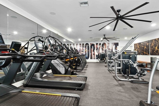
Apartment
Maricopa
AO
Arizona
04013C1320L
11.89 AC
2025
North Scottsdale
2025
Phoenix
216851
Phoenix-Mesa-Chandler, AZ
228,465 SF
DEMOGRAPHICS near 7900 E Princess Dr
1 Mile
3 Mile
5 Mile
2024 Total Population
5,290
72,036
174,827
2029 Population
5,921
79,589
191,303
Pop Growth 2024-2029
+ 11.93%
+ 10.49%
+ 9.42%
Average Age
43
43
44
2024 Total Households
2,759
33,753
76,425
HH Growth 2024-2029
+ 12.14%
+ 10.85%
+ 9.74%
Median Household Inc
$95,688
$110,352
$113,747
Avg Household Size
1.80
2.10
2.20
2024 Avg HH Vehicles
1.00
2.00
2.00
Median Home Value
$649,540
$691,821
$676,319
Median Year Built
1998
1997
1993
Nearby Places
Map Layers
Map Styles
 Street
 Aerial
- Restaurants
- Banks
- Shops
- Fitness
- Groceries
PUBLIC TRANSPORTATION
AIRPORT
Phoenix Sky Harbor International
DRIVE
WALK
Distance
Phoenix Sky Harbor International
33 min
22.5 mi
Phoenix-Mesa Gateway
DRIVE
WALK
Distance
Phoenix-Mesa Gateway
52 min
37.5 mi
Freight Ports
Port of San Diego
DRIVE
WALK
Distance
Port of San Diego
423 min
378.3 mi
Nearby Properties
Address
Land Use
TOTAL SIZE
Lot Size
Zoning
Address
Land Use
TOTAL SIZE
Lot Size
Zoning
1,504,047 SF
40.43 AC
I-P
Address
Land Use
TOTAL SIZE
Lot Size
Zoning
20.98 AC
Address
Land Use
TOTAL SIZE
Lot Size
Zoning
13.01 AC
Address
Land Use
TOTAL SIZE
Lot Size
Zoning
35.76 AC
R1-18
Address
Land Use
TOTAL SIZE
Lot Size
Zoning
1,293,284 SF
14.50 AC
C-R
Address
Land Use
TOTAL SIZE
Lot Size
Zoning
1,479,005 SF
12.55 AC
PC
Address
Land Use
TOTAL SIZE
Lot Size
Zoning
Address
Land Use
TOTAL SIZE
Lot Size
Zoning
3.15 AC
I-P
Address
Land Use
TOTAL SIZE
Lot Size
Zoning
667,688 SF
277.21 AC
Address
Land Use
TOTAL SIZE
Lot Size
Zoning
Address
Land Use
TOTAL SIZE
Lot Size
Zoning
694,644 SF
34.41 AC
C-C
Address
Land Use
TOTAL SIZE
Lot Size
Zoning
670,926 SF
20.92 AC
I-P
Address
Land Use
TOTAL SIZE
Lot Size
Zoning
229,856 SF
7.71 AC
C-T
Address
Land Use
TOTAL SIZE
Lot Size
Zoning
794,304 SF
14.59 AC
WTP
Address
Land Use
TOTAL SIZE
Lot Size
Zoning
762,044 SF
16.66 AC
I1
Address
Land Use
TOTAL SIZE
Lot Size
Zoning
7,803 SF
2.31 AC
I-P
Address
Land Use
TOTAL SIZE
Lot Size
Zoning
368,657 SF
40.11 AC
Address
Land Use
TOTAL SIZE
Lot Size
Zoning
514,088 SF
6.70 AC
PAD
Address
Land Use
TOTAL SIZE
Lot Size
Zoning
533,288 SF
18.61 AC
I-P
Address
Land Use
TOTAL SIZE
Lot Size
Zoning
428,891 SF
6.48 AC
PAD
Address
Land Use
TOTAL SIZE
Lot Size
Zoning
707,542 SF
28.49 AC
R-3A
Address
Land Use
TOTAL SIZE
Lot Size
Zoning
421,002 SF
23.48 AC
Address
Land Use
TOTAL SIZE
Lot Size
Zoning
824,672 SF
11.52 AC
Address
Land Use
TOTAL SIZE
Lot Size
Zoning
487,786 SF
18.42 AC
S1
Address
Land Use
TOTAL SIZE
Lot Size
Zoning
884,258 SF
30.63 AC
PCD
Address
Land Use
TOTAL SIZE
Lot Size
Zoning
90.73 AC
O-S
Address
Land Use
TOTAL SIZE
Lot Size
Zoning
497,704 SF
6.77 AC
Address
Land Use
TOTAL SIZE
Lot Size
Zoning
337,668 SF
8.14 AC
PAD
Address
Land Use
TOTAL SIZE
Lot Size
Zoning
539,135 SF
15.11 AC
R3A
Address
Land Use
TOTAL SIZE
Lot Size
Zoning
417,831 SF
2.68 AC
C-R
The World's #1 Commercial Real Estate Marketplace
Connect with us
© 2026 CoStar Group
The information above has been obtained from sources believed reliable. While we do not doubt its accuracy we have not verified it and make no guarantee, warranty or representation about it. It is your responsibility to independently confirm its accuracy and completeness. Any projections, opinions, assumptions, or estimates used are for example only and do not represent the current or future performance of the property. The value of this transaction to you depends on tax and other factors which should be evaluated by your tax, financial, and legal advisors. You and your advisors should conduct a careful, independent investigation of the property to determine to your satisfaction the suitability of the property for your needs.