Property Record
7900 W Ridge Rd, Elyria, OH 44035
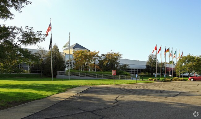


Property Detail
7900 W Ridge Rd
Cleveland-Elyria, OH
TRW NELSON STUD
05-00-086-000-001
Lorain
Lightindustrial
Ohio
B and X Area of moderate flood hazard, usually the area between the limits of the 100-year and 500-year floods.
75,86
2024
43.21 AC
2024
Lorain/Avon Lake
057100
Cleveland
182,568 SF
NEARBY LISTINGS FOR SALE OR LEASE
DEMOGRAPHICS near 7900 W Ridge Rd
1 mile
3 mile
5 mile
2025 Total Population
739
25,703
115,939
2030 Population
774
26,330
118,705
Pop Growth 2025-2030
+ 4.74%
+ 2.44%
+ 2.39%
Average Age
42
43
41
2025 Total Households
338
11,118
48,443
HH Growth 2025-2030
+ 4.73%
+ 2.57%
+ 2.40%
Median Household Inc
$53,035
$60,986
$59,050
Avg Household Size
2.20
2.30
2.30
2025 Avg HH Vehicles
2.00
2.00
2.00
Median Home Value
$176,691
$168,582
$164,240
Median Year Built
1974
1968
1964
Nearby Places
Map Layers
Map Styles
 Street
 Aerial
Layers
 Traffic
 Biking
Places
Listings with unknown addresses are not visible on the map
- Restaurants
- Banks
- Shops
- Fitness
- Groceries
PUBLIC TRANSPORTATION
COMMUTER RAIL
Drive
Walk
Distance
12 min
5.6 mi
AIRPORT
Cleveland-Hopkins International
Drive
Walk
Distance
Cleveland-Hopkins International
32 min
20.6 mi
Nearby Properties
Address
Land Use
TOTAL SIZE
Lot Size
Zoning
Address
Land Use
TOTAL SIZE
Lot Size
Zoning
187,340 SF
42.98 AC
Address
Land Use
TOTAL SIZE
Lot Size
Zoning
112,888 SF
8.92 AC
Address
Land Use
TOTAL SIZE
Lot Size
Zoning
Address
Land Use
TOTAL SIZE
Lot Size
Zoning
194,787 SF
19.04 AC
Address
Land Use
TOTAL SIZE
Lot Size
Zoning
89,540 SF
4.62 AC
Address
Land Use
TOTAL SIZE
Lot Size
Zoning
31,871 SF
6.90 AC
Address
Land Use
TOTAL SIZE
Lot Size
Zoning
54,831 SF
3.93 AC
Address
Land Use
TOTAL SIZE
Lot Size
Zoning
76,610 SF
2.49 AC
Address
Land Use
TOTAL SIZE
Lot Size
Zoning
52,685 SF
13.19 AC
Address
Land Use
TOTAL SIZE
Lot Size
Zoning
42,095 SF
2.34 AC
Address
Land Use
TOTAL SIZE
Lot Size
Zoning
105,718 SF
5.11 AC
Address
Land Use
TOTAL SIZE
Lot Size
Zoning
22,737 SF
8.58 AC
Address
Land Use
TOTAL SIZE
Lot Size
Zoning
135,641 SF
9.97 AC
Address
Land Use
TOTAL SIZE
Lot Size
Zoning
42,808 SF
7.08 AC
Address
Land Use
TOTAL SIZE
Lot Size
Zoning
16,844 SF
2.32 AC
Address
Land Use
TOTAL SIZE
Lot Size
Zoning
27,756 SF
2.61 AC
Address
Land Use
TOTAL SIZE
Lot Size
Zoning
28,524 SF
5.90 AC
Address
Land Use
TOTAL SIZE
Lot Size
Zoning
423,598 SF
160.58 AC
Address
Land Use
TOTAL SIZE
Lot Size
Zoning
21,240 SF
3.13 AC
Address
Land Use
TOTAL SIZE
Lot Size
Zoning
109,425 SF
8.46 AC
Address
Land Use
TOTAL SIZE
Lot Size
Zoning
64,390 SF
5.60 AC
Address
Land Use
TOTAL SIZE
Lot Size
Zoning
4,392 SF
0.82 AC
Address
Land Use
TOTAL SIZE
Lot Size
Zoning
48,978 SF
6.60 AC
Address
Land Use
TOTAL SIZE
Lot Size
Zoning
3.07 AC
Address
Land Use
TOTAL SIZE
Lot Size
Zoning
191,480 SF
7.10 AC
Address
Land Use
TOTAL SIZE
Lot Size
Zoning
11.65 AC
Address
Land Use
TOTAL SIZE
Lot Size
Zoning
110,868 SF
7.52 AC
Address
Land Use
TOTAL SIZE
Lot Size
Zoning
26,990 SF
20.02 AC
Address
Land Use
TOTAL SIZE
Lot Size
Zoning
23,568 SF
3.04 AC
The World's #1 Commercial Real Estate Marketplace
Connect with us
© 2026 CoStar Group
The information above has been obtained from sources believed reliable. While we do not doubt its accuracy we have not verified it and make no guarantee, warranty or representation about it. It is your responsibility to independently confirm its accuracy and completeness. Any projections, opinions, assumptions, or estimates used are for example only and do not represent the current or future performance of the property. The value of this transaction to you depends on tax and other factors which should be evaluated by your tax, financial, and legal advisors. You and your advisors should conduct a careful, independent investigation of the property to determine to your satisfaction the suitability of the property for your needs.