Property Record
7901 Freeport Blvd, Sacramento, CA 95832


NEARBY LISTINGS FOR SALE OR LEASE
Property Detail
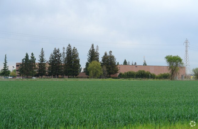
7901 Freeport Blvd
119-0010-066
POR SEC 11 & 12, T7N, R4E, MDB&M BEG AT A PT ON THE ELY R/WLN OF FREEPORT BL LOC S07%0730W 4270.93 FR THE NE COR SDSEC 11;
Officebuilding
Sacramento
X
California
06067C0305H
15.76 AC
2024
South Sacramento
2025
Sacramento
004302
Sacramento--Roseville--Arden-Arcade, CA
165,523 SF
DEMOGRAPHICS near 7901 Freeport Blvd
1 Mile
3 Mile
5 Mile
2024 Total Population
7,792
87,880
271,412
2029 Population
7,790
88,297
272,813
Pop Growth 2024-2029
(0.03%)
+ 0.47%
+ 0.52%
Average Age
37
39
38
2024 Total Households
2,173
29,164
90,652
HH Growth 2024-2029
(0.14%)
+ 0.45%
+ 0.48%
Median Household Inc
$81,410
$76,597
$71,966
Avg Household Size
3.50
2.90
2.90
2024 Avg HH Vehicles
2.00
2.00
2.00
Median Home Value
$454,987
$418,989
$435,402
Median Year Built
1984
1979
1979
Nearby Places
Map Layers
Map Styles
 Street
 Aerial
- Restaurants
- Banks
- Shops
- Fitness
- Groceries
PUBLIC TRANSPORTATION
COMMUTER RAIL
Sacramento (Capitol Corridor - Capitol Corridor Joint Powers Authority)
DRIVE
WALK
Distance
Sacramento (Capitol Corridor - Capitol Corridor Joint Powers Authority)
13 min
9.2 mi
AIRPORT
Sacramento International
DRIVE
WALK
Distance
Sacramento International
27 min
19.5 mi
Freight Ports
Port of Stockton
DRIVE
WALK
Distance
Port of Stockton
45 min
38.2 mi
Nearby Properties
Address
Land Use
TOTAL SIZE
Lot Size
Zoning
Address
Land Use
TOTAL SIZE
Lot Size
Zoning
306,028 SF
9.74 AC
LI
Address
Land Use
TOTAL SIZE
Lot Size
Zoning
12.70 AC
SC-PUD
Address
Land Use
TOTAL SIZE
Lot Size
Zoning
253,984 SF
11.58 AC
R-2B-PUD
Address
Land Use
TOTAL SIZE
Lot Size
Zoning
165,704 SF
9.57 AC
R-2B-R
Address
Land Use
TOTAL SIZE
Lot Size
Zoning
175,855 SF
8.90 AC
R-2B-R-PUD
Address
Land Use
TOTAL SIZE
Lot Size
Zoning
170,514 SF
9 AC
R-2B-R-PUD
Address
Land Use
TOTAL SIZE
Lot Size
Zoning
173,323 SF
10.39 AC
C-2-PUD
Address
Land Use
TOTAL SIZE
Lot Size
Zoning
13.87 AC
C-2-PUD
Address
Land Use
TOTAL SIZE
Lot Size
Zoning
166,941 SF
7.46 AC
R-2B-PUD
Address
Land Use
TOTAL SIZE
Lot Size
Zoning
64,082 SF
2.38 AC
R-1
Address
Land Use
TOTAL SIZE
Lot Size
Zoning
187,708 SF
13.50 AC
C-2-PUD
Address
Land Use
TOTAL SIZE
Lot Size
Zoning
186.36 AC
R-1-PUD R-
Address
Land Use
TOTAL SIZE
Lot Size
Zoning
156,873 SF
14.98 AC
C-2-PUD
Address
Land Use
TOTAL SIZE
Lot Size
Zoning
267,580 SF
16.12 AC
R-1A
Address
Land Use
TOTAL SIZE
Lot Size
Zoning
207,000 SF
11.53 AC
LI
Address
Land Use
TOTAL SIZE
Lot Size
Zoning
181,766 SF
4.79 AC
R-4-PUD R-
Address
Land Use
TOTAL SIZE
Lot Size
Zoning
137,916 SF
11.62 AC
SC-R
Address
Land Use
TOTAL SIZE
Lot Size
Zoning
227,396 SF
15.76 AC
R-2A-R-EA-
Address
Land Use
TOTAL SIZE
Lot Size
Zoning
91,586 SF
6.03 AC
R-3-R
Address
Land Use
TOTAL SIZE
Lot Size
Zoning
85,131 SF
7.40 AC
C-2-PUD
Address
Land Use
TOTAL SIZE
Lot Size
Zoning
84,087 SF
4.11 AC
R-3-R
Address
Land Use
TOTAL SIZE
Lot Size
Zoning
162,259 SF
12.73 AC
R-3
Address
Land Use
TOTAL SIZE
Lot Size
Zoning
45,949 SF
4.24 AC
R-2A
Address
Land Use
TOTAL SIZE
Lot Size
Zoning
6.34 AC
C-2-PUD
Address
Land Use
TOTAL SIZE
Lot Size
Zoning
106,803 SF
7.18 AC
R-2A-R
Address
Land Use
TOTAL SIZE
Lot Size
Zoning
29.28 AC
C-2-PUD
Address
Land Use
TOTAL SIZE
Lot Size
Zoning
105,700 SF
12.41 AC
C-2-R
Address
Land Use
TOTAL SIZE
Lot Size
Zoning
161,242 SF
9.95 AC
R-2B
Address
Land Use
TOTAL SIZE
Lot Size
Zoning
136,738 SF
11.92 AC
SC
The World's #1 Commercial Real Estate Marketplace
Connect with us
© 2025 CoStar Group
The information above has been obtained from sources believed reliable. While we do not doubt its accuracy we have not verified it and make no guarantee, warranty or representation about it. It is your responsibility to independently confirm its accuracy and completeness. Any projections, opinions, assumptions, or estimates used are for example only and do not represent the current or future performance of the property. The value of this transaction to you depends on tax and other factors which should be evaluated by your tax, financial, and legal advisors. You and your advisors should conduct a careful, independent investigation of the property to determine to your satisfaction the suitability of the property for your needs.