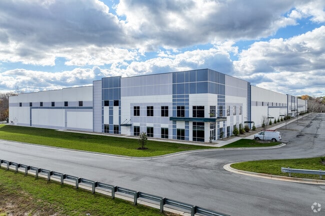
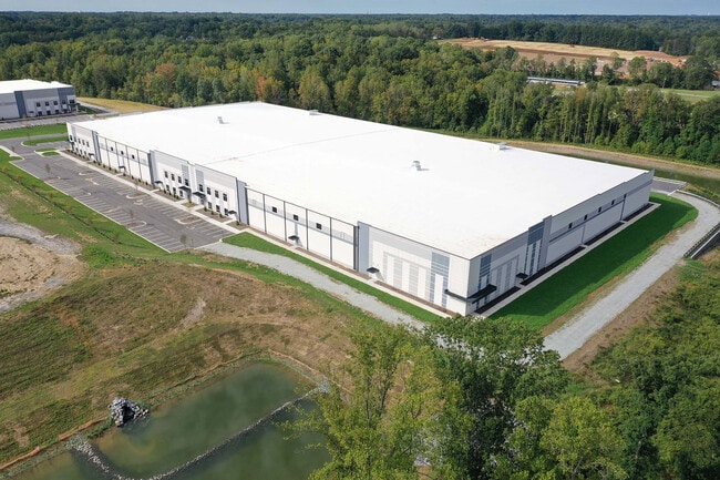
Property Record
7902 Indlea Pt, Colfax, NC 27235

Current Lease Availabilities
Property Detail
7902 Indlea Pt
0235047
GREENLEA 68 SITE LO:2A
Industrialgeneral
GUILFORD
LI
North Carolina
2024
21.68 AC
2025
Airport/W Guilford County
016203
Greensboro/Winston-Salem
192,200 SF
Greensboro-High Point, NC
NEARBY LISTINGS FOR SALE OR LEASE
DEMOGRAPHICS near 7902 Indlea Pt
1 mile
3 mile
5 mile
2025 Total Population
2,136
17,680
46,330
2030 Population
2,232
18,280
47,980
Pop Growth 2025-2030
+ 4.49%
+ 3.39%
+ 3.56%
Average Age
39
40
41
2025 Total Households
799
6,543
18,567
HH Growth 2025-2030
+ 4.76%
+ 3.56%
+ 3.70%
Median Household Inc
$88,986
$111,813
$93,936
Avg Household Size
2.70
2.70
2.50
2025 Avg HH Vehicles
2.00
2.00
2.00
Median Home Value
$403,247
$378,827
$352,763
Median Year Built
1996
1996
1995
Nearby Places
Map Layers
Map Styles
 Street
 Aerial
Transit
 Traffic
 Biking
Places
Listings with unknown addresses are not visible on the map
- Restaurants
- Banks
- Shops
- Fitness
- Groceries
PUBLIC TRANSPORTATION
AIRPORT
Piedmont Triad International
Drive
Walk
Distance
Piedmont Triad International
16 min
8.1 mi
Freight Ports
Virginia Port Authority - Richmond
Drive
Walk
Distance
Virginia Port Authority - Richmond
245 min
211.9 mi
Nearby Properties
Address
Land Use
TOTAL SIZE
Lot Size
Zoning
Address
Land Use
TOTAL SIZE
Lot Size
Zoning
404,766 SF
153.35 AC
AR
Address
Land Use
TOTAL SIZE
Lot Size
Zoning
543,043 SF
62.40 AC
BP
Address
Land Use
TOTAL SIZE
Lot Size
Zoning
324,931 SF
16.32 AC
PUD
Address
Land Use
TOTAL SIZE
Lot Size
Zoning
340,508 SF
15.45 AC
RM-26
Address
Land Use
TOTAL SIZE
Lot Size
Zoning
509,216 SF
40.85 AC
LI
Address
Land Use
TOTAL SIZE
Lot Size
Zoning
285,123 SF
22.44 AC
PUD
Address
Land Use
TOTAL SIZE
Lot Size
Zoning
428,867 SF
76.65 AC
LI
Address
Land Use
TOTAL SIZE
Lot Size
Zoning
180,568 SF
0.01 AC
AR
Address
Land Use
TOTAL SIZE
Lot Size
Zoning
341,000 SF
29.55 AC
LI
Address
Land Use
TOTAL SIZE
Lot Size
Zoning
543,123 SF
24.66 AC
LI
Address
Land Use
TOTAL SIZE
Lot Size
Zoning
217,000 SF
16.58 AC
LI
Address
Land Use
TOTAL SIZE
Lot Size
Zoning
267,381 SF
18.98 AC
RM-12
Address
Land Use
TOTAL SIZE
Lot Size
Zoning
208,936 SF
22.88 AC
LI
Address
Land Use
TOTAL SIZE
Lot Size
Zoning
134,781 SF
140.63 AC
AR
Address
Land Use
TOTAL SIZE
Lot Size
Zoning
209,128 SF
17.45 AC
RM-18
Address
Land Use
TOTAL SIZE
Lot Size
Zoning
112,728 SF
9.18 AC
BP
Address
Land Use
TOTAL SIZE
Lot Size
Zoning
121,932 SF
38.04 AC
BP
Address
Land Use
TOTAL SIZE
Lot Size
Zoning
169,401 SF
30.89 AC
PI
Address
Land Use
TOTAL SIZE
Lot Size
Zoning
254,857 SF
82.98 AC
PI
Address
Land Use
TOTAL SIZE
Lot Size
Zoning
292,513 SF
23.84 AC
HI
Address
Land Use
TOTAL SIZE
Lot Size
Zoning
121,396 SF
23.67 AC
BP
Address
Land Use
TOTAL SIZE
Lot Size
Zoning
195,056 SF
9.64 AC
LI
Address
Land Use
TOTAL SIZE
Lot Size
Zoning
290,328 SF
24.55 AC
LI
Address
Land Use
TOTAL SIZE
Lot Size
Zoning
154,988 SF
34.21 AC
BP
Address
Land Use
TOTAL SIZE
Lot Size
Zoning
22,757 SF
94.40 AC
PI
Address
Land Use
TOTAL SIZE
Lot Size
Zoning
380,568 SF
29.47 AC
LI
Address
Land Use
TOTAL SIZE
Lot Size
Zoning
151,726 SF
15.68 AC
LI
Address
Land Use
TOTAL SIZE
Lot Size
Zoning
85,651 SF
27.22 AC
PI
Address
Land Use
TOTAL SIZE
Lot Size
Zoning
120,000 SF
6.84 AC
LI
The World's #1 Commercial Real Estate Marketplace
Connect with us
© 2026 CoStar Group
The information above has been obtained from sources believed reliable. While we do not doubt its accuracy we have not verified it and make no guarantee, warranty or representation about it. It is your responsibility to independently confirm its accuracy and completeness. Any projections, opinions, assumptions, or estimates used are for example only and do not represent the current or future performance of the property. The value of this transaction to you depends on tax and other factors which should be evaluated by your tax, financial, and legal advisors. You and your advisors should conduct a careful, independent investigation of the property to determine to your satisfaction the suitability of the property for your needs.