Property Record
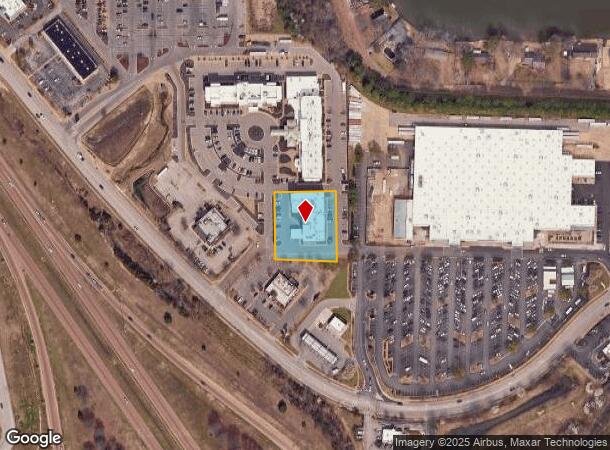
7904 Craft Goodman Rd, Olive Branch, MS 38654
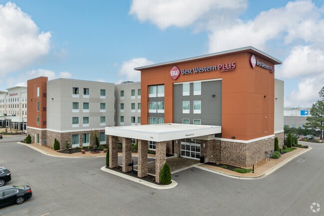
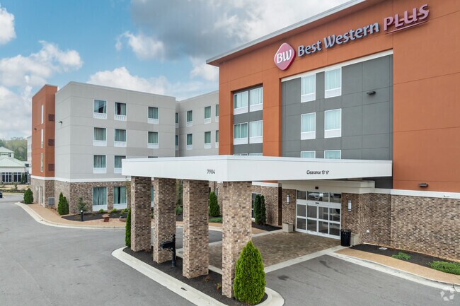
This Property Is For Sale
NEARBY LISTINGS FOR SALE OR LEASE
Property Detail
7904 Craft Goodman Rd
Memphis, TN-MS-AR
Crossings At Olive Branch Ph Iii
1069293000001400
CROSSINGS AT OLIVE BRANCH PH 3 LOT 14
Commercialnec
DeSoto
X
Mississippi
28033C0090H
14
2025
1 AC
2025
Memphis Airport/South
070811
Memphis
43,604 SF
DEMOGRAPHICS near 7904 Craft Goodman Rd
1 Mile
3 Mile
5 Mile
2024 Total Population
3,720
36,437
89,247
2029 Population
4,056
39,127
92,820
Pop Growth 2024-2029
+ 9.03%
+ 7.38%
+ 4.00%
Average Age
42
39
38
2024 Total Households
1,409
13,395
31,671
HH Growth 2024-2029
+ 9.16%
+ 7.40%
+ 4.08%
Median Household Inc
$76,894
$78,099
$76,980
Avg Household Size
2.60
2.70
2.80
2024 Avg HH Vehicles
2.00
2.00
2.00
Median Home Value
$254,610
$226,990
$226,346
Median Year Built
1996
1996
1994
Nearby Places
Map Layers
Map Styles
 Street
 Aerial
- Restaurants
- Banks
- Shops
- Fitness
- Groceries
PUBLIC TRANSPORTATION
AIRPORT
Memphis International
DRIVE
WALK
Distance
Memphis International
19 min
12.5 mi
Freight Ports
Port of Shreveport
DRIVE
WALK
Distance
Port of Shreveport
423 min
386.3 mi
Nearby Properties
Address
Land Use
TOTAL SIZE
Lot Size
Zoning
Address
Land Use
TOTAL SIZE
Lot Size
Zoning
1,059,729 SF
74.33 AC
M-2
Address
Land Use
TOTAL SIZE
Lot Size
Zoning
834,463 SF
37.46 AC
EMP
Address
Land Use
TOTAL SIZE
Lot Size
Zoning
434,122 SF
23.97 AC
R-6
Address
Land Use
TOTAL SIZE
Lot Size
Zoning
158,366 SF
24.31 AC
R-6
Address
Land Use
TOTAL SIZE
Lot Size
Zoning
326,743 SF
22.91 AC
R-8
Address
Land Use
TOTAL SIZE
Lot Size
Zoning
345,770 SF
18.13 AC
EMP
Address
Land Use
TOTAL SIZE
Lot Size
Zoning
903,083 SF
45.12 AC
EMP
Address
Land Use
TOTAL SIZE
Lot Size
Zoning
642,900 SF
29.71 AC
EMP
Address
Land Use
TOTAL SIZE
Lot Size
Zoning
466,532 SF
21.76 AC
EMP
Address
Land Use
TOTAL SIZE
Lot Size
Zoning
864,054 SF
72.19 AC
M-1
Address
Land Use
TOTAL SIZE
Lot Size
Zoning
379,348 SF
23.82 AC
IH
Address
Land Use
TOTAL SIZE
Lot Size
Zoning
364,578 SF
19.76 AC
IH
Address
Land Use
TOTAL SIZE
Lot Size
Zoning
307,100 SF
18.95 AC
CA
Address
Land Use
TOTAL SIZE
Lot Size
Zoning
309,885 SF
17.49 AC
R-8
Address
Land Use
TOTAL SIZE
Lot Size
Zoning
860,464 SF
54.55 AC
M-1
Address
Land Use
TOTAL SIZE
Lot Size
Zoning
88,090 SF
6.05 AC
CA
Address
Land Use
TOTAL SIZE
Lot Size
Zoning
693,680 SF
47.15 AC
M-1
Address
Land Use
TOTAL SIZE
Lot Size
Zoning
814,054 SF
51.14 AC
M-1
Address
Land Use
TOTAL SIZE
Lot Size
Zoning
217,172 SF
12.32 AC
R-6
Address
Land Use
TOTAL SIZE
Lot Size
Zoning
210,161 SF
14.86 AC
R-6
Address
Land Use
TOTAL SIZE
Lot Size
Zoning
174,148 SF
7.09 AC
CA
Address
Land Use
TOTAL SIZE
Lot Size
Zoning
210,354 SF
17.31 AC
R-8
Address
Land Use
TOTAL SIZE
Lot Size
Zoning
60,296 SF
18.86 AC
CA
Address
Land Use
TOTAL SIZE
Lot Size
Zoning
390,874 SF
122.03 AC
M-1
Address
Land Use
TOTAL SIZE
Lot Size
Zoning
170,280 SF
8.65 AC
CA
Address
Land Use
TOTAL SIZE
Lot Size
Zoning
445,114 SF
32.34 AC
M-1
Address
Land Use
TOTAL SIZE
Lot Size
Zoning
27,669 SF
34.27 AC
R-4
Address
Land Use
TOTAL SIZE
Lot Size
Zoning
480,000 SF
23.80 AC
M-2
Address
Land Use
TOTAL SIZE
Lot Size
Zoning
130,360 SF
8.63 AC
CA
Address
Land Use
TOTAL SIZE
Lot Size
Zoning
10,155 SF
26.43 AC
R-4
The World's #1 Commercial Real Estate Marketplace
Connect with us
© 2025 CoStar Group
The information above has been obtained from sources believed reliable. While we do not doubt its accuracy we have not verified it and make no guarantee, warranty or representation about it. It is your responsibility to independently confirm its accuracy and completeness. Any projections, opinions, assumptions, or estimates used are for example only and do not represent the current or future performance of the property. The value of this transaction to you depends on tax and other factors which should be evaluated by your tax, financial, and legal advisors. You and your advisors should conduct a careful, independent investigation of the property to determine to your satisfaction the suitability of the property for your needs.