Property Record
7909 N May Ave, Oklahoma City, OK 73120


Current Lease Availabilities
NEARBY LISTINGS FOR SALE OR LEASE
Property Detail
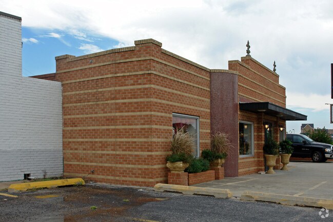
7909 N May Ave
Oklahoma City, OK
Nichols Hills Suburban Trs
179465000
NICHOLS HILLS SUBURBAN TRS 000 000 LOTS 18 19 & 20 OF BLK 101A
Storebuilding
Oklahoma
X
Oklahoma
40109C0165H
18
2023
0.16 AC
2024
North
108507
Oklahoma City
2,548 SF
DEMOGRAPHICS near 7909 N May Ave
1 Mile
3 Mile
5 Mile
2024 Total Population
7,445
73,114
223,735
2029 Population
7,608
74,811
229,605
Pop Growth 2024-2029
+ 2.19%
+ 2.32%
+ 2.62%
Average Age
43
40
38
2024 Total Households
3,600
33,517
100,441
HH Growth 2024-2029
+ 2.28%
+ 2.37%
+ 2.75%
Median Household Inc
$71,573
$59,249
$53,493
Avg Household Size
2.00
2.10
2.10
2024 Avg HH Vehicles
2.00
2.00
2.00
Median Home Value
$285,888
$193,122
$183,188
Median Year Built
1960
1966
1970
Nearby Places
Map Layers
Map Styles
 Street
 Aerial
- Restaurants
- Banks
- Shops
- Fitness
- Groceries
PUBLIC TRANSPORTATION
COMMUTER RAIL
DRIVE
WALK
Distance
16 min
8.5 mi
AIRPORT
Will Rogers World
DRIVE
WALK
Distance
Will Rogers World
21 min
13.4 mi
Nearby Properties
Address
Land Use
TOTAL SIZE
Lot Size
Zoning
Address
Land Use
TOTAL SIZE
Lot Size
Zoning
819,976 SF
21.87 AC
C-3
Address
Land Use
TOTAL SIZE
Lot Size
Zoning
467,216 SF
66.90 AC
C-3
Address
Land Use
TOTAL SIZE
Lot Size
Zoning
58,071 SF
4.15 AC
PUD
Address
Land Use
TOTAL SIZE
Lot Size
Zoning
312,308 SF
9.76 AC
C-3
Address
Land Use
TOTAL SIZE
Lot Size
Zoning
294,583 SF
20.14 AC
PUD
Address
Land Use
TOTAL SIZE
Lot Size
Zoning
430,092 SF
17.35 AC
R-4
Address
Land Use
TOTAL SIZE
Lot Size
Zoning
202,147 SF
44.36 AC
PUD
Address
Land Use
TOTAL SIZE
Lot Size
Zoning
485,764 SF
6.05 AC
C-3
Address
Land Use
TOTAL SIZE
Lot Size
Zoning
452,123 SF
5.64 AC
O-2
Address
Land Use
TOTAL SIZE
Lot Size
Zoning
10,922 SF
1.04 AC
SPUD
Address
Land Use
TOTAL SIZE
Lot Size
Zoning
258,381 SF
2.54 AC
PUD
Address
Land Use
TOTAL SIZE
Lot Size
Zoning
28,099 SF
1.21 AC
O-2
Address
Land Use
TOTAL SIZE
Lot Size
Zoning
254,126 SF
2.11 AC
SPUD
Address
Land Use
TOTAL SIZE
Lot Size
Zoning
49,950 SF
3.69 AC
R-1
Address
Land Use
TOTAL SIZE
Lot Size
Zoning
21,111 SF
2.57 AC
R-4
Address
Land Use
TOTAL SIZE
Lot Size
Zoning
347,288 SF
19 AC
C-3
Address
Land Use
TOTAL SIZE
Lot Size
Zoning
34,734 SF
9.07 AC
PUD
Address
Land Use
TOTAL SIZE
Lot Size
Zoning
203,712 SF
10.01 AC
R-4
Address
Land Use
TOTAL SIZE
Lot Size
Zoning
29,274 SF
0.93 AC
C-3
Address
Land Use
TOTAL SIZE
Lot Size
Zoning
244,699 SF
11.83 AC
C-3
Address
Land Use
TOTAL SIZE
Lot Size
Zoning
681,708 SF
20.54 AC
C-3
Address
Land Use
TOTAL SIZE
Lot Size
Zoning
436,316 SF
5.23 AC
I-1
Address
Land Use
TOTAL SIZE
Lot Size
Zoning
164,880 SF
8.95 AC
O-2
Address
Land Use
TOTAL SIZE
Lot Size
Zoning
60,238 SF
4.93 AC
PUD
Address
Land Use
TOTAL SIZE
Lot Size
Zoning
285,771 SF
8.64 AC
PUD
Address
Land Use
TOTAL SIZE
Lot Size
Zoning
1 SF
3.72 AC
C-3
Address
Land Use
TOTAL SIZE
Lot Size
Zoning
327,372 SF
14.79 AC
R-4
Address
Land Use
TOTAL SIZE
Lot Size
Zoning
167,057 SF
2.62 AC
PUD
Address
Land Use
TOTAL SIZE
Lot Size
Zoning
370,066 SF
6.83 AC
O-2
Address
Land Use
TOTAL SIZE
Lot Size
Zoning
14,720 SF
0.81 AC
C-3
The World's #1 Commercial Real Estate Marketplace
Connect with us
© 2026 CoStar Group
The information above has been obtained from sources believed reliable. While we do not doubt its accuracy we have not verified it and make no guarantee, warranty or representation about it. It is your responsibility to independently confirm its accuracy and completeness. Any projections, opinions, assumptions, or estimates used are for example only and do not represent the current or future performance of the property. The value of this transaction to you depends on tax and other factors which should be evaluated by your tax, financial, and legal advisors. You and your advisors should conduct a careful, independent investigation of the property to determine to your satisfaction the suitability of the property for your needs.