Property Record
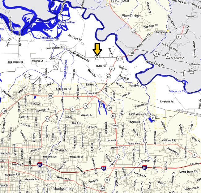
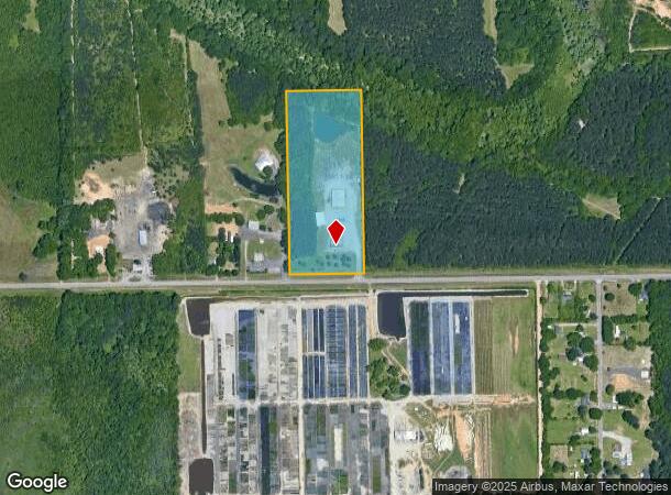
791 Anderson Rd, Montgomery, AL 36110
NEARBY LISTINGS FOR SALE OR LEASE
Property Detail
791 Anderson Rd
Montgomery, AL
Summit 1
04-06-13-2-000-002.001
0406132000002001
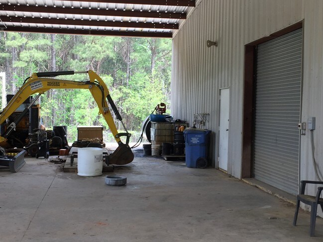
Officebuilding
Montgomery
AE
Alabama
01101C0103J
a
2025
11.36 AC
2025
North Montgomery
005101
Montgomery
2,540 SF
DEMOGRAPHICS near 791 Anderson Rd
1 Mile
3 Mile
5 Mile
2024 Total Population
203
2,883
32,620
2029 Population
203
2,923
31,993
Pop Growth 2024-2029
0.00%
+ 1.39%
(1.92%)
Average Age
45
45
39
2024 Total Households
68
1,070
12,898
HH Growth 2024-2029
0.00%
+ 1.50%
(2.02%)
Median Household Inc
$49,499
$59,140
$53,683
Avg Household Size
2.00
2.30
2.40
2024 Avg HH Vehicles
2.00
2.00
2.00
Median Home Value
$76,470
$214,897
$131,428
Median Year Built
1972
1985
1976
Nearby Places
Map Layers
Map Styles
 Street
 Aerial
- Restaurants
- Banks
- Shops
- Fitness
- Groceries
PUBLIC TRANSPORTATION
AIRPORT
Montgomery Regional (Dannelly Field)
DRIVE
WALK
Distance
Montgomery Regional (Dannelly Field)
25 min
19.4 mi
Freight Ports
Port of Panama City
DRIVE
WALK
Distance
Port of Panama City
244 min
193.2 mi
SALE & LEASE HISTORY
LISTING DATE
SALE/LEASE

May 12, 2017
For Sale
Nearby Properties
Address
Land Use
TOTAL SIZE
Lot Size
Zoning
Address
Land Use
TOTAL SIZE
Lot Size
Zoning
591,904 SF
26 AC
M-1
Address
Land Use
TOTAL SIZE
Lot Size
Zoning
48,672 SF
31 AC
Address
Land Use
TOTAL SIZE
Lot Size
Zoning
38,998 SF
10.43 AC
AGR-2
Address
Land Use
TOTAL SIZE
Lot Size
Zoning
76,213 SF
15 AC
Address
Land Use
TOTAL SIZE
Lot Size
Zoning
52,302 SF
10.41 AC
B-2
Address
Land Use
TOTAL SIZE
Lot Size
Zoning
125,646 SF
9.57 AC
M-3
Address
Land Use
TOTAL SIZE
Lot Size
Zoning
11,297 SF
4.86 AC
Address
Land Use
TOTAL SIZE
Lot Size
Zoning
3,059 SF
115.30 AC
INST
Address
Land Use
TOTAL SIZE
Lot Size
Zoning
27,436 SF
19 AC
AGR-2
Address
Land Use
TOTAL SIZE
Lot Size
Zoning
32,600 SF
1.80 AC
B-2
Address
Land Use
TOTAL SIZE
Lot Size
Zoning
29,266 SF
15 AC
INST
Address
Land Use
TOTAL SIZE
Lot Size
Zoning
4,752 SF
16.49 AC
Address
Land Use
TOTAL SIZE
Lot Size
Zoning
7,990 SF
0.90 AC
Address
Land Use
TOTAL SIZE
Lot Size
Zoning
21,587 SF
16.91 AC
M-3
Address
Land Use
TOTAL SIZE
Lot Size
Zoning
22,491 SF
9.92 AC
B-5
Address
Land Use
TOTAL SIZE
Lot Size
Zoning
26,642 SF
5.10 AC
B-2
Address
Land Use
TOTAL SIZE
Lot Size
Zoning
30,646 SF
1.70 AC
B-3
Address
Land Use
TOTAL SIZE
Lot Size
Zoning
22,440 SF
5.89 AC
Address
Land Use
TOTAL SIZE
Lot Size
Zoning
10,315 SF
1.70 AC
B-2
Address
Land Use
TOTAL SIZE
Lot Size
Zoning
10,772 SF
3.10 AC
Address
Land Use
TOTAL SIZE
Lot Size
Zoning
629.90 AC
Address
Land Use
TOTAL SIZE
Lot Size
Zoning
10,120 SF
2.25 AC
Address
Land Use
TOTAL SIZE
Lot Size
Zoning
24,368 SF
5.66 AC
B-2
Address
Land Use
TOTAL SIZE
Lot Size
Zoning
19,685 SF
1.38 AC
M-1
Address
Land Use
TOTAL SIZE
Lot Size
Zoning
54,559 SF
4.30 AC
M-1
Address
Land Use
TOTAL SIZE
Lot Size
Zoning
12,064 SF
2.79 AC
Address
Land Use
TOTAL SIZE
Lot Size
Zoning
576 SF
5.91 AC
M-3
Address
Land Use
TOTAL SIZE
Lot Size
Zoning
21,206 SF
2.25 AC
B-3
Address
Land Use
TOTAL SIZE
Lot Size
Zoning
960 SF
327.50 AC
Address
Land Use
TOTAL SIZE
Lot Size
Zoning
494 SF
20 AC
AGR-2
The World's #1 Commercial Real Estate Marketplace
Connect with us
© 2026 CoStar Group
The information above has been obtained from sources believed reliable. While we do not doubt its accuracy we have not verified it and make no guarantee, warranty or representation about it. It is your responsibility to independently confirm its accuracy and completeness. Any projections, opinions, assumptions, or estimates used are for example only and do not represent the current or future performance of the property. The value of this transaction to you depends on tax and other factors which should be evaluated by your tax, financial, and legal advisors. You and your advisors should conduct a careful, independent investigation of the property to determine to your satisfaction the suitability of the property for your needs.