Property Record
7910 S 3500 E, Salt Lake City, UT 84121


NEARBY LISTINGS FOR SALE OR LEASE
Property Detail
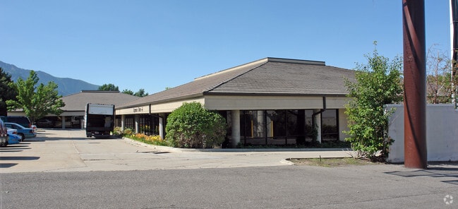
7910 S 3500 E
22-35-226-028-0000
BEG S 0^0825 W 1119.99 FT & N 38^5244 W 46.06 FT FR NE COR OF SEC 35, T 2S, R 1E, S L M; N 38^5244 W 594.37 FT; N89^5620 E 374.2 FT TO W LINE OF 3500 EAST ST; S 0^0825 W463.1 FT TO BEG. 1.99 AC 5625-744, 5569-549, 551, 553, 555, 4821-0105 4714-1190 T
Officebuilding
Salt Lake
X
Utah
49035C0456G
m
2024
1.99 AC
2025
Cottonwood
111304
Salt Lake City
22,752 SF
Salt Lake City, UT
DEMOGRAPHICS near 7910 S 3500 E
1 Mile
3 Mile
5 Mile
2024 Total Population
9,210
54,756
165,849
2029 Population
9,371
55,111
166,657
Pop Growth 2024-2029
+ 1.75%
+ 0.65%
+ 0.49%
Average Age
43
41
40
2024 Total Households
3,283
19,310
60,636
HH Growth 2024-2029
+ 1.58%
+ 0.55%
+ 0.37%
Median Household Inc
$125,283
$113,984
$95,557
Avg Household Size
2.80
2.80
2.70
2024 Avg HH Vehicles
2.00
2.00
2.00
Median Home Value
$670,934
$649,162
$561,314
Median Year Built
1976
1977
1977
Nearby Places
Map Layers
Map Styles
 Street
 Aerial
- Restaurants
- Banks
- Shops
- Fitness
- Groceries
PUBLIC TRANSPORTATION
COMMUTER RAIL
DRIVE
WALK
Distance
20 min
8.9 mi
AIRPORT
Salt Lake City International
DRIVE
WALK
Distance
Salt Lake City International
28 min
21.9 mi
Provo Municipal
DRIVE
WALK
Distance
Provo Municipal
54 min
38.8 mi
SALE & LEASE HISTORY
LISTING DATE
SALE/LEASE

Sep 25, 2016
For Lease
Oct 17, 2022
For Lease
Apr 21, 2020
For Lease
Nearby Properties
Address
Land Use
TOTAL SIZE
Lot Size
Zoning
Address
Land Use
TOTAL SIZE
Lot Size
Zoning
257,906 SF
36.42 AC
1110
Address
Land Use
TOTAL SIZE
Lot Size
Zoning
186,717 SF
21.58 AC
RM
Address
Land Use
TOTAL SIZE
Lot Size
Zoning
133,669 SF
19.81 AC
R-M
Address
Land Use
TOTAL SIZE
Lot Size
Zoning
225,849 SF
16.36 AC
RM-ZC
Address
Land Use
TOTAL SIZE
Lot Size
Zoning
241,418 SF
8.84 AC
ORD
Address
Land Use
TOTAL SIZE
Lot Size
Zoning
106,016 SF
32.73 AC
1108
Address
Land Use
TOTAL SIZE
Lot Size
Zoning
317,495 SF
2.75 AC
O-R-D
Address
Land Use
TOTAL SIZE
Lot Size
Zoning
3,867 SF
2.20 AC
1144
Address
Land Use
TOTAL SIZE
Lot Size
Zoning
150,570 SF
12.76 AC
ORD
Address
Land Use
TOTAL SIZE
Lot Size
Zoning
49,722 SF
7.59 AC
RM-ZC
Address
Land Use
TOTAL SIZE
Lot Size
Zoning
176,372 SF
3.68 AC
ORD
Address
Land Use
TOTAL SIZE
Lot Size
Zoning
152,184 SF
4.40 AC
ORD
Address
Land Use
TOTAL SIZE
Lot Size
Zoning
74,394 SF
9.27 AC
RM
Address
Land Use
TOTAL SIZE
Lot Size
Zoning
78,330 SF
3 AC
O-R-D
Address
Land Use
TOTAL SIZE
Lot Size
Zoning
105,015 SF
3.91 AC
O R D
Address
Land Use
TOTAL SIZE
Lot Size
Zoning
171,805 SF
3.95 AC
ORD
Address
Land Use
TOTAL SIZE
Lot Size
Zoning
206,860 SF
3.57 AC
O-R-D
Address
Land Use
TOTAL SIZE
Lot Size
Zoning
94,729 SF
9.18 AC
CN
Address
Land Use
TOTAL SIZE
Lot Size
Zoning
52,182 SF
5 AC
1108
Address
Land Use
TOTAL SIZE
Lot Size
Zoning
188,750 SF
1.01 AC
O-R-D
Address
Land Use
TOTAL SIZE
Lot Size
Zoning
83,690 SF
3.67 AC
ORD
Address
Land Use
TOTAL SIZE
Lot Size
Zoning
177,585 SF
4.65 AC
O-R-D
Address
Land Use
TOTAL SIZE
Lot Size
Zoning
126,796 SF
19.14 AC
1110
Address
Land Use
TOTAL SIZE
Lot Size
Zoning
78,833 SF
5.19 AC
O-R-D
Address
Land Use
TOTAL SIZE
Lot Size
Zoning
52,430 SF
9.92 AC
1108
Address
Land Use
TOTAL SIZE
Lot Size
Zoning
185,522 SF
17.26 AC
C2/ZC
Address
Land Use
TOTAL SIZE
Lot Size
Zoning
99,537 SF
10 AC
1108
Address
Land Use
TOTAL SIZE
Lot Size
Zoning
10.83 AC
RM
Address
Land Use
TOTAL SIZE
Lot Size
Zoning
59,909 SF
9.91 AC
PF
Address
Land Use
TOTAL SIZE
Lot Size
Zoning
88,146 SF
2.73 AC
RM
The World's #1 Commercial Real Estate Marketplace
Connect with us
© 2026 CoStar Group
The information above has been obtained from sources believed reliable. While we do not doubt its accuracy we have not verified it and make no guarantee, warranty or representation about it. It is your responsibility to independently confirm its accuracy and completeness. Any projections, opinions, assumptions, or estimates used are for example only and do not represent the current or future performance of the property. The value of this transaction to you depends on tax and other factors which should be evaluated by your tax, financial, and legal advisors. You and your advisors should conduct a careful, independent investigation of the property to determine to your satisfaction the suitability of the property for your needs.