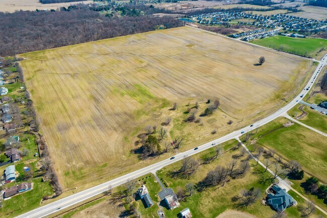
Property Record
Hazelton-Et Rd, Pataskala, OH 43062

NEARBY LISTINGS FOR SALE OR LEASE
Property Detail
Hazelton-Et Rd
Columbus
Se Quarter
Columbus, OH
Licking
064-152964-00.000
Ohio
Residentialnec
42.61 AC
X
Licking County
39089C0431J
DEMOGRAPHICS near Hazelton-Et Rd
1 Mile
3 Mile
5 Mile
2024 Total Population
2,600
18,701
45,210
2029 Population
2,723
19,642
47,643
Pop Growth 2024-2029
+ 4.73%
+ 5.03%
+ 5.38%
Average Age
40
39
40
2024 Total Households
990
6,837
15,991
HH Growth 2024-2029
+ 4.65%
+ 5.00%
+ 5.32%
Median Household Inc
$80,812
$88,806
$98,016
Avg Household Size
2.60
2.70
2.80
2024 Avg HH Vehicles
2.00
2.00
2.00
Median Home Value
$230,219
$236,978
$254,346
Median Year Built
1995
1995
1994
Nearby Places
Map Layers
Map Styles
 Street
 Aerial
- Restaurants
- Banks
- Shops
- Fitness
- Groceries
PUBLIC TRANSPORTATION
AIRPORT
John Glenn Columbus International
DRIVE
WALK
Distance
John Glenn Columbus International
27 min
16.4 mi
Rickenbacker International
DRIVE
WALK
Distance
Rickenbacker International
29 min
21.5 mi
Freight Ports
Port of Toledo
DRIVE
WALK
Distance
Port of Toledo
194 min
155.8 mi
SALE & LEASE HISTORY
LISTING DATE
SALE/LEASE

Mar 31, 2023
For Sale
Nearby Properties
Address
Land Use
TOTAL SIZE
Lot Size
Zoning
Address
Land Use
TOTAL SIZE
Lot Size
Zoning
2,556 SF
93.78 AC
Address
Land Use
TOTAL SIZE
Lot Size
Zoning
1,230,350 SF
78.26 AC
Address
Land Use
TOTAL SIZE
Lot Size
Zoning
1,191,656 SF
56.97 AC
Address
Land Use
TOTAL SIZE
Lot Size
Zoning
1,078,218 SF
63.12 AC
Address
Land Use
TOTAL SIZE
Lot Size
Zoning
1,091,997 SF
49.37 AC
Address
Land Use
TOTAL SIZE
Lot Size
Zoning
1,014,005 SF
101.26 AC
Address
Land Use
TOTAL SIZE
Lot Size
Zoning
855,000 SF
96 AC
Address
Land Use
TOTAL SIZE
Lot Size
Zoning
588,910 SF
52.23 AC
Address
Land Use
TOTAL SIZE
Lot Size
Zoning
437,569 SF
33 AC
Address
Land Use
TOTAL SIZE
Lot Size
Zoning
700,491 SF
92.80 AC
Address
Land Use
TOTAL SIZE
Lot Size
Zoning
699,016 SF
43.57 AC
Address
Land Use
TOTAL SIZE
Lot Size
Zoning
756,333 SF
44.37 AC
Address
Land Use
TOTAL SIZE
Lot Size
Zoning
179.65 AC
Address
Land Use
TOTAL SIZE
Lot Size
Zoning
524,490 SF
25.40 AC
Address
Land Use
TOTAL SIZE
Lot Size
Zoning
524,494 SF
25.67 AC
Address
Land Use
TOTAL SIZE
Lot Size
Zoning
410,332 SF
21.81 AC
Address
Land Use
TOTAL SIZE
Lot Size
Zoning
512,267 SF
22.36 AC
Address
Land Use
TOTAL SIZE
Lot Size
Zoning
73,671 SF
80.57 AC
Address
Land Use
TOTAL SIZE
Lot Size
Zoning
47.69 AC
Address
Land Use
TOTAL SIZE
Lot Size
Zoning
303,408 SF
29.74 AC
Address
Land Use
TOTAL SIZE
Lot Size
Zoning
252,322 SF
13.77 AC
Address
Land Use
TOTAL SIZE
Lot Size
Zoning
2,436 SF
16.52 AC
Address
Land Use
TOTAL SIZE
Lot Size
Zoning
9,408 SF
12.53 AC
Address
Land Use
TOTAL SIZE
Lot Size
Zoning
78,136 SF
7.46 AC
Address
Land Use
TOTAL SIZE
Lot Size
Zoning
53,202 SF
38.44 AC
Address
Land Use
TOTAL SIZE
Lot Size
Zoning
1,862 SF
105.97 AC
Address
Land Use
TOTAL SIZE
Lot Size
Zoning
14,790 SF
8.18 AC
Address
Land Use
TOTAL SIZE
Lot Size
Zoning
38,787 SF
22.61 AC
Address
Land Use
TOTAL SIZE
Lot Size
Zoning
9,600 SF
6.36 AC
Address
Land Use
TOTAL SIZE
Lot Size
Zoning
54,972 SF
15 AC
The World's #1 Commercial Real Estate Marketplace
Connect with us
© 2026 CoStar Group
The information above has been obtained from sources believed reliable. While we do not doubt its accuracy we have not verified it and make no guarantee, warranty or representation about it. It is your responsibility to independently confirm its accuracy and completeness. Any projections, opinions, assumptions, or estimates used are for example only and do not represent the current or future performance of the property. The value of this transaction to you depends on tax and other factors which should be evaluated by your tax, financial, and legal advisors. You and your advisors should conduct a careful, independent investigation of the property to determine to your satisfaction the suitability of the property for your needs.