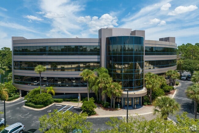
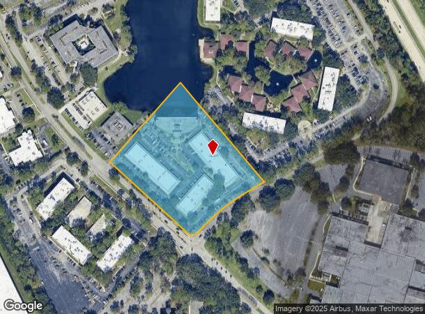
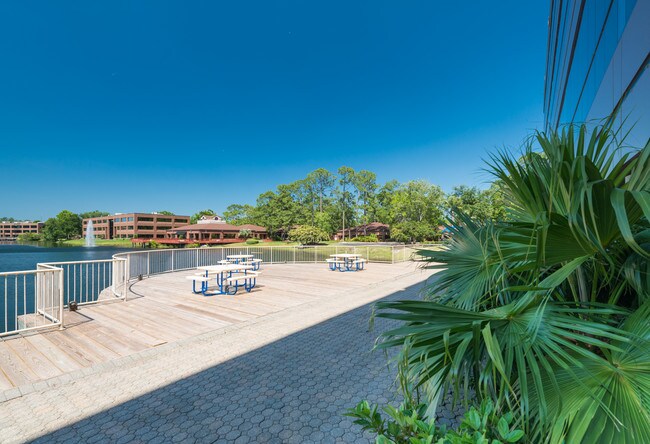
Property Record
7915 Baymeadows Way, Jacksonville, FL 32256
Current Lease Availabilities
NEARBY LISTINGS FOR SALE OR LEASE
Property Detail
7915 Baymeadows Way
Jacksonville, FL
Section Land
152612-1120
56-3S-27E 6.27 F RICHARD GRANT PT RECD O/RS 19718-1543, -1548
Officebuilding
Duval
2024
Florida
2025
6.27 AC
016605
Butler/Baymeadows
108,125 SF
Jacksonville (Florida)
DEMOGRAPHICS near 7915 Baymeadows Way
1 Mile
3 Mile
5 Mile
2024 Total Population
3,381
82,780
192,096
2029 Population
3,638
87,293
201,694
Pop Growth 2024-2029
+ 7.60%
+ 5.45%
+ 5.00%
Average Age
37
38
39
2024 Total Households
1,593
37,276
82,970
HH Growth 2024-2029
+ 7.85%
+ 5.64%
+ 5.15%
Median Household Inc
$56,271
$61,242
$65,508
Avg Household Size
2.10
2.10
2.20
2024 Avg HH Vehicles
1.00
1.00
2.00
Median Home Value
$212,605
$273,509
$262,597
Median Year Built
1987
1989
1989
Nearby Places
- Restaurants
- Banks
- Shops
- Fitness
- Groceries
PUBLIC TRANSPORTATION
AIRPORT
Jacksonville International
DRIVE
WALK
Distance
Jacksonville International
38 min
25.3 mi
Nearby Properties
Address
Land Use
TOTAL SIZE
Lot Size
Zoning
Address
Land Use
TOTAL SIZE
Lot Size
Zoning
1,037,304 SF
103.91 AC
PUD
Address
Land Use
TOTAL SIZE
Lot Size
Zoning
1,159,855 SF
89.44 AC
RMD-D
Address
Land Use
TOTAL SIZE
Lot Size
Zoning
1,013,318 SF
131.30 AC
PUD
Address
Land Use
TOTAL SIZE
Lot Size
Zoning
209,436 SF
14.38 AC
PUD
Address
Land Use
TOTAL SIZE
Lot Size
Zoning
251,691 SF
17.51 AC
PUD
Address
Land Use
TOTAL SIZE
Lot Size
Zoning
478,012 SF
29.87 AC
PUD
Address
Land Use
TOTAL SIZE
Lot Size
Zoning
419,299 SF
40.24 AC
PUD
Address
Land Use
TOTAL SIZE
Lot Size
Zoning
371,466 SF
49.16 AC
PBF-2
Address
Land Use
TOTAL SIZE
Lot Size
Zoning
723,629 SF
18.30 AC
PUD
Address
Land Use
TOTAL SIZE
Lot Size
Zoning
293,072 SF
16.52 AC
PUD
Address
Land Use
TOTAL SIZE
Lot Size
Zoning
223,939 SF
13.28 AC
PUD
Address
Land Use
TOTAL SIZE
Lot Size
Zoning
426,575 SF
32.98 AC
PUD
Address
Land Use
TOTAL SIZE
Lot Size
Zoning
276,424 SF
5.06 AC
PUD
Address
Land Use
TOTAL SIZE
Lot Size
Zoning
951,179 SF
56.79 AC
PUD
Address
Land Use
TOTAL SIZE
Lot Size
Zoning
273,196 SF
16.57 AC
PUD
Address
Land Use
TOTAL SIZE
Lot Size
Zoning
446,326 SF
23.68 AC
RMD-D
Address
Land Use
TOTAL SIZE
Lot Size
Zoning
306,416 SF
12.27 AC
PUD
Address
Land Use
TOTAL SIZE
Lot Size
Zoning
341,849 SF
15 AC
PUD
Address
Land Use
TOTAL SIZE
Lot Size
Zoning
217,493 SF
14.72 AC
PUD
Address
Land Use
TOTAL SIZE
Lot Size
Zoning
464,189 SF
44.85 AC
RMD-D
Address
Land Use
TOTAL SIZE
Lot Size
Zoning
383,228 SF
40.69 AC
PUD
Address
Land Use
TOTAL SIZE
Lot Size
Zoning
316,705 SF
15.44 AC
PUD
Address
Land Use
TOTAL SIZE
Lot Size
Zoning
380,690 SF
6.68 AC
PUD
Address
Land Use
TOTAL SIZE
Lot Size
Zoning
358,537 SF
29.16 AC
RMD-C
Address
Land Use
TOTAL SIZE
Lot Size
Zoning
281,793 SF
17.43 AC
PUD
Address
Land Use
TOTAL SIZE
Lot Size
Zoning
367,197 SF
42.36 AC
RMD-B
Address
Land Use
TOTAL SIZE
Lot Size
Zoning
193,941 SF
7.35 AC
PUD
Address
Land Use
TOTAL SIZE
Lot Size
Zoning
282,193 SF
18.68 AC
RMD-D
Address
Land Use
TOTAL SIZE
Lot Size
Zoning
325,620 SF
17.76 AC
PUD
Address
Land Use
TOTAL SIZE
Lot Size
Zoning
273,616 SF
34.49 AC
RMD-B
The World's #1 Commercial Real Estate Marketplace
Connect with us
© 2025 CoStar Group
The information above has been obtained from sources believed reliable. While we do not doubt its accuracy we have not verified it and make no guarantee, warranty or representation about it. It is your responsibility to independently confirm its accuracy and completeness. Any projections, opinions, assumptions, or estimates used are for example only and do not represent the current or future performance of the property. The value of this transaction to you depends on tax and other factors which should be evaluated by your tax, financial, and legal advisors. You and your advisors should conduct a careful, independent investigation of the property to determine to your satisfaction the suitability of the property for your needs.