Property Record
7917 Walerga Rd, Antelope, CA 95843


Save to a Folder
{{folder.Name}}
{{folder.ListingIds.length}} Properties
{{folder.ListingIds.length}} Property
Create a New Folder
Property Detail
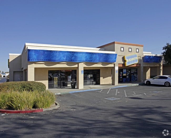
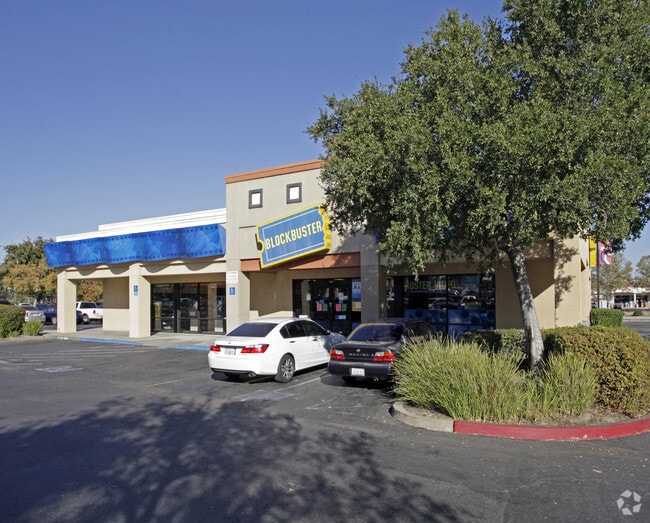
7917 Walerga Rd
203-1380-004
PARCEL MAP, LOT 4
Regionalshoppingcenterormallwithanchorstore
Sacramento
SC
California
B and X Area of moderate flood hazard, usually the area between the limits of the 100-year and 500-year floods.
4
2024
0.57 AC
2025
Rio Linda/N Highlands
007427
Sacramento
4,130 SF
Sacramento-Roseville-Folsom, CA
NEARBY LISTINGS FOR SALE OR LEASE
DEMOGRAPHICS near 7917 Walerga Rd
1 mile
3 mile
5 mile
2025 Total Population
29,143
125,229
296,099
2030 Population
29,446
127,118
302,134
Pop Growth 2025-2030
+ 1.04%
+ 1.51%
+ 2.04%
Average Age
37
38
39
2025 Total Households
9,280
40,357
105,117
HH Growth 2025-2030
+ 1.00%
+ 1.52%
+ 2.08%
Median Household Inc
$87,008
$88,093
$86,189
Avg Household Size
3.10
3.00
2.70
2025 Avg HH Vehicles
2.00
2.00
2.00
Median Home Value
$472,432
$449,911
$484,528
Median Year Built
1991
1983
1982
Nearby Places
Map Layers
Map Styles
 Street
 Aerial
Layers
 Traffic
 Biking
Places
Listings with unknown addresses are not visible on the map
- Restaurants
- Banks
- Shops
- Fitness
- Groceries
PUBLIC TRANSPORTATION
COMMUTER RAIL
Drive
Walk
Distance
12 min
6.2 mi
AIRPORT
Sacramento International
Drive
Walk
Distance
Sacramento International
28 min
16.7 mi
Nearby Properties
Address
Land Use
TOTAL SIZE
Lot Size
Zoning
Address
Land Use
TOTAL SIZE
Lot Size
Zoning
430,406 SF
24.45 AC
RD-20
Address
Land Use
TOTAL SIZE
Lot Size
Zoning
345,370 SF
12.80 AC
Address
Land Use
TOTAL SIZE
Lot Size
Zoning
173,174 SF
8.89 AC
RD-30
Address
Land Use
TOTAL SIZE
Lot Size
Zoning
180,595 SF
10.74 AC
RD-30
Address
Land Use
TOTAL SIZE
Lot Size
Zoning
183,000 SF
12.49 AC
RD-20
Address
Land Use
TOTAL SIZE
Lot Size
Zoning
14.88 AC
RD-20
Address
Land Use
TOTAL SIZE
Lot Size
Zoning
58.14 AC
RD-2
Address
Land Use
TOTAL SIZE
Lot Size
Zoning
217,550 SF
21.31 AC
SPA
Address
Land Use
TOTAL SIZE
Lot Size
Zoning
217,380 SF
10 AC
SPA
Address
Land Use
TOTAL SIZE
Lot Size
Zoning
200,104 SF
13.85 AC
RD-20
Address
Land Use
TOTAL SIZE
Lot Size
Zoning
98,508 SF
5.33 AC
RD20
Address
Land Use
TOTAL SIZE
Lot Size
Zoning
146,283 SF
8.73 AC
RD-20
Address
Land Use
TOTAL SIZE
Lot Size
Zoning
244,048 SF
13.38 AC
RD-30
Address
Land Use
TOTAL SIZE
Lot Size
Zoning
160,497 SF
6.85 AC
RD-30
Address
Land Use
TOTAL SIZE
Lot Size
Zoning
0.16 AC
RD-5
Address
Land Use
TOTAL SIZE
Lot Size
Zoning
280,864 SF
14.94 AC
RD-20
Address
Land Use
TOTAL SIZE
Lot Size
Zoning
288,524 SF
11.64 AC
M-1
Address
Land Use
TOTAL SIZE
Lot Size
Zoning
141,274 SF
7.06 AC
RD-20
Address
Land Use
TOTAL SIZE
Lot Size
Zoning
185,342 SF
11.13 AC
RD-20
Address
Land Use
TOTAL SIZE
Lot Size
Zoning
0.13 AC
RD-7
Address
Land Use
TOTAL SIZE
Lot Size
Zoning
29.68 AC
Address
Land Use
TOTAL SIZE
Lot Size
Zoning
81,124 SF
4.81 AC
RD-20
Address
Land Use
TOTAL SIZE
Lot Size
Zoning
124,819 SF
13.10 AC
SC
Address
Land Use
TOTAL SIZE
Lot Size
Zoning
250,000 SF
13.90 AC
M-1
Address
Land Use
TOTAL SIZE
Lot Size
Zoning
194,580 SF
9.66 AC
RD-30
Address
Land Use
TOTAL SIZE
Lot Size
Zoning
134,214 SF
11.21 AC
SPA
Address
Land Use
TOTAL SIZE
Lot Size
Zoning
106,370 SF
5.91 AC
RD-30
Address
Land Use
TOTAL SIZE
Lot Size
Zoning
Address
Land Use
TOTAL SIZE
Lot Size
Zoning
47.32 AC
SPA
Address
Land Use
TOTAL SIZE
Lot Size
Zoning
91,526 SF
7.45 AC
SC
The World's #1 Commercial Real Estate Marketplace
Connect with us
© 2026 CoStar Group
The information above has been obtained from sources believed reliable. While we do not doubt its accuracy we have not verified it and make no guarantee, warranty or representation about it. It is your responsibility to independently confirm its accuracy and completeness. Any projections, opinions, assumptions, or estimates used are for example only and do not represent the current or future performance of the property. The value of this transaction to you depends on tax and other factors which should be evaluated by your tax, financial, and legal advisors. You and your advisors should conduct a careful, independent investigation of the property to determine to your satisfaction the suitability of the property for your needs.