Property Record
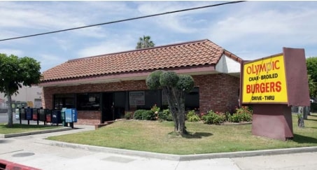
7919 Paramount Blvd, Pico Rivera, CA 90660

Property Detail
7919 Paramount Blvd
6368-003-019
RO SANTA GERTRUDES FOR DESC SEE ASSESSORS MAPS POR OF SD RO
Warehouse
Los Angeles
PRIG-P*
California
2024
3.03 AC
2025
Southeast Los Angeles
502500
Los Angeles
62,103 SF
Los Angeles-Long Beach-Glendale, CA
NEARBY LISTINGS FOR SALE OR LEASE
-
-
-
-
-
-
-
-
-
-
-
-
-
-
-
-
-
-
-
-
No Photo
-
-
View all Pico Rivera listings for sale on LoopNet.com
DEMOGRAPHICS near 7919 Paramount Blvd
1 mile
3 mile
5 mile
2025 Total Population
18,842
201,506
602,328
2030 Population
18,632
198,275
592,333
Pop Growth 2025-2030
(1.11%)
(1.60%)
(1.66%)
Average Age
39
39
39
2025 Total Households
5,398
56,723
171,594
HH Growth 2025-2030
(1.32%)
(1.85%)
(1.89%)
Median Household Inc
$86,469
$83,397
$79,968
Avg Household Size
3.40
3.40
3.40
2025 Avg HH Vehicles
2.00
2.00
2.00
Median Home Value
$721,899
$732,903
$723,851
Median Year Built
1957
1956
1956
Nearby Places
Map Layers
Map Styles
 Street
 Aerial
Layers
 Traffic
 Biking
Places
Listings with unknown addresses are not visible on the map
- Restaurants
- Banks
- Shops
- Fitness
- Groceries
PUBLIC TRANSPORTATION
COMMUTER RAIL
Commerce (91 Line - Southern California Regional Rail Authority (Metrolink), Orange County Line - Southern California Regional Rail Authority (Metrolink))
Drive
Walk
Distance
Commerce (91 Line - Southern California Regional Rail Authority (Metrolink), Orange County Line - Southern California Regional Rail Authority (Metrolink))
6 min
2.5 mi
Montebello/Commerce (Riverside Line - Southern California Regional Rail Authority (Metrolink))
Drive
Walk
Distance
Montebello/Commerce (Riverside Line - Southern California Regional Rail Authority (Metrolink))
8 min
3.8 mi
AIRPORT
Long Beach (Daugherty Field)
Drive
Walk
Distance
Long Beach (Daugherty Field)
24 min
15.7 mi
Los Angeles International
Drive
Walk
Distance
Los Angeles International
32 min
21.1 mi
Bob Hope
Drive
Walk
Distance
Bob Hope
34 min
25.8 mi
Freight Ports
Port of Long Beach
Drive
Walk
Distance
Port of Long Beach
29 min
19.0 mi
Nearby Properties
Address
Land Use
TOTAL SIZE
Lot Size
Zoning
Address
Land Use
TOTAL SIZE
Lot Size
Zoning
397,549 SF
15.73 AC
CMM2*
Address
Land Use
TOTAL SIZE
Lot Size
Zoning
368,164 SF
7.82 AC
CMM2YY
Address
Land Use
TOTAL SIZE
Lot Size
Zoning
609,466 SF
19.83 AC
CMM2*
Address
Land Use
TOTAL SIZE
Lot Size
Zoning
332,504 SF
7.76 AC
DOHM
Address
Land Use
TOTAL SIZE
Lot Size
Zoning
244,768 SF
10.59 AC
PR1G
Address
Land Use
TOTAL SIZE
Lot Size
Zoning
875,558 SF
24.08 AC
CMM2*
Address
Land Use
TOTAL SIZE
Lot Size
Zoning
170,222 SF
7.50 AC
PR1G
Address
Land Use
TOTAL SIZE
Lot Size
Zoning
117,004 SF
6.27 AC
CMM2*
Address
Land Use
TOTAL SIZE
Lot Size
Zoning
173,100 SF
7.83 AC
PRIG*
Address
Land Use
TOTAL SIZE
Lot Size
Zoning
168,548 SF
7.53 AC
CMM2*
Address
Land Use
TOTAL SIZE
Lot Size
Zoning
188,940 SF
9 AC
PR1G
Address
Land Use
TOTAL SIZE
Lot Size
Zoning
513,222 SF
13.35 AC
PR1G
Address
Land Use
TOTAL SIZE
Lot Size
Zoning
183,000 SF
7.76 AC
SSM2*
Address
Land Use
TOTAL SIZE
Lot Size
Zoning
382,648 SF
14.73 AC
CMM2*
Address
Land Use
TOTAL SIZE
Lot Size
Zoning
657,978 SF
31.68 AC
SSM2*
Address
Land Use
TOTAL SIZE
Lot Size
Zoning
1,094,138 SF
23.73 AC
CMM2YY
Address
Land Use
TOTAL SIZE
Lot Size
Zoning
118,026 SF
5.73 AC
CMM2*
Address
Land Use
TOTAL SIZE
Lot Size
Zoning
244,390 SF
12.99 AC
CMM2
Address
Land Use
TOTAL SIZE
Lot Size
Zoning
826,068 SF
21.11 AC
Address
Land Use
TOTAL SIZE
Lot Size
Zoning
289,422 SF
12.43 AC
CMM2*
Address
Land Use
TOTAL SIZE
Lot Size
Zoning
102,761 SF
4.47 AC
CMM2YY
Address
Land Use
TOTAL SIZE
Lot Size
Zoning
506,144 SF
19.97 AC
CMM2*
Address
Land Use
TOTAL SIZE
Lot Size
Zoning
331,322 SF
13.69 AC
MNM2*
Address
Land Use
TOTAL SIZE
Lot Size
Zoning
312,052 SF
6.78 AC
SSM2
Address
Land Use
TOTAL SIZE
Lot Size
Zoning
122,184 SF
4.03 AC
DOC2*
Address
Land Use
TOTAL SIZE
Lot Size
Zoning
244,489 SF
6.73 AC
CMM2*
Address
Land Use
TOTAL SIZE
Lot Size
Zoning
313,965 SF
8.22 AC
PRCG*
Address
Land Use
TOTAL SIZE
Lot Size
Zoning
168,514 SF
8.41 AC
CMM2*
Address
Land Use
TOTAL SIZE
Lot Size
Zoning
221,850 SF
17.91 AC
PR1G
Address
Land Use
TOTAL SIZE
Lot Size
Zoning
141,377 SF
6.93 AC
PRIG-P*
The World's #1 Commercial Real Estate Marketplace
Connect with us
© 2026 CoStar Group
The information above has been obtained from sources believed reliable. While we do not doubt its accuracy we have not verified it and make no guarantee, warranty or representation about it. It is your responsibility to independently confirm its accuracy and completeness. Any projections, opinions, assumptions, or estimates used are for example only and do not represent the current or future performance of the property. The value of this transaction to you depends on tax and other factors which should be evaluated by your tax, financial, and legal advisors. You and your advisors should conduct a careful, independent investigation of the property to determine to your satisfaction the suitability of the property for your needs.