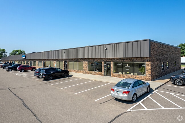
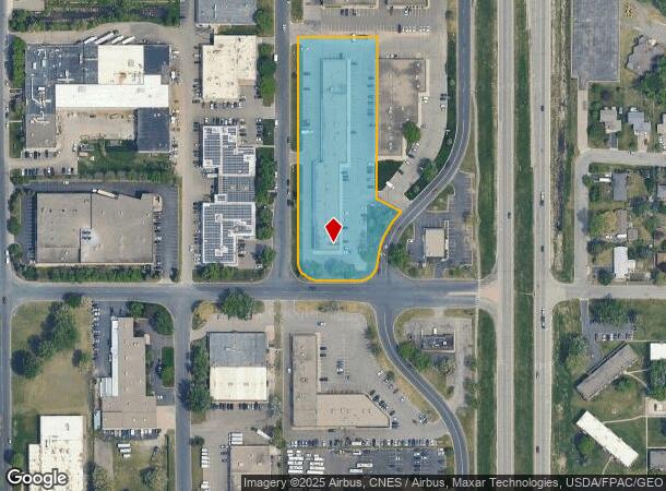
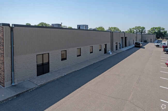
Property Record
7920 University Ave Ne, Minneapolis, MN 55432
Current Lease Availabilities
NEARBY LISTINGS FOR SALE OR LEASE
Property Detail
7920 University Ave Ne
Minneapolis-St. Paul-Bloomington, MN-WI
University Industrial Park
02-30-24-32-0028
LOTS 4, 5 & 6 BLK 3 UNIVERSITY INDUSTRIAL PARK SUBJ TO EASE OF REC
Commercialnec
Anoka
X
Minnesota
27053C0207F
4-6
2025
4.68 AC
2025
North Central
051101
Minneapolis/St Paul
28,800 SF
DEMOGRAPHICS near 7920 University Ave Ne
1 Mile
3 Mile
5 Mile
2024 Total Population
9,236
83,991
242,427
2029 Population
9,587
85,021
244,531
Pop Growth 2024-2029
+ 3.80%
+ 1.23%
+ 0.87%
Average Age
40
39
39
2024 Total Households
3,701
31,495
88,929
HH Growth 2024-2029
+ 3.84%
+ 1.41%
+ 0.98%
Median Household Inc
$77,525
$74,577
$74,985
Avg Household Size
2.50
2.60
2.60
2024 Avg HH Vehicles
2.00
2.00
2.00
Median Home Value
$251,011
$258,351
$256,966
Median Year Built
1966
1975
1975
Nearby Places
- Restaurants
- Banks
- Shops
- Fitness
- Groceries
PUBLIC TRANSPORTATION
COMMUTER RAIL
Fridley Station (Northstar Corridor - Northstar Commuter Rail)
DRIVE
WALK
Distance
Fridley Station (Northstar Corridor - Northstar Commuter Rail)
6 min
3.1 mi
Coon Rapids-Riverdale Station (Northstar Corridor - Northstar Commuter Rail)
DRIVE
WALK
Distance
Coon Rapids-Riverdale Station (Northstar Corridor - Northstar Commuter Rail)
13 min
8.6 mi
AIRPORT
Minneapolis-St Paul International/Wold-Chamberlain
DRIVE
WALK
Distance
Minneapolis-St Paul International/Wold-Chamberlain
36 min
22.7 mi
Freight Ports
Port Milwaukee
DRIVE
WALK
Distance
Port Milwaukee
383 min
346.9 mi
Nearby Properties
Address
Land Use
TOTAL SIZE
Lot Size
Zoning
Address
Land Use
TOTAL SIZE
Lot Size
Zoning
47,727 SF
17.03 AC
Address
Land Use
TOTAL SIZE
Lot Size
Zoning
35,488 SF
39.07 AC
Address
Land Use
TOTAL SIZE
Lot Size
Zoning
Address
Land Use
TOTAL SIZE
Lot Size
Zoning
663,908 SF
109.91 AC
Address
Land Use
TOTAL SIZE
Lot Size
Zoning
417,810 SF
20.60 AC
Address
Land Use
TOTAL SIZE
Lot Size
Zoning
33,060 SF
20.14 AC
Address
Land Use
TOTAL SIZE
Lot Size
Zoning
66,342 SF
8.85 AC
Address
Land Use
TOTAL SIZE
Lot Size
Zoning
229,420 SF
4.14 AC
Address
Land Use
TOTAL SIZE
Lot Size
Zoning
214,300 SF
9.15 AC
Address
Land Use
TOTAL SIZE
Lot Size
Zoning
539,671 SF
26.93 AC
Address
Land Use
TOTAL SIZE
Lot Size
Zoning
249,884 SF
Address
Land Use
TOTAL SIZE
Lot Size
Zoning
13,588 SF
129.03 AC
Address
Land Use
TOTAL SIZE
Lot Size
Zoning
Address
Land Use
TOTAL SIZE
Lot Size
Zoning
Address
Land Use
TOTAL SIZE
Lot Size
Zoning
12.37 AC
Address
Land Use
TOTAL SIZE
Lot Size
Zoning
208 SF
228 AC
Address
Land Use
TOTAL SIZE
Lot Size
Zoning
194,221 SF
27.83 AC
Address
Land Use
TOTAL SIZE
Lot Size
Zoning
173,183 SF
18.87 AC
Address
Land Use
TOTAL SIZE
Lot Size
Zoning
14,908 SF
28.38 AC
Address
Land Use
TOTAL SIZE
Lot Size
Zoning
196 SF
9.81 AC
Address
Land Use
TOTAL SIZE
Lot Size
Zoning
169,628 SF
2.67 AC
Address
Land Use
TOTAL SIZE
Lot Size
Zoning
10.28 AC
Address
Land Use
TOTAL SIZE
Lot Size
Zoning
368,545 SF
18.09 AC
Address
Land Use
TOTAL SIZE
Lot Size
Zoning
128,841 SF
13 AC
Address
Land Use
TOTAL SIZE
Lot Size
Zoning
122,498 SF
31.67 AC
Address
Land Use
TOTAL SIZE
Lot Size
Zoning
262,452 SF
Address
Land Use
TOTAL SIZE
Lot Size
Zoning
286,519 SF
24.51 AC
Address
Land Use
TOTAL SIZE
Lot Size
Zoning
287,568 SF
8.01 AC
Address
Land Use
TOTAL SIZE
Lot Size
Zoning
128,557 SF
12.06 AC
The World's #1 Commercial Real Estate Marketplace
Connect with us
© 2025 CoStar Group
The information above has been obtained from sources believed reliable. While we do not doubt its accuracy we have not verified it and make no guarantee, warranty or representation about it. It is your responsibility to independently confirm its accuracy and completeness. Any projections, opinions, assumptions, or estimates used are for example only and do not represent the current or future performance of the property. The value of this transaction to you depends on tax and other factors which should be evaluated by your tax, financial, and legal advisors. You and your advisors should conduct a careful, independent investigation of the property to determine to your satisfaction the suitability of the property for your needs.