Property Record
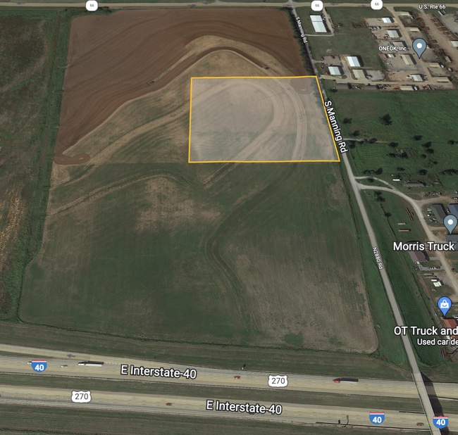
7920 E Highway 66, El Reno, OK 73036

Property Detail
7920 E Highway 66
090146582
T12N R06W S19 NE4 A#5 PT NE4 - BEG 1245.90N OF SE/C, TH W33 SW107.04 W608.03 N1500.24 E661.69 S1396.45 TPB
Warehouse
CANADIAN
AE The base floodplain where base flood elevations are provided. AE Zones are now used on new format FIRMs instead of A1-A30 Zones.
Oklahoma
2024
22.70 AC
2025
Canadian County
3002022030
Oklahoma City
20,000 SF
Oklahoma City, OK
NEARBY LISTINGS FOR SALE OR LEASE
DEMOGRAPHICS near 7920 E Highway 66
1 mile
3 mile
5 mile
2025 Total Population
188
1,180
8,447
2030 Population
215
1,351
9,682
Pop Growth 2025-2030
+ 14.36%
+ 14.49%
+ 14.62%
Average Age
40
40
39
2025 Total Households
67
428
3,083
HH Growth 2025-2030
+ 14.93%
+ 13.55%
+ 13.75%
Median Household Inc
$97,916
$91,282
$71,711
Avg Household Size
2.70
2.70
2.60
2025 Avg HH Vehicles
3.00
3.00
2.00
Median Home Value
$357,142
$347,727
$251,339
Median Year Built
1996
1996
1979
Nearby Places
Map Layers
Map Styles
 Street
 Aerial
Layers
 Traffic
 Biking
Places
Listings with unknown addresses are not visible on the map
- Restaurants
- Banks
- Shops
- Fitness
- Groceries
PUBLIC TRANSPORTATION
AIRPORT
Will Rogers World
Drive
Walk
Distance
Will Rogers World
33 min
22.2 mi
Freight Ports
Tulsa Port Of Catoosa
Drive
Walk
Distance
Tulsa Port Of Catoosa
156 min
140.2 mi
SALE & LEASE HISTORY
LISTING DATE
SALE/LEASE

Apr 22, 2022
For Sale
Nearby Properties
Address
Land Use
TOTAL SIZE
Lot Size
Zoning
Address
Land Use
TOTAL SIZE
Lot Size
Zoning
29,493 SF
22.95 AC
Address
Land Use
TOTAL SIZE
Lot Size
Zoning
13,195 SF
4.70 AC
Address
Land Use
TOTAL SIZE
Lot Size
Zoning
1,273 SF
160 AC
Address
Land Use
TOTAL SIZE
Lot Size
Zoning
1,188 SF
155.31 AC
Address
Land Use
TOTAL SIZE
Lot Size
Zoning
1,472 SF
120 AC
Address
Land Use
TOTAL SIZE
Lot Size
Zoning
11,700 SF
24.33 AC
Address
Land Use
TOTAL SIZE
Lot Size
Zoning
42,326 SF
54.72 AC
Address
Land Use
TOTAL SIZE
Lot Size
Zoning
70,434 SF
137.22 AC
Address
Land Use
TOTAL SIZE
Lot Size
Zoning
20,870 SF
4 AC
Address
Land Use
TOTAL SIZE
Lot Size
Zoning
600 SF
80 AC
Address
Land Use
TOTAL SIZE
Lot Size
Zoning
1,472 SF
80 AC
Address
Land Use
TOTAL SIZE
Lot Size
Zoning
1,188 SF
80 AC
Address
Land Use
TOTAL SIZE
Lot Size
Zoning
58,756 SF
21.43 AC
Address
Land Use
TOTAL SIZE
Lot Size
Zoning
80,115 SF
60.84 AC
Address
Land Use
TOTAL SIZE
Lot Size
Zoning
270 SF
1.78 AC
Address
Land Use
TOTAL SIZE
Lot Size
Zoning
3,360 SF
92.22 AC
Address
Land Use
TOTAL SIZE
Lot Size
Zoning
5,175 SF
1 AC
Address
Land Use
TOTAL SIZE
Lot Size
Zoning
1,472 SF
40 AC
Address
Land Use
TOTAL SIZE
Lot Size
Zoning
28,466 SF
11.54 AC
Address
Land Use
TOTAL SIZE
Lot Size
Zoning
16,400 SF
13.77 AC
Address
Land Use
TOTAL SIZE
Lot Size
Zoning
55,710 SF
42.48 AC
Address
Land Use
TOTAL SIZE
Lot Size
Zoning
28,150 SF
8.55 AC
Address
Land Use
TOTAL SIZE
Lot Size
Zoning
4,500 SF
5.03 AC
Address
Land Use
TOTAL SIZE
Lot Size
Zoning
160 SF
15 AC
Address
Land Use
TOTAL SIZE
Lot Size
Zoning
2,000 SF
10.66 AC
Address
Land Use
TOTAL SIZE
Lot Size
Zoning
14,800 SF
7.74 AC
Address
Land Use
TOTAL SIZE
Lot Size
Zoning
54,444 SF
136.45 AC
Address
Land Use
TOTAL SIZE
Lot Size
Zoning
16,450 SF
97.52 AC
The World's #1 Commercial Real Estate Marketplace
Connect with us
© 2026 CoStar Group
The information above has been obtained from sources believed reliable. While we do not doubt its accuracy we have not verified it and make no guarantee, warranty or representation about it. It is your responsibility to independently confirm its accuracy and completeness. Any projections, opinions, assumptions, or estimates used are for example only and do not represent the current or future performance of the property. The value of this transaction to you depends on tax and other factors which should be evaluated by your tax, financial, and legal advisors. You and your advisors should conduct a careful, independent investigation of the property to determine to your satisfaction the suitability of the property for your needs.