Property Record
79200 Varner Rd, Indio, CA 92203
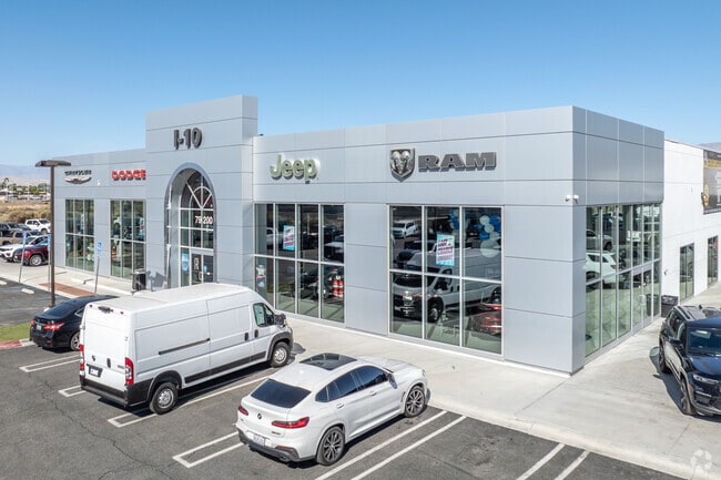

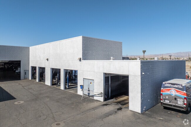
Property Detail
79200 Varner Rd
607-230-055
ACRES 4.06000000 ACREAGEQUALCODE AC
Storebuilding
RIVERSIDE
B and X Area of moderate flood hazard, usually the area between the limits of the 100-year and 500-year floods.
California
2024
4.06 AC
2025
Coachella Valley
049400
Inland Empire (California)
35,324 SF
Riverside-San Bernardino-Ontario, CA
NEARBY LISTINGS FOR SALE OR LEASE
DEMOGRAPHICS near 79200 Varner Rd
1 mile
3 mile
5 mile
2025 Total Population
7,241
65,753
152,979
2030 Population
7,582
69,596
161,290
Pop Growth 2025-2030
+ 4.71%
+ 5.84%
+ 5.43%
Average Age
46
49
45
2025 Total Households
3,053
28,226
59,385
HH Growth 2025-2030
+ 4.52%
+ 5.82%
+ 5.88%
Median Household Inc
$79,901
$90,440
$90,690
Avg Household Size
2.30
2.30
2.50
2025 Avg HH Vehicles
2.00
2.00
2.00
Median Home Value
$525,401
$643,934
$638,433
Median Year Built
1993
1997
1994
Nearby Places
Map Layers
Map Styles
 Street
 Aerial
Transit
 Traffic
 Biking
Places
Listings with unknown addresses are not visible on the map
- Restaurants
- Banks
- Shops
- Fitness
- Groceries
PUBLIC TRANSPORTATION
AIRPORT
Palm Springs International
Drive
Walk
Distance
Palm Springs International
23 min
16.5 mi
Freight Ports
Port of San Diego
Drive
Walk
Distance
Port of San Diego
168 min
140.6 mi
Nearby Properties
Address
Land Use
TOTAL SIZE
Lot Size
Zoning
Address
Land Use
TOTAL SIZE
Lot Size
Zoning
51.81 AC
Address
Land Use
TOTAL SIZE
Lot Size
Zoning
110,000 SF
39.46 AC
Address
Land Use
TOTAL SIZE
Lot Size
Zoning
160,365 SF
6.98 AC
PC2
Address
Land Use
TOTAL SIZE
Lot Size
Zoning
110,354 SF
14.15 AC
RH
Address
Land Use
TOTAL SIZE
Lot Size
Zoning
284,977 SF
23.95 AC
Address
Land Use
TOTAL SIZE
Lot Size
Zoning
92,591 SF
4.56 AC
Address
Land Use
TOTAL SIZE
Lot Size
Zoning
229,800 SF
3.89 AC
Address
Land Use
TOTAL SIZE
Lot Size
Zoning
123,134 SF
6.61 AC
RM
Address
Land Use
TOTAL SIZE
Lot Size
Zoning
139,456 SF
8.02 AC
R-3
Address
Land Use
TOTAL SIZE
Lot Size
Zoning
208,171 SF
16.83 AC
CBOOK
Address
Land Use
TOTAL SIZE
Lot Size
Zoning
96,384 SF
9.90 AC
SPZONE
Address
Land Use
TOTAL SIZE
Lot Size
Zoning
131,298 SF
10.06 AC
CPS
Address
Land Use
TOTAL SIZE
Lot Size
Zoning
83,753 SF
2.77 AC
RM
Address
Land Use
TOTAL SIZE
Lot Size
Zoning
158,234 SF
7.38 AC
IP
Address
Land Use
TOTAL SIZE
Lot Size
Zoning
70,397 SF
3.20 AC
M
Address
Land Use
TOTAL SIZE
Lot Size
Zoning
38,644 SF
18.57 AC
Address
Land Use
TOTAL SIZE
Lot Size
Zoning
53,250 SF
6.62 AC
Address
Land Use
TOTAL SIZE
Lot Size
Zoning
53,531 SF
5.22 AC
Address
Land Use
TOTAL SIZE
Lot Size
Zoning
42,414 SF
1.43 AC
NC
Address
Land Use
TOTAL SIZE
Lot Size
Zoning
71,058 SF
3.22 AC
Address
Land Use
TOTAL SIZE
Lot Size
Zoning
61 AC
A15
Address
Land Use
TOTAL SIZE
Lot Size
Zoning
106,160 SF
9.02 AC
MIX
Address
Land Use
TOTAL SIZE
Lot Size
Zoning
85,102 SF
61.12 AC
Address
Land Use
TOTAL SIZE
Lot Size
Zoning
59,416 SF
3.38 AC
W2
Address
Land Use
TOTAL SIZE
Lot Size
Zoning
16,588 SF
3.80 AC
R2A3500
Address
Land Use
TOTAL SIZE
Lot Size
Zoning
18,348 SF
5.92 AC
R3
Address
Land Use
TOTAL SIZE
Lot Size
Zoning
58,771 SF
3.41 AC
Address
Land Use
TOTAL SIZE
Lot Size
Zoning
67,857 SF
3.54 AC
IP
Address
Land Use
TOTAL SIZE
Lot Size
Zoning
99,491 SF
2.29 AC
W2
The World's #1 Commercial Real Estate Marketplace
Connect with us
© 2026 CoStar Group
The information above has been obtained from sources believed reliable. While we do not doubt its accuracy we have not verified it and make no guarantee, warranty or representation about it. It is your responsibility to independently confirm its accuracy and completeness. Any projections, opinions, assumptions, or estimates used are for example only and do not represent the current or future performance of the property. The value of this transaction to you depends on tax and other factors which should be evaluated by your tax, financial, and legal advisors. You and your advisors should conduct a careful, independent investigation of the property to determine to your satisfaction the suitability of the property for your needs.