Property Record
7929 Hazel Ave, Orangevale, CA 95662


Save to a Folder
{{folder.Name}}
{{folder.ListingIds.length}} Properties
{{folder.ListingIds.length}} Property
Create a New Folder
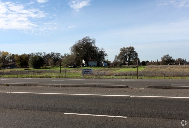
Property Detail
7929 Hazel Ave
Sacramento-Roseville-Folsom, CA
PCL 2 PM 104-26, EXC R/W PER 20020314/83310.96 AC M/LC M/L
224-0200-029
Sacramento
Recreationalacreage
California
AR-2
2
B and X Area of moderate flood hazard, usually the area between the limits of the 100-year and 500-year floods.
10.96 AC
2024
Citrus Heights/Orangevale
2025
Sacramento
008203
NEARBY LISTINGS FOR SALE OR LEASE
DEMOGRAPHICS near 7929 Hazel Ave
1 mile
3 mile
5 mile
2025 Total Population
4,197
94,181
248,712
2030 Population
4,298
96,103
253,776
Pop Growth 2025-2030
+ 2.41%
+ 2.04%
+ 2.04%
Average Age
45
43
42
2025 Total Households
1,414
35,899
95,143
HH Growth 2025-2030
+ 2.33%
+ 2.07%
+ 2.08%
Median Household Inc
$138,820
$102,209
$97,377
Avg Household Size
2.80
2.60
2.50
2025 Avg HH Vehicles
2.00
2.00
2.00
Median Home Value
$809,071
$673,584
$634,389
Median Year Built
1988
1981
1980
Nearby Places
Map Layers
Map Styles
 Street
 Aerial
Layers
 Traffic
 Biking
Places
Listings with unknown addresses are not visible on the map
- Restaurants
- Banks
- Shops
- Fitness
- Groceries
PUBLIC TRANSPORTATION
COMMUTER RAIL
Roseville Amtrak (California Zephyr - Capitol Corridor Joint Powers Authority, Capitol Corridor - Capitol Corridor Joint Powers Authority)
Drive
Walk
Distance
Roseville Amtrak (California Zephyr - Capitol Corridor Joint Powers Authority, Capitol Corridor - Capitol Corridor Joint Powers Authority)
14 min
6.9 mi
Rocklin (Capitol Corridor - Capitol Corridor Joint Powers Authority)
Drive
Walk
Distance
Rocklin (Capitol Corridor - Capitol Corridor Joint Powers Authority)
13 min
7.4 mi
AIRPORT
Sacramento International
Drive
Walk
Distance
Sacramento International
38 min
27.2 mi
Freight Ports
Port of Stockton
Drive
Walk
Distance
Port of Stockton
81 min
67.4 mi
Nearby Properties
Address
Land Use
TOTAL SIZE
Lot Size
Zoning
Address
Land Use
TOTAL SIZE
Lot Size
Zoning
1,444,630 SF
53.20 AC
Address
Land Use
TOTAL SIZE
Lot Size
Zoning
638,040 SF
38.70 AC
Address
Land Use
TOTAL SIZE
Lot Size
Zoning
289,557 SF
28.31 AC
R-M (PD)
Address
Land Use
TOTAL SIZE
Lot Size
Zoning
120,983 SF
17.60 AC
Address
Land Use
TOTAL SIZE
Lot Size
Zoning
157,580 SF
16.93 AC
R-M
Address
Land Use
TOTAL SIZE
Lot Size
Zoning
142,063 SF
8.70 AC
Address
Land Use
TOTAL SIZE
Lot Size
Zoning
78,730 SF
8.03 AC
RD20 BP
Address
Land Use
TOTAL SIZE
Lot Size
Zoning
118,155 SF
3.80 AC
Address
Land Use
TOTAL SIZE
Lot Size
Zoning
128,480 SF
7.95 AC
RD30 BP
Address
Land Use
TOTAL SIZE
Lot Size
Zoning
126,521 SF
11 AC
Address
Land Use
TOTAL SIZE
Lot Size
Zoning
96,522 SF
19.90 AC
FBX
Address
Land Use
TOTAL SIZE
Lot Size
Zoning
10,800 SF
6.70 AC
RAB100
Address
Land Use
TOTAL SIZE
Lot Size
Zoning
109,098 SF
5.50 AC
Address
Land Use
TOTAL SIZE
Lot Size
Zoning
111,418 SF
10.90 AC
Address
Land Use
TOTAL SIZE
Lot Size
Zoning
121,155 SF
4.70 AC
C-2 (PD)
Address
Land Use
TOTAL SIZE
Lot Size
Zoning
91,983 SF
3.27 AC
SPA
Address
Land Use
TOTAL SIZE
Lot Size
Zoning
162,401 SF
5.29 AC
Address
Land Use
TOTAL SIZE
Lot Size
Zoning
254,982 SF
19.60 AC
Address
Land Use
TOTAL SIZE
Lot Size
Zoning
82,499 SF
4.74 AC
RD-30
Address
Land Use
TOTAL SIZE
Lot Size
Zoning
87,942 SF
9.03 AC
SPA
Address
Land Use
TOTAL SIZE
Lot Size
Zoning
141,124 SF
17 AC
Address
Land Use
TOTAL SIZE
Lot Size
Zoning
134,216 SF
7.79 AC
SPA
Address
Land Use
TOTAL SIZE
Lot Size
Zoning
61,056 SF
4.50 AC
Address
Land Use
TOTAL SIZE
Lot Size
Zoning
145,700 SF
9.30 AC
Address
Land Use
TOTAL SIZE
Lot Size
Zoning
139,734 SF
8.03 AC
SPA
Address
Land Use
TOTAL SIZE
Lot Size
Zoning
112,068 SF
10.22 AC
SC
Address
Land Use
TOTAL SIZE
Lot Size
Zoning
102,494 SF
7.70 AC
Address
Land Use
TOTAL SIZE
Lot Size
Zoning
116,300 SF
7.50 AC
Address
Land Use
TOTAL SIZE
Lot Size
Zoning
107,500 SF
7.50 AC
Address
Land Use
TOTAL SIZE
Lot Size
Zoning
107,047 SF
6.12 AC
SPA
The World's #1 Commercial Real Estate Marketplace
Connect with us
© 2026 CoStar Group
The information above has been obtained from sources believed reliable. While we do not doubt its accuracy we have not verified it and make no guarantee, warranty or representation about it. It is your responsibility to independently confirm its accuracy and completeness. Any projections, opinions, assumptions, or estimates used are for example only and do not represent the current or future performance of the property. The value of this transaction to you depends on tax and other factors which should be evaluated by your tax, financial, and legal advisors. You and your advisors should conduct a careful, independent investigation of the property to determine to your satisfaction the suitability of the property for your needs.