Property Record
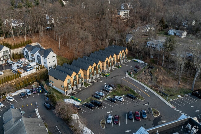
793 Post Rd E, Westport, CT 06880


Property Detail
793 Post Rd E
WPOR-000009E-000000-000193
Western Ct
Apartmenthouse5plusunits
Connecticut
A/GBDI
193-0
B and X Area of moderate flood hazard, usually the area between the limits of the 100-year and 500-year floods.
2.40 AC
2025
Outer Middle Fairfield County
2025
Westchester/So Connecticut
050302
Bridgeport-Stamford-Danbury, CT
NEARBY LISTINGS FOR SALE OR LEASE
-
-
View all Westport listings for sale on LoopNet.com
DEMOGRAPHICS near 793 Post Rd E
1 mile
3 mile
5 mile
2025 Total Population
5,796
36,640
116,847
2030 Population
5,976
37,887
120,132
Pop Growth 2025-2030
+ 3.11%
+ 3.40%
+ 2.81%
Average Age
42
43
42
2025 Total Households
1,997
13,366
43,546
HH Growth 2025-2030
+ 3.05%
+ 3.40%
+ 2.90%
Median Household Inc
$221,467
$210,721
$152,451
Avg Household Size
2.90
2.70
2.50
2025 Avg HH Vehicles
2.00
2.00
2.00
Median Home Value
$1,081,513
$1,056,984
$865,897
Median Year Built
1966
1968
1966
Nearby Places
Map Layers
Map Styles
 Street
 Aerial
Transit
 Traffic
 Biking
Places
Listings with unknown addresses are not visible on the map
- Restaurants
- Banks
- Shops
- Fitness
- Groceries
PUBLIC TRANSPORTATION
COMMUTER RAIL
Green's Farms Station (New Haven Line - Metro-North Commuter Railroad Company (Metro-North))
Drive
Walk
Distance
Green's Farms Station (New Haven Line - Metro-North Commuter Railroad Company (Metro-North))
7 min
2.6 mi
Southport Station (New Haven Line - Metro-North Commuter Railroad Company (Metro-North))
Drive
Walk
Distance
Southport Station (New Haven Line - Metro-North Commuter Railroad Company (Metro-North))
8 min
3.4 mi
AIRPORT
Westchester County
Drive
Walk
Distance
Westchester County
42 min
27.7 mi
Tweed/New Haven
Drive
Walk
Distance
Tweed/New Haven
52 min
31.1 mi
Freight Ports
Port of New Haven
Drive
Walk
Distance
Port of New Haven
46 min
28.9 mi
SALE & LEASE HISTORY
LISTING DATE
SALE/LEASE

Mar 23, 2021
For Sale
Nearby Properties
Address
Land Use
TOTAL SIZE
Lot Size
Zoning
Address
Land Use
TOTAL SIZE
Lot Size
Zoning
50.42 AC
DDD4
Address
Land Use
TOTAL SIZE
Lot Size
Zoning
6.80 AC
B2
Address
Land Use
TOTAL SIZE
Lot Size
Zoning
226,920 SF
24.75 AC
B
Address
Land Use
TOTAL SIZE
Lot Size
Zoning
27.33 AC
AAA
Address
Land Use
TOTAL SIZE
Lot Size
Zoning
252,316 SF
Address
Land Use
TOTAL SIZE
Lot Size
Zoning
1.44 AC
BCD/H
Address
Land Use
TOTAL SIZE
Lot Size
Zoning
272.25 AC
AAA
Address
Land Use
TOTAL SIZE
Lot Size
Zoning
45.06 AC
AAA
Address
Land Use
TOTAL SIZE
Lot Size
Zoning
13.10 AC
RBD
Address
Land Use
TOTAL SIZE
Lot Size
Zoning
29.50 AC
DOSRD1
Address
Land Use
TOTAL SIZE
Lot Size
Zoning
23.15 AC
A
Address
Land Use
TOTAL SIZE
Lot Size
Zoning
12.30 AC
AA
Address
Land Use
TOTAL SIZE
Lot Size
Zoning
168.95 AC
AAA_AA
Address
Land Use
TOTAL SIZE
Lot Size
Zoning
23.87 AC
A
Address
Land Use
TOTAL SIZE
Lot Size
Zoning
24.82 AC
AA_A
Address
Land Use
TOTAL SIZE
Lot Size
Zoning
90,056 SF
28.10 AC
AA_A
Address
Land Use
TOTAL SIZE
Lot Size
Zoning
85,050 SF
6.76 AC
GBD
Address
Land Use
TOTAL SIZE
Lot Size
Zoning
10.55 AC
AA
Address
Land Use
TOTAL SIZE
Lot Size
Zoning
7.13 AC
B
Address
Land Use
TOTAL SIZE
Lot Size
Zoning
94,449 SF
5.40 AC
BPD/A
Address
Land Use
TOTAL SIZE
Lot Size
Zoning
23.70 AC
AAA
Address
Land Use
TOTAL SIZE
Lot Size
Zoning
10.37 AC
B2
Address
Land Use
TOTAL SIZE
Lot Size
Zoning
21.93 AC
DDD4
Address
Land Use
TOTAL SIZE
Lot Size
Zoning
99,778 SF
Address
Land Use
TOTAL SIZE
Lot Size
Zoning
3.43 AC
GBD_AA
Address
Land Use
TOTAL SIZE
Lot Size
Zoning
13.40 AC
A
Address
Land Use
TOTAL SIZE
Lot Size
Zoning
97,746 SF
8.68 AC
GBD/A
Address
Land Use
TOTAL SIZE
Lot Size
Zoning
92,057 SF
10.20 AC
B
Address
Land Use
TOTAL SIZE
Lot Size
Zoning
17.19 AC
AA
Address
Land Use
TOTAL SIZE
Lot Size
Zoning
98,755 SF
7.20 AC
DID
The World's #1 Commercial Real Estate Marketplace
Connect with us
© 2026 CoStar Group
The information above has been obtained from sources believed reliable. While we do not doubt its accuracy we have not verified it and make no guarantee, warranty or representation about it. It is your responsibility to independently confirm its accuracy and completeness. Any projections, opinions, assumptions, or estimates used are for example only and do not represent the current or future performance of the property. The value of this transaction to you depends on tax and other factors which should be evaluated by your tax, financial, and legal advisors. You and your advisors should conduct a careful, independent investigation of the property to determine to your satisfaction the suitability of the property for your needs.